 Route Editor

| Guide | ♦ | 8 Triplogs | 0 Topics |
details | drive | permit | forecast | 🔥 route |
stats |
photos | triplogs | topics | location |
| 85 | 8 | 0 |
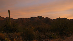
Bushwhack Extraordinaire! by GrottoGirl  Overview OverviewA great bushwhack to Rattlesnake Peak from Sabino Canyon Visitor Center - only 4 of the approximate 10 miles were on-trail. Rattlesnake Peak is the highest point between Cathedral Rock and Sabino Canyon. You may not have even noticed it, but it is there and ready to be bagged. From the top, you will be treated to great views of the Catalinas and beyond. Warning The majority of this hike is off-trail. It is advisable to eat a large dinner the night before this hike. You'll need all the energy you can muster - but it is worth it!
You start on the road going into Sabino Canyon. After a half-mile turn north onto the Esperero Trail. After almost two miles into the journey, you will reach the ridge between Rattlesnake and Bird canyons. This is where the off-trail adventure begins! Follow a route that leaves the trail to the east. Look for some cairns up to the top of the ridge at point 3490. Mind you it is very easy to lose track of the route and the cairns so keep in mind that your goal is to get on top of the ridge. This part of the trek will involve dodging a lot of bushes and cactus. If you're lucky, you will get through without having to stop and remove the cactus spines! Once you get on top of the ridge, you will notice that there is less vegetation to battle. From there you will follow the ridge going northeast generally staying on top of the ridge until the ridge turned to go more north. At that point, avoid the higher part of the ridge by contouring on the west side of the ridge. The nearer you get to the peak, the steeper the route will become. You will have to do a bit of navigating around some big rocks and bushes. As the route was getting steeper, you should aim to be more on the east side of the ridge. The Santa Catalina Mountains, A Guide to the Trails and Routes puts it all into perspective saying, "This is the hardest part but not because it is steep and rocky. The difficulty is finding routes through the thickets of manzanita and oak. Staying on the crest is no good. Most hikers drop down 50 feet or so on the east side and thrash their way to the top." Sooner or later (depending on how many times you have to stop to rest), you'll reach the top. This is a great place to take a lunch break. There are many rocks on which to hang out and explore around. The views are outstanding in all 360 degrees! On the return trip, you'll retrace your steps. You might find the journey down a bit hard on the knees - I know I did! Check out the Official Route and Triplogs. Note This is a more difficult hike. It would be unwise to attempt this without prior experience hiking. Leave No Trace and +Add a Triplog after your hike to support this local community. | ||||||||||||||||||||||||||||||||||||||||||||||||||||||||||||||||||||||||||||||||||||||||||||||||||||||||||||


