 Route Editor

| Guide | ♦ | 59 Triplogs | 2 Topics |
details | drive | no permit | forecast | 🔥 route |
stats |
photos | triplogs | topics | location |
| 730 | 59 | 2 |
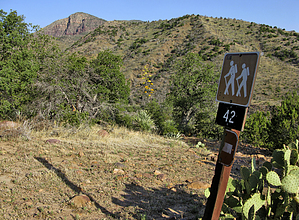
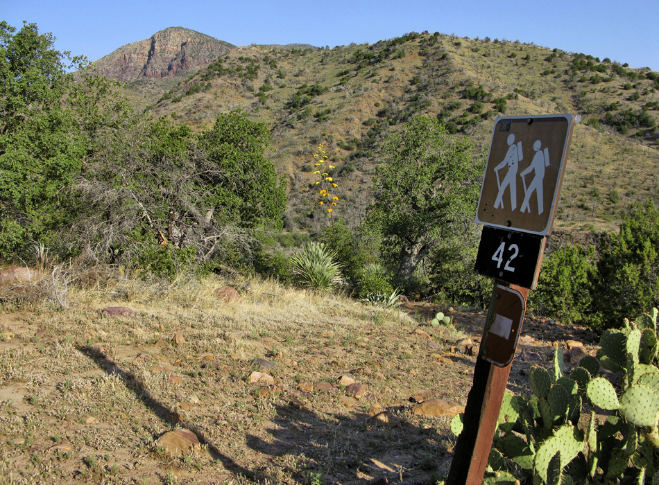
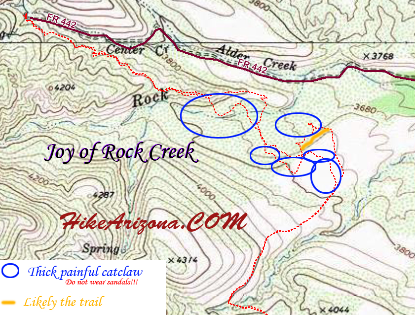
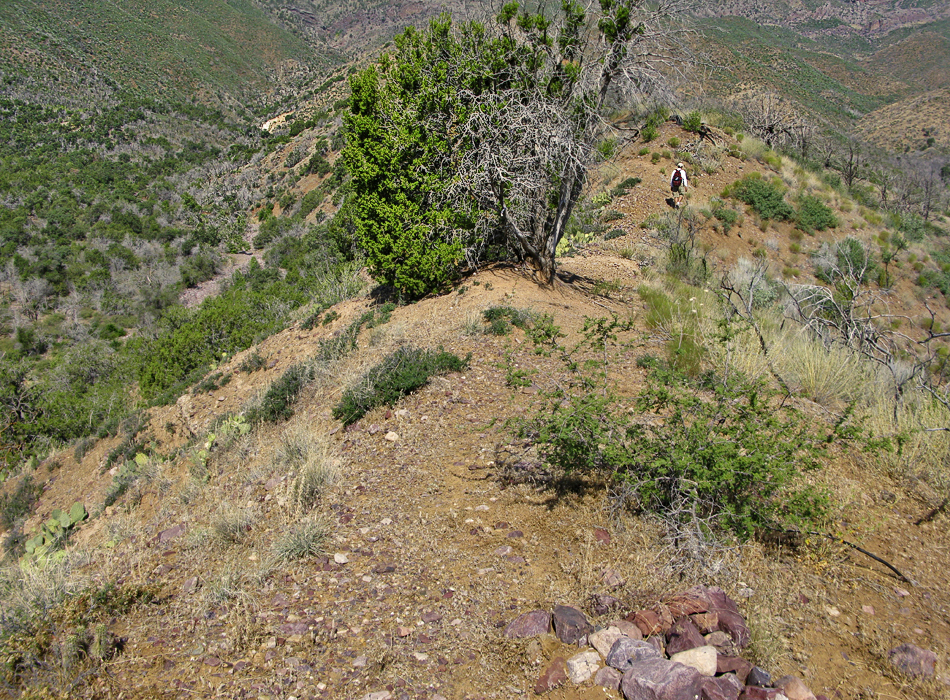
Springs, ravines and a little place called HELL! by joebartels   Overview OverviewConnects Barnhardt TH (FS 419) and Rock Creek TH (FS 442) on the lower eastern foothills of the Mazatzal range. Please note the FS lists this trail as #288 however it's signed #42. The hike starts at an elevation of 4,175ft from the Barnhardt Trailhead. It passes over several ravines along its journey. All of which are relatively low-key elevation gains/losses. The entire trail is just outside of the wilderness boundary.
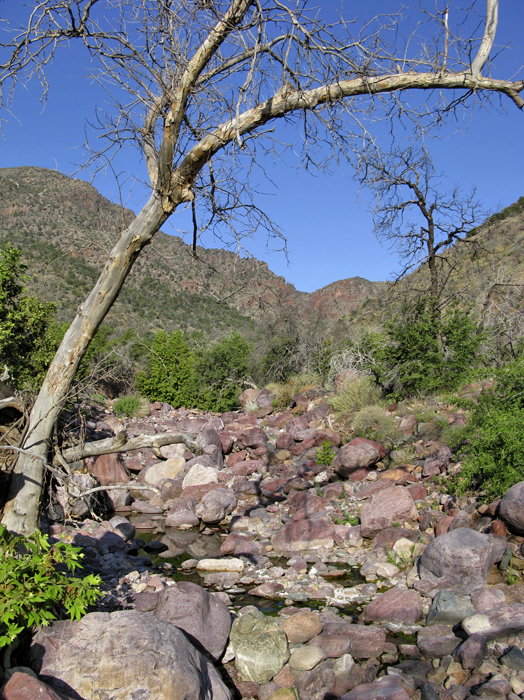
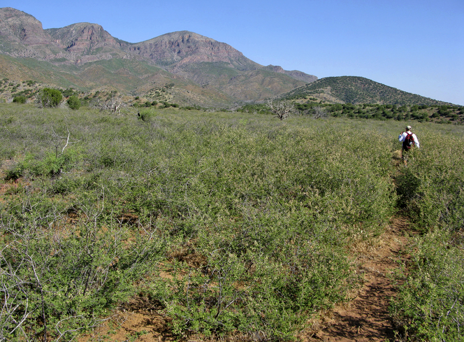
You pass through a gate from the Barnhardt Trailhead and immediately descend into the first ravine. This happens to be the fading end of Barnhardt Canyon. Garden Spring, a half-mile upstream, is generally reliable if it's rained recently. The second ravine encountered is Eisenhauer Canyon. You'll encounter some light catclaw on route and eventually a road. A left takes you up canyon to Eisenhauer Spring. Take a right to stay on course and look for cairns leading off the road and out of the ravine. The journey continues to a third ravine. This one is less defined, unnamed and the location of Half Moon Spring. Coming out of this ravine, you start moving east/away from the Mazatzal range onto Fisher Mesa. The hike is enjoyable up through this point. Coming down off of Fisher Mesa, you drop into the fourth ravine, which is Rock Creek. It starts off nice but turns nasty quick. This section is the cursed with catclaw and poor definition of trail. That's two things that should never be mixed! If somehow you make it onto the opposing ridge without a scratch, then consider yourself lucky! On the ridge, you have Rock Creek to your left, Alder Creek to your right, and you're heading down towards Center Creek. Light bushwhacking is encountered in spots. Dipping through several ravines, you have to search and find for the trail on the other side. Soon you'll reach a wide swath in Center Creek. Here you'll find the junction with Rock Creek Trail. This is also the Rock Creek Trailhead at the end of FS 442. We didn't see any "trailhead" signs, so it may officially be down the road a quarter-mile or so. We saw a trickle in Center Creek in June. However, Spring was unusually wet. Gate Policy: If a gate is closed upon arrival, leave it closed after you go through. If it is open, leave it open. Leaving a closed gate open may put cattle in danger. Closing an open gate may cut them off from water. Please be respectful, leave gates as found. The exception is signage on the gate directing you otherwise. Check out the Official Route and Triplogs. Leave No Trace and +Add a Triplog after your hike to support this local community. One-Way Notice This hike is listed as One-Way. When hiking several trails on a single "hike", log it with a generic name that describes the hike. Then link the trails traveled, check out the example. | ||||||||||||||||||||||||||||||||||||||||||||||||||||||||||||||||||||||||||||||||||||||||||||||||||||||||||||||||||||||||||||||||||||||||||||||||||||||||||||||||||||||||||||||||||||||||||||||||||||||||||


