username
X
password
register
for free!
help
 This is likely a great time to hike this trail!  Check out "Preferred" months below, keep in mind this is an estimate.
  

Johnson Peak Loop aka Pole/Morse, AZ

Guide 4 Triplogs  0 Topics
  4 of 5  
Fav
Wish
0
details
drive
permit
forecast
map
stats
photos
triplogs
topics
location
15 4 0
Statistics
tap row or icons for details
Difficulty 5 of 5
Distance Round Trip 6 miles
Trailhead Elevation 6,609 feet
Elevation Gain 2,030 feet
Accumulated Gain 2,443 feet
Kokopelli Seeds 18.22
 Interest Seasonal Creek
unreported if dogs are allowed
editedit > ops > dogs to adjust
feature photo
Photos Viewed All MineFollowing
14  2016-04-24
Monte Vista Peak via Turkey Creek
John9L
27  2016-04-24
Monte Vista Peak
chumley
15  2011-03-20 SkyIslander18
Author
author avatar Guides 16,843
Routes 17,472
Photos 24
Trips 1 map ( 6 miles )
Age 28 Male Gender
Location HAZ, TrailDEX
Associated Areas
list map done
Tucson Region
Historical Weather
Trailhead Forecast
Expand Map
Preferred May, Sep, Aug, Jul
Sun  5:54am - 6:38pm
1 Route
 
3 Alternative


remove free decal offer

 Likely In-Season!
Guide Needed
Publish Full Detail Guide


Use +Add above to share photos and triplogs
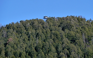
Overview: This hike combines the Morse Canyon and Pole Bridge Canyon trails with 1.2 miles of the Turkey Creek road to form a loop that makes a circuit around Johnson Peak. A side trip of 1.5 miles (one way) can be added from the top of the loop to reach the Monte Vista lookout tower.


  • Morse Trail 43 & Pole Trail 264 Map
    guide related
    Morse Trail 43 & Pole Trail 264 Map


Check out the Triplogs.

Note
This is a difficult hike. Arrive fit and prepared or this could get ugly.
Leave No Trace and +Add a Triplog after your hike to support this local community.
WARNING! Hiking and outdoor related sports can be dangerous. Be responsible and prepare for the trip. Study the area you are entering and plan accordingly. Dress for the current and unexpected weather changes. Take plenty of water. Never go alone. Make an itinerary with your plan(s), route(s), destination(s) and expected return time. Give your itinerary to trusted family and/or friends.

 Permit $$
None

Coronado Forest
MVUMs are rarely necessary to review unless mentioned in the description or directions
Coronado Motor Vehicle Use Maps (MVUMs)


 Directions
or
 Road
FR / Dirt Road / Gravel - Car Okay

To hike
From Arizona Highway 181 east of Sunizona, take the Turkey Creek road (Forest Road 41) to its end to reach the Morse Canyon trailhead. The Pole Bridge trailhead is 1.2 miles farther down the canyon.
page created by SkyIslander18 on Mar 21 2011 12:40 pm
 90+° 8am - 6pm kills
helpcorrectionissue

end of page marker