 Route Editor

| Guide | ♦ | 102 Triplogs | 1 Topic |
details | drive | no permit | forecast | 🔥 route |
stats |
photos | triplogs | topic | location |
| 266 | 102 | 1 |
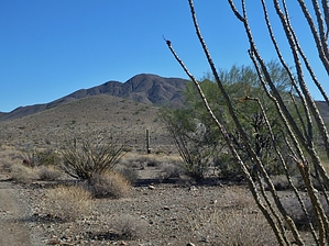
Better for you than the outlet stores. by AZWanderingBear  Driving past Anthem on I-17, most people look west to the outlet stores. Hikers look east to the big mountain on the other side of all the houses. Daisy Mountain is a big lump with a long north/south ridgeline. There is a nice trail that leaves Anthem and ascends to the two highest peaks along the ridge - the northernmost hosting a large American Flag, a summit log, and some lovely views. Driving past Anthem on I-17, most people look west to the outlet stores. Hikers look east to the big mountain on the other side of all the houses. Daisy Mountain is a big lump with a long north/south ridgeline. There is a nice trail that leaves Anthem and ascends to the two highest peaks along the ridge - the northernmost hosting a large American Flag, a summit log, and some lovely views.The trailhead is tucked into an Anthem community at the intersection of Navigation Way and Livingstone Way. Exit I-17 and go east on Anthem Way. Turn north at the first traffic light onto Navigation Way. Navigate Navigation Way until you see a small park on your left and a break in the sea of houses that is Anthem straight ahead. I suggest parking by the park on the very misnamed street National Way. You can also park around the corner on Courage Way. There are no parking signs all along Navigation Way, and only the most courageous park there.
At 1.9 miles (N33 53.1371 W112 06.7658), a large cairn marks a split in the trail. Take the fainter right trail. If you look NE between the two prominent peaks, the flag peak is visible in the background. The slope of the trail increases as you climb to the saddle at the 2.46-mile point. At the saddle (N33 52.8331 W112 06.4914), the trail splits again. This is the ridgeline trail. The south fork eventually takes you down and into the eastern communities of Anthem. The left fork takes you north to the higher peaks and the flag. From the saddle, you climb another 500 feet over 0.7 miles to the summit and the flag (N33 53.1998 W112 06.0760). The views of the north valley are good. I could see west to Vulture Peak. The Bradshaws loom northwest, with the New River Mountains due north. A few years ago, a friend encountered a mountain lion in a wash just past the turn up to the saddle. She's no longer haunting Daisy Mountain, but I'm not sure about the mountain lion. The trail is through a sea of brittlebush with lots of jojobas. Jojoba seeds are edible in the early autumn but only in smaller quantities. They have a definitive laxative effect. I prefer mine slightly roasted and salted. There are ironwood, paloverde, Crucifixion Thorn, Mormon tea along the trail. Cacti include saguaro, barrel, ocotillo, various cholla (but thankfully few), and hedgehog. Daisy Mountain makes for an excellent day hike without leaving the uncivilized urban environment too far behind. Check out the Official Route and Triplogs. Leave No Trace and +Add a Triplog after your hike to support this local community. One-Way Notice This hike is listed as One-Way. When hiking several trails on a single "hike", log it with a generic name that describes the hike. Then link the trails traveled, check out the example. | |||||||||||||||||||||||||||||||||||||||||||||||||||||||||||||||||||||||||||||||||||||||||||


