Route Editor

| Guide | ♦ | 8 Triplogs | 0 Topics |
details | drive | permit | forecast | route |
stats |
photos | triplogs | topics | location |
| 33 | 8 | 0 |
At least it is long by kingsnake  The hike starts at the southeast corner of the horse lot. Go 0.25 miles south along the pea gravel road (Coldwater Trail). Just past the first small wash, veer east onto Butterfield Trail. As with other trails in Estrella, the trail is wide and the surface tends to be rather benign, varying from mostly smooth, to occasionally strewn with small rocks, sandy in the washes. Butterfield has quite a few down & up wash crossings as it heads south towards Knobb Hill. About 2/3s of the way down Butterfield, just south of the Dysart Trail intersection, Butterfield reaches its maximum elevation after a short, but very steep, climb. Then you begin descending towards Gadsden Wash. The hike starts at the southeast corner of the horse lot. Go 0.25 miles south along the pea gravel road (Coldwater Trail). Just past the first small wash, veer east onto Butterfield Trail. As with other trails in Estrella, the trail is wide and the surface tends to be rather benign, varying from mostly smooth, to occasionally strewn with small rocks, sandy in the washes. Butterfield has quite a few down & up wash crossings as it heads south towards Knobb Hill. About 2/3s of the way down Butterfield, just south of the Dysart Trail intersection, Butterfield reaches its maximum elevation after a short, but very steep, climb. Then you begin descending towards Gadsden Wash.Across Gadsden Trail, almost as an extension of Butterfield is a small hill with a very steep grade. This isn't part of the trail system -- someone blocked it off with a small wall of brush and rocks since I was last out there a few months ago -- but the trail to the top is obvious. Might be worth exploring.
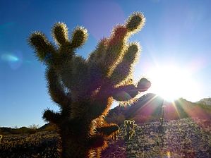
Turn south onto Pedersen Trail, which is a single track for the next several miles. It also has *a lot* more cacti than any other part of the Estrella trail system. Especially cholla. Lots of cholla. (At one point the cholla balls that had fallen on the trail were so dense I had to take a small detour to avoid stepping on the "punji sticks".) You will cross two washes, then parallel a third for a bit, before dropping into it. As you near Hill 1547 is the first decent resting spot, about 6 miles into the overall hike. There are some good sitting rocks and good morning shade. Thus ends the only interesting parts of the loop. After leaving the wash, Pedersen turns west onto what might be the smoothest jeep trail in Arizona. Seriously, even my 14-year-old rust-bucket could drive it without losing any parts. (GPS claims the jeep trail is known as "W. Queen Creek Rd.") Put your head down, and keep putting one foot in front of the other for the next couple of miles. As you appear to be getting close to some sort of antennas, or other installation, you will reach the intersection of another jeep trail. (The GPS claims this is "155th Ave.") Turn north. Repeat the head down, one foot in front of the other routine for a little over a mile. You will come to a wide, flat, sandy wash. This is probably the only confusing part of the whole hike and the only one where I did not see a sign. Basically, aim straight across the wash. In a few hundred feet you will the jeep trail back up. After that, the trail turns east. Repeat the previous jeep trail routine. Yeah, exciting. After a mile or so, as you near the first mountain in several hours, you will begin bending north. At the Toothaker Trail intersection, you have a choice: Take Toothaker back to the trailhead, or continue a bit to Coldwater Trail, then take that back. Coldwater is a mile less and, if you are as burnt out by this point as I was, you will take it. Continue past the Toothaker intersection a few hundred yards to the Coldwater intersection. In the wash, there are a few trees with trunks large enough to support sitting. Take break. You've gone about 12 miles. Turn north up Coldwater, along the west side of Knobb Hill. The washes are not as numerous, or as deep, like Butterfield, on the east side of the mountain. After about 1.7 miles, you will cross Dysart Trail, and just after that enter the "secondary horse lot" (for want of a better term) at the head of the pea gravel road. Lots of big logs here to sit on, but you are almost home, so why bother? Continue north on the pea gravel road, past the Butterfield intersection, to the main horse lot. You are done. Yahoo. In summation: Butterfield is okay (**), Coldwater eh (*), and Pedersen a slog. (0 Hazopellis if Teva Joe allowed that few.) Check out the Official Route and Triplogs. Leave No Trace and +Add a Triplog after your hike to support this local community. | |||||||||||||||||||||||||||||||||||||||||||||||||||||||||||||||||||||||||||||||||||||