squeeze a lemon on the Pima County highpoint by PrestonSands
Overview
There is no official trail to the actual 9157-foot summit of Mount Lemmon, but it is relatively easy to reach via a short off-trail hike described below. Although much of Mount Lemmon's top is fenced off due to the Steward Observatory, it is possible to reach the summit without having to trespass. The summit of Mount Lemmon makes a great side trip if you are hiking any of the trails that converge on the Mount Lemmon Trailhead/Radio Ridge area.
Hike
At the end of the Catalina Highway lies the signed Mount Lemmon Trailhead, located at the gated entrance to the Steward Observatory. Walk past the gate and continue up the paved observatory road. Within a quarter of a mile, you will pass a sign for Steward Observatory. Just past this sign (on the right) is a dirt parking area located a short distance before the road reaches a chain-link fence gate guarding the observatory entrance. Leave the road at the dirt parking area (32.4409 N, -110.7877) and drop down into a little grassy meadow. A faint trail departs from the meadow's far end, paralleling the observatory fence along a beautifully wooded hillside. Signs along the fence announce that the observatory grounds are off-limits. No need to worry about that, though, as the route stays outside the fenced area.
Reaching the northeast corner of the observatory fence, the faint trail swings left and climbs onto the flat mountain top near a cluster of small white observatory structures. Welcome to the summit of Mount Lemmon! Here you will find a metal survey cap set into a small platform of concrete. Up against the fence is a small pile of rocks guarding the summit register (32.44291 N, -110.78861). From the reasonably open summit, one has excellent views to the east of the Galiuro and Pinaleno Mountain ranges. To the north, the forested Catalinas give way to a series of distant desert mountains. One can also get a nice view of Samaniego Ridge and the Oro Valley area by walking a couple of hundred feet to the western side of the summit.
Gate Policy: If a gate is closed upon arrival, leave it closed after you go through. If it is open, leave it open. Leaving a closed gate open may put cattle in danger. Closing an open gate may cut them off from water. Please be respectful, leave gates as found. The exception is signage on the gate directing you otherwise.
WARNING! Hiking and outdoor related sports can be dangerous. Be responsible and prepare for the trip. Study the area you are entering and plan accordingly. Dress for the current and unexpected weather changes. Take plenty of water. Never go alone. Make an itinerary with your plan(s), route(s), destination(s) and expected return time. Give your itinerary to trusted family and/or friends.
Four specific day-use areas require a Coronado Recreational Pass or a National Pass/America the Beautiful Pass.
1) Sabino Canyon - located on the Santa Catalina Ranger District (520)749-8700
2) Madera Canyon - located on the Nogales Ranger District (520)281-2296
3) Cave Creek - located on the Douglas Ranger District (520)364-3468
4) Mt. Lemmon at 11 day-use sites.
2025Catalina State Park
Per vehicle (1 person): $10.00
Per vehicle (2-4 people): $20.00
Individual/bicycle: $5.00
Coronado Forest MVUMs are rarely necessary to review unless mentioned in the description or directions Coronado Motor Vehicle Use Maps (MVUMs)
Directions
Road
Paved - Car Okay
To hike Take the Catalina Highway off Tanque Verde Road in Tucson. Follow the Catalina Highway past Mt. Lemmon Ski Valley to its very end at the signed Mount Lemmon Trailhead, located at the gated entrance to the Steward Observatory.
The Catalina Highway is paved and suitable for passenger cars. The road may be snow-covered in winter, causing chains or 4-wheel drive to be required. The road beyond Mt. Lemmon Ski Valley is not maintained for public use during the winter. It is closed when snow-covered or icy.
page created by PrestonSands on May 29 2011 2:11 am
 Route Editor

 Overview
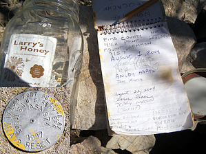


