username
X
password
register
for free!
help
 This is likely a great time to hike this trail!  Check out "Preferred" months below, keep in mind this is an estimate.
 

Ice Cave Trail #608, AZ

Guide 21 Triplogs  0 Topics
  3 of 5  
Fav
Wish
1
details
drive
no permit
forecast
route  
stats
photos
triplogs
topics
location
112 21 0
Statistics
tap row or icons for details
Difficulty 1.5 of 5
Distance One Way 3.5 miles
Trailhead Elevation 6,703 feet
Elevation Gain 504 feet
Accumulated Gain 613 feet
Kokopelli Seeds 5.54
unreported if dogs are allowed
editedit > ops > dogs to adjust
feature photo
Photos Viewed All MineFollowing
Will recalculate on button tap!
29  2022-08-13 Vashti
9  2018-11-21
Blue Ridge Trail
markthurman53
6  2017-09-09 fricknaley
60  2015-04-05
Pinetop AZ and Area - April 2015
Randal_Schulhaus
8  2012-02-26 leonesiegel
Author
author avatar Guides 16,843
Routes 17,472
Photos 24
Trips 1 map ( 6 miles )
Age 28 Male Gender
Location HAZ, TrailDEX
Associated Areas
list map done
Alpine Region
Historical Weather
Trailhead Forecast
Radar Map
Expand Map
Preferred Oct, May, Apr, Sep
Sun  5:55am - 6:42pm
Official Route & 6 Rts
 
3 Alternative


remove free decal offer
hip hop
by HAZ_Hikebot

 Likely In-Season!
Ice Cave Trail winds its way along Porter Creek and the south side of Scott Reservoir before connecting to Blue Ridge Trail.
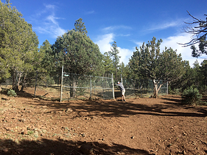

Note
The cave is currently fenced off for protection and preservation. Mountain Biking rating is difficult.


    Check out the Official Route and Triplogs.
    Leave No Trace and +Add a Triplog after your hike to support this local community.

    One-Way Notice
    This hike is listed as One-Way.

    When hiking several trails on a single "hike", log it with a generic name that describes the hike. Then link the trails traveled, check out the example.
    WARNING! Hiking and outdoor related sports can be dangerous. Be responsible and prepare for the trip. Study the area you are entering and plan accordingly. Dress for the current and unexpected weather changes. Take plenty of water. Never go alone. Make an itinerary with your plan(s), route(s), destination(s) and expected return time. Give your itinerary to trusted family and/or friends.

     Permit $$
    no fees or permits reported

    if incorrect tell us about it


     Directions
    or
     Road


    To hike
    From the Lakeside Ranger Station, travel south on State Highway 260. Turn left on Porter Mountain Road (Forest Road 45) for 1 mile. The trailhead is on the right.
    page created by joebartels on Jun 22 2011 10:16 am
     90+° 8am - 6pm kills
    helpcorrectionissue

    end of page marker