Route Editor

| Guide | ♦ | 19 Triplogs | 0 Topics |
details | drive | no permit | forecast | route |
stats |
photos | triplogs | topics | location |
| 67 | 19 | 0 |
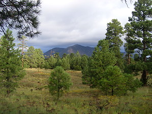
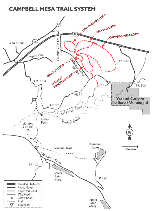
mmm mmm good by HAZ_Hikebot   Campbell Mesa Trail System consists of several looping trails. Page data reflects all the loops. Adjust mileage accordingly when posting triplogs. Campbell Mesa Trail System consists of several looping trails. Page data reflects all the loops. Adjust mileage accordingly when posting triplogs.Campbell Mesa trail is located on a low and relatively flat mesa just east of the County Club area of Flagstaff, AZ. The trail consists of five loops of varying sizes. There is a half-mile connector trail at the south end of the southern-most loop to access the Arizona Trail. All five loops of the Campbell Mesa Trail are interconnected and accessed from the Campbell Mesa trailhead.
Campbell Mesa is within a non-motorized use area that aims to provide solitude for the visitors and shelter for the wildlife.
Check out the Official Route and Triplogs. Leave No Trace and +Add a Triplog after your hike to support this local community. | |||||||||||||||||||||||||||||||||||||||||||||||||||||||||||||||||||||||||||||||||||||||||