 Route Editor

| Guide | ♦ | 59 Triplogs | 0 Topics |
details | drive | no permit | forecast | route |
stats |
photos | triplogs | topics | location |
| 38 | 59 | 0 |
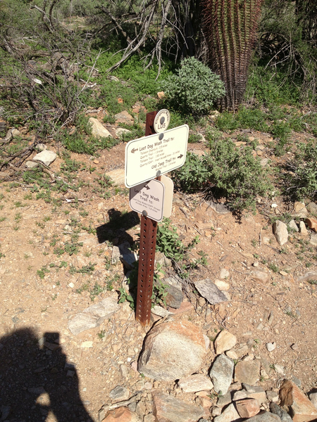
Yes, that is a nice view! by paulshikleejr  Overview OverviewThis is a quiet, relatively less used connector trail with its northern terminus at Lost Dog Trail and its southern terminus at Ringtail trail. About 0.77 miles from the northern terminus and 0.60 miles from the southern terminus, there is an informal scenic overlook area I'm calling "Old Jeep Overlook." Warning Even though this is a relatively easy trail, you will frequently encounter rocky, loose terrain.
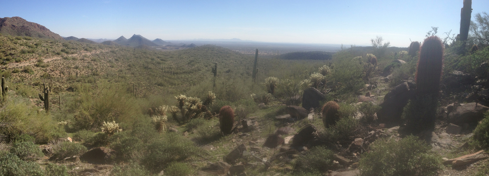
This short trail runs between the better known and more frequently used Lost Dog Wash Trail and Ringtail Trail. About 1.58 miles from the Lost Dog Wash Trailhead on the Lost Dog Wash Trail is the northern terminus of the Old Jeep Trail. The Lost Dog Wash Trail "T"s with the Old Jeep Trail heading off and up to the right/east. A short 0.20 mile later, the trail zigs south and head down into a small creekbed. As you ascend up and out of the creekbed, the trail soon zags northward, and an easy 1/6 mile later (all told, 0.48 mile in), you'll reach the highest point of the trail (2,133 ft elevation). There is a teaser view of what you'll be able to see in a few more minutes to the right/south. After that, the trail descends gently for 0.1 miles, after which it hairpins down into another dry creekbed. After bending back and heading up and out, just before turning again to the right/south (all told, 0.68 mile in), you'll find the marker for EM JT1. After a short 0.09 mile later, at (33.61652, -111.81163) is where you hang right and thread your way south quick 0.01 mile south to find a few rocks to sit upon to enjoy the "Old Jeep Overlook." At night, or during the day, you'll be able to see down onto Scottsdale and the Salt River Pima-Maricopa Indian Community. Far in the distance, you'll see San Tan Mountain. After returning to the trail, you'll head southeast for a 0.05 mile before the trail bends to run northeast along a dry creekbed for 0.09 mile. Soon, you'll make your way down into the creekbed, and after climbing out (0.11 mile later), the trail heads nearly south for about 1/6 mile before bending slightly to the east (all told, 1.19 miles in). The downward grade you're already on continues south-southeast for another 1/6 mile, and you descend about 109 feet to the southern terminus of the trail at the Ringtail Trail. Water Sources There are no water sources along this trail. The Lost Dog Wash Trailhead has a refrigerated drinking fountain. Camping Camping is not allowed on this trail.
Check out the Official Route and Triplogs. Leave No Trace and +Add a Triplog after your hike to support this local community. One-Way Notice This hike is listed as One-Way. When hiking several trails on a single "hike", log it with a generic name that describes the hike. Then link the trails traveled, check out the example. | ||||||||||||||||||||||||||||||||||||||||||||||||||||||||||||||||||||||||||||||||||||||||||||||||||||||||||||||||||||||||||||||||||||||||||||||||||||||||||||||||||||||||||||||||||||||||


