When hiking several trails on a single "hike", log it with a generic name that describes the hike. Then link the trails traveled, check out the example.
WARNING! Hiking and outdoor related sports can be dangerous. Be responsible and prepare for the trip. Study the area you are entering and plan accordingly. Dress for the current and unexpected weather changes. Take plenty of water. Never go alone. Make an itinerary with your plan(s), route(s), destination(s) and expected return time. Give your itinerary to trusted family and/or friends.
Permit $$
no fees or permits reported
if incorrect tell us about it
Directions
Road
Paved - Car Okay
To Horton Trailhead
From Payson take 260 East for 16 miles to FR289 which is Tonto Creek Road. Turn left on to FR289 and follow a mile to the Upper Tonto Creek campgrounds. Hiker parking is before the campgrounds (left) across a bridge in a small lot. A composite toilet is available.
Horton Creek Trailhead cross back over the bridge and follow the dirt road up towards the campgrounds for about 150 feet. The trailhead should now be apparent on the left.
Derrick Trailhead2015 Update! New trailhead for the Derrick trail about 200 yards before the Horton Spring Trailhead/Parking. There is a large parking lot and new Outhouse opposite the Trailhead.
Note: If the trailhead parking lot is full the campground host may or may not allow you to park for a fee in the campground. It varies year to year so it's good to ask first.
From PHX (I-10 & AZ-51) - 105 mi, 2 hours 2 mins From TUC (Jct 1-10 & Grant) - 203 mi, 3 hours 32 mins From FLG (Jct I-17 & I-40) - 130 mi, 2 hours 32 mins
page created by joebartels on Jun 02 2012 10:40 pm
 Route Editor


 Steady moderate ascent through a nice forest. Ends at the Highline Trail #31.
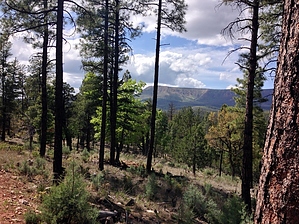


