 Route Editor

| Guide | ♦ | 33 Triplogs | 0 Topics |
details | drive | permit | forecast | route |
stats |
photos | triplogs | topics | location |
| 329 | 33 | 0 |
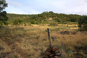
Mingus shorty by PrestonSands  Overview OverviewConveniently located near the Mingus Summit on Highway 89A, the Upper Mescal Trail #550 meanders along Mingus Mountain's forested slopes and deposits one into Mescal Gulch. You can also hike it in conjunction with its connecting trails: Mescal Trail #547 and Bug Hollow Trail #548. Hike From its trailhead along Highway 89A, the Upper Mescal Trail heads south through a fence next to a "550" signpost, following the route of a closed road. The trail gently descends to a large, grassy flat with a few scattered ponderosa pines, where the route fades into a footpath and continues in an east-southeast direction. One needs to watch carefully for cairns to remain on the route in this area.
Having left the grassy flat, the trail enters a pine forest and begins a gradual descent into a sloping basin at the head of Mescal Gulch. The roadbed portion ends abruptly at about 0.8 miles, where the trail makes a sharp left next to a cairn. Continuing now as a footpath, the trail drops into a shallow, oak-filled ravine to begin its final descent. After a 0.25 mile descent from the end of the roadbed, the Upper Mescal Trail reaches its end at a signed junction with the Bug Hollow Trail #548. To reach the Mescal Trail #547, turn left and follow the Bug Hollow Trail for a few hundred feet. One nice return hike option is to hang a left on the Bug Hollow Trail and follow it back to its beginning along Highway 89A, just 0.3 miles down the highway from the Upper Mescal trailhead. See the Bug Hollow Trail #548 hike for more information on this option. Check out the Official Route and Triplogs. Leave No Trace and +Add a Triplog after your hike to support this local community. One-Way Notice This hike is listed as One-Way. When hiking several trails on a single "hike", log it with a generic name that describes the hike. Then link the trails traveled, check out the example. | ||||||||||||||||||||||||||||||||||||||||||||||||||||||||||||||||||||||||||||||||||||||||||||||||||||||||||||||||||||||||||||||||||||||||||||||||||||||||||||||||||||||||||||||||||||||||||


