 Route Editor

| Guide | ♦ | 27 Triplogs | 0 Topics |
details | drive | permit | forecast | route |
stats |
photos | triplogs | topics | location |
| 419 | 27 | 0 |
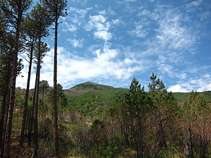
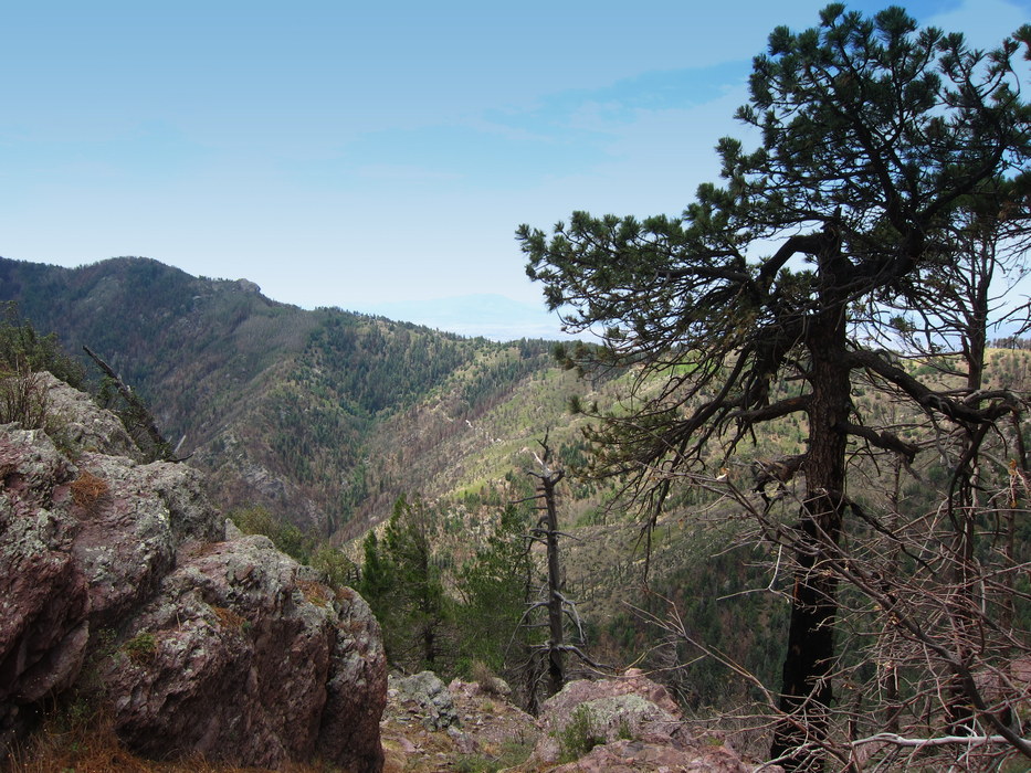
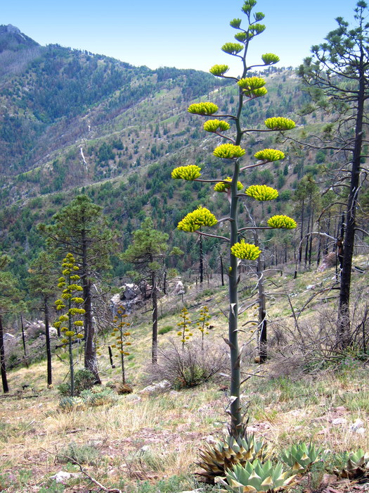
See both sides of the Thunder Mountains... by writelots  Overview OverviewThe Coronado National Forest webpage describes the Carr Peak trail as a "relatively moderate hike to some of the best views in the Huachucas". But what if you get up in the high country of this spectacular sky island and just can't quit at 'relatively moderate' anything? What if you want more - more than the sweeping views, wildflower meadows, and stunning cliffs? What if you want a taste of what the Huachuca Mountains were like before the string of fires that have laid Carr Peak bare? Then add a couple-three miles to your trip and loop around the "back" of the range for a whole different side of the mountain. History The Carr Peak trail owes much of its character to disaster. A massive wildfire in 1977 combined with unusually heavy rains to burn and wash away much of the vegetation and soil from the rocky slopes of Carr Peak. Once there were stands of pine and fir rich enough to support several profitable sawmill operations, there are now large open meadows, aspen stands, and exposed open mountainside. A second major fire in 1991 removed even more forest cover - and subsequent fires, including the Monument Fire in 2011, have continued to ravage the slopes. However, the upside of this intensive fire regime is the opening of the landscape to incredible views and impressive summer wildflower displays unique among the sky island ranges.
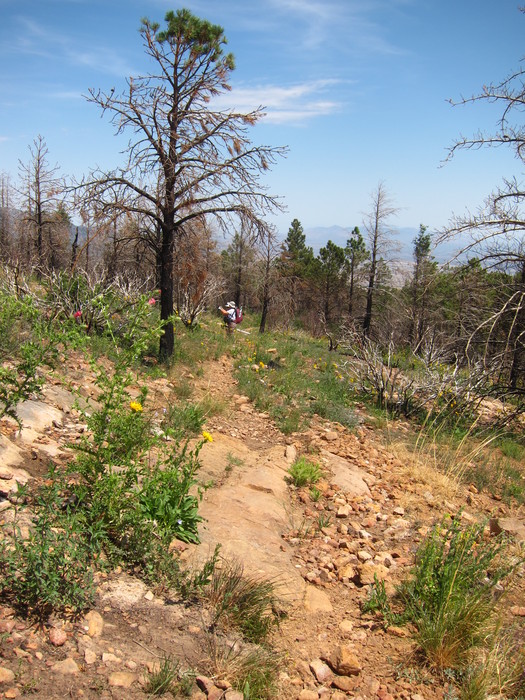
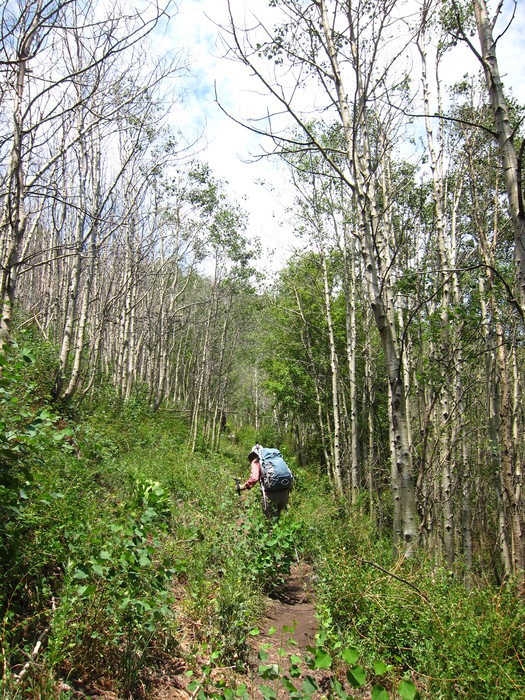
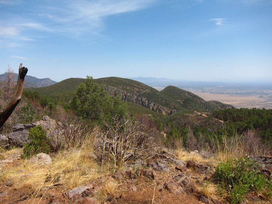
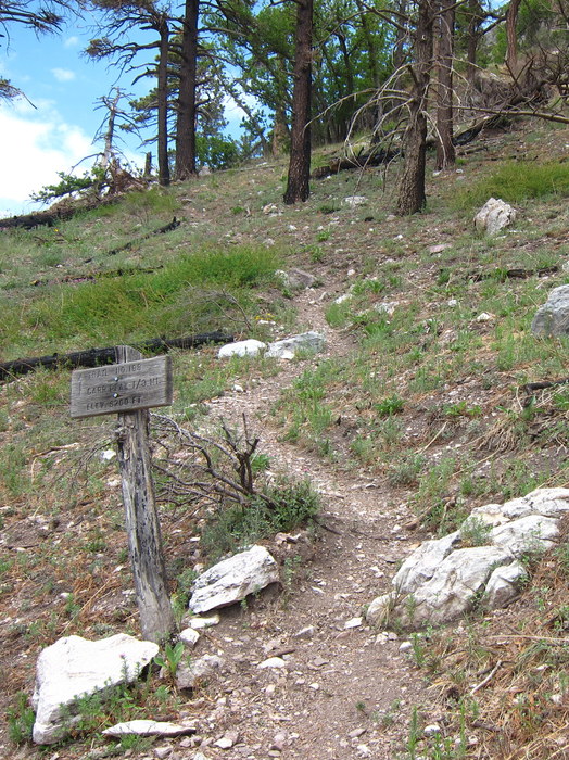
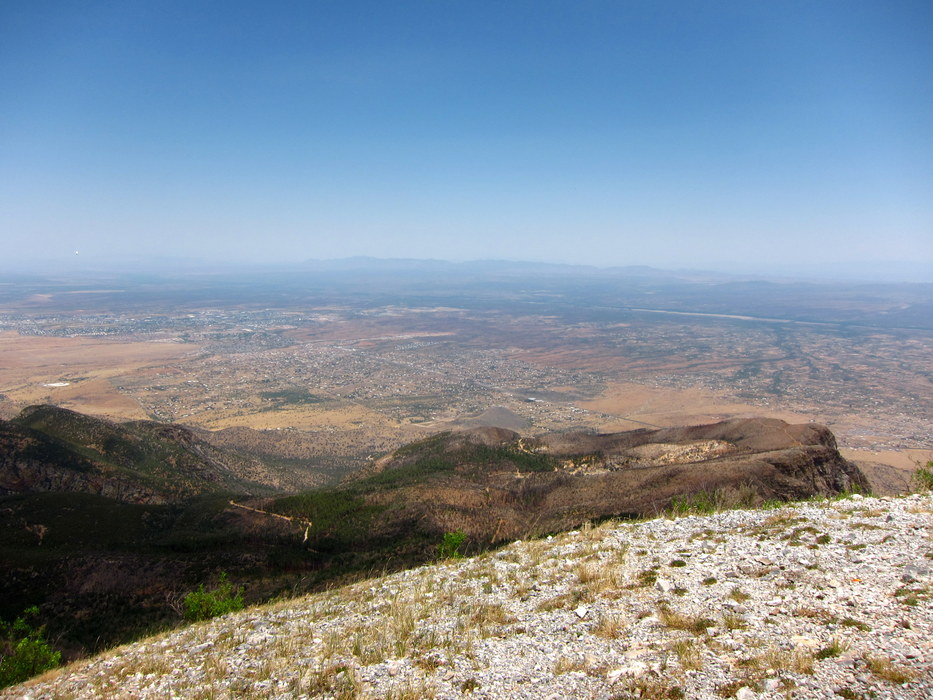
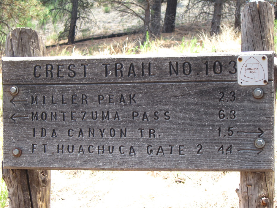
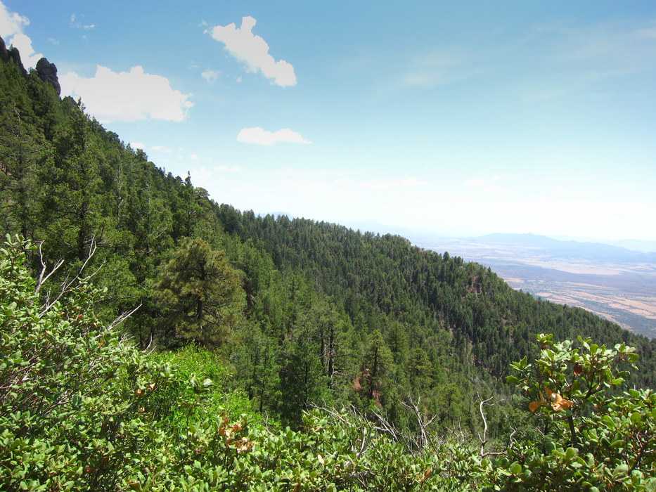
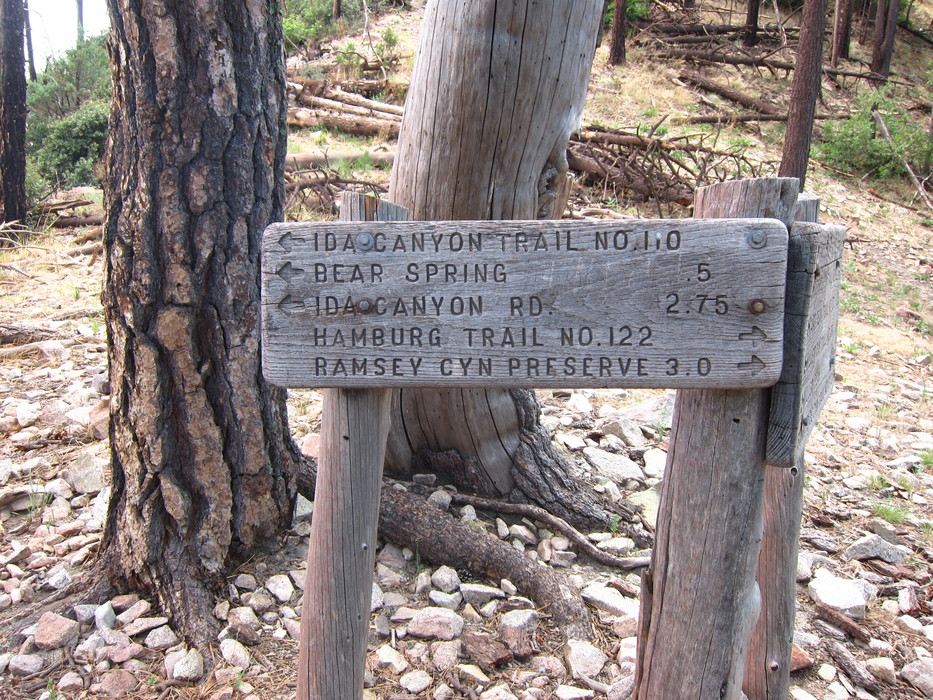
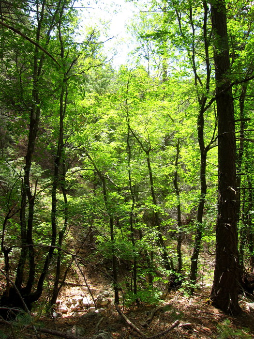
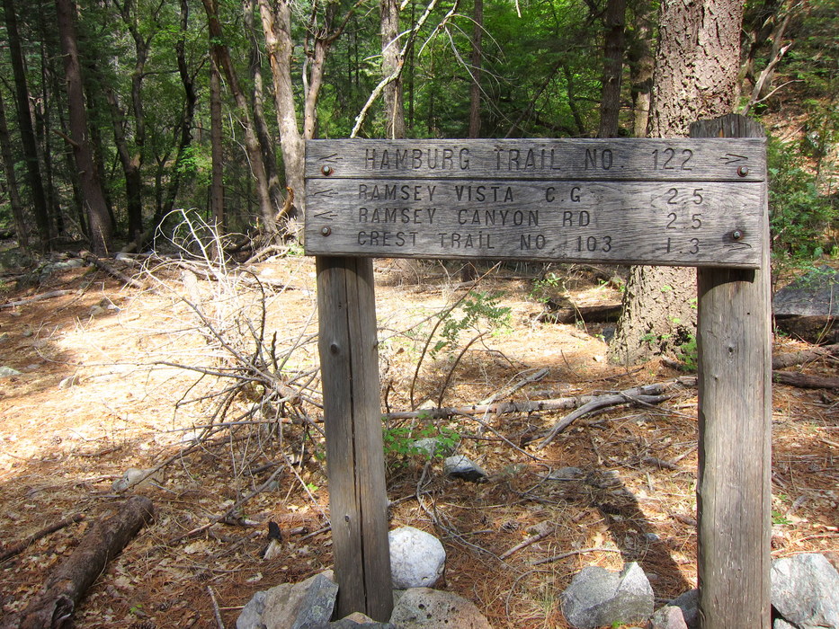
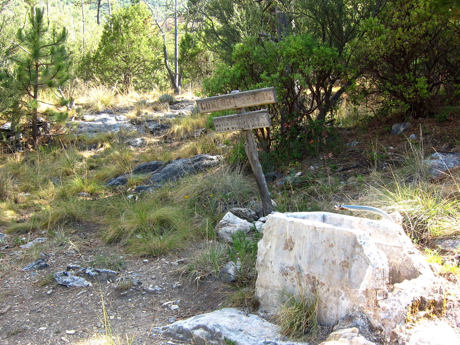
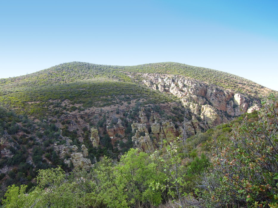
We believe this hike is best done clockwise, starting the day with the climb up to the Carr Peak summit. This way, you hit the peak still fresh and energized. There are several access points for the Carr Peak Trail, the lowest being via the Old Sawmill Spring trail out of the Reef Townsite campground. There are also two higher access points from the upper Ramsey Vista campground - one just below the campground itself and one inside the campground. This description leaves from this uppermost trailhead, as this is also its finish point at the end of the Comfort Springs Trail. From the campground, the trail begins a gradual ascent up the north and eastern slopes of Carr Peak. At about 1/4 mile, the trail passes the Old Sawmill Spring Trail spur leading to the Reef Townsite Campground. The slopes here are patchy with burned stands of pine and fir and large open meadows where wildflowers have begun to stabilize the thin soil. Stands of fresh-smelling aspen provide occasional patches of shade on the climb, but seldom interrupt the incredible views. The trail continues to climb gradually as it wraps around to the mountain's south flank and then up to a high saddle at approximately 9,000'. From here, you can see the ridgeline continuing more or less south toward the high point of the range - Miller Peak. The fires have exposed some amazing quartz veins on the mountainside here, and in many places, the Crest Trail is visible as it heads toward Miller. This portion of the Crest is on the AZT, as well. At approx. 2.6 miles from the trailhead, the trail reaches the junction with the Carr Peak Spur which continues the final 1/3 mile to the peak at 9,200ft (according to the sign). The peak is bald and rocky, with seemingly eternal views to the north, south and east - into Mexico and across Sierra Vista and Fort Huachuca. The extent of the fires can be seen most clearly from this vantage point, and it isn't easy to imagine what this landscape might have looked like before that big burn in '77. It is almost exactly 3 miles from the trailhead to the top of the peak. Returning to the spur junction, it is a quick and easy 1 1/3 miles downhill to the Crest Saddle and the end of the Carr Peak trail. This area has also been heavily affected by fires, and from the profusion of agave blooms we encountered in 2012, it is clear that these succulents have benefited from the clearing of the pine overstory. As mentioned earlier, the Crest/Arizona Trail continues south to Miller Peak and the Mexican border and north to the rest of the range. This loop turns right (north) and continues toward Bear Saddle and the Oversite/Ida Canyon trails. Here you begin to see the other 'side' of the Huachuca mountains. This area has been largely unaffected by the past wildfires and retains its rich, thick cover of pines and fir trees. It feels as though you have entered a whole different part of the state. The route passes the junction with the Oversite Canyon trail, which descends a steep south draining canyon ending near the Coronado National Memorial. About 2.3 miles from the peak, the trail reaches Bear Saddle, where the loop leaves the Crest/Arizona Trail and heads down the Hamburg Trail toward the Hamburg Mine. Signs indicate that you are heading to the Ramsey Canyon Preserve, as well. The Hamburg Trail begins to descend Wisconsin Canyon amid lush stands of pine, juniper, and maple (making this an ideal goal for a fall color trek). The 1,100' descent to the old mines and townsite at Hamburg might feel excessive - and Hamburg is almost 500 feet lower than the trailhead back at Ramsey Vista. There's even a quick drop further from the junction with the Pat Scott Canyon trail to the Comfort Springs Trail junction where the route heads back up toward the campground. From the Hamburg Junction, the Comfort Springs trail climbs gradually up the western face of Ramsey Canyon. Although the fires have not heavily affected this area, the natural cover is light - with only occasional short junipers and pinons to provide dotted shade. On our trip, nearly everyone ran out of water on this stretch, so caution is advised. The route climbs up to a low saddle, then drops slightly back down into a basin to meet up with Comfort Spring (which was bone dry on our visit and looks to be dry most of the year). The short climb back up to the trailhead is scenic, with the characteristic exposed slopes and rocky cliffs providing plenty of interest to help get up that last bit of trail. Water Sources: - Old Sawmill Spring - Bear Spring - Comfort Spring In wet seasons, water may be available below the junction with the Pat Scott Canyon Trail in Ramsey Canyon. Camping Excellent backcountry camping opportunities exist at several points along the Crest Trail and the Hamburg Townsite. However, illegal human and drug traffic has been common in this area, and most management agencies recommend camping in groups and exercising caution. Check out the Official Route and Triplogs. Leave No Trace and +Add a Triplog after your hike to support this local community. | |||||||||||||||||||||||||||||||||||||||||||||||||||||||||||||||||||||||||||||||||||||||||||||||||||||||||||||||||||||||||||||||||||||||||||||||||||||||||||||||||||||||||||||||||||||||||||||||


