 Route Editor

| Guide | ♦ | 74 Triplogs | 0 Topics |
details | drive | permit | forecast | 🔥 route |
stats |
photos | triplogs | topics | location |
| 669 | 74 | 0 |
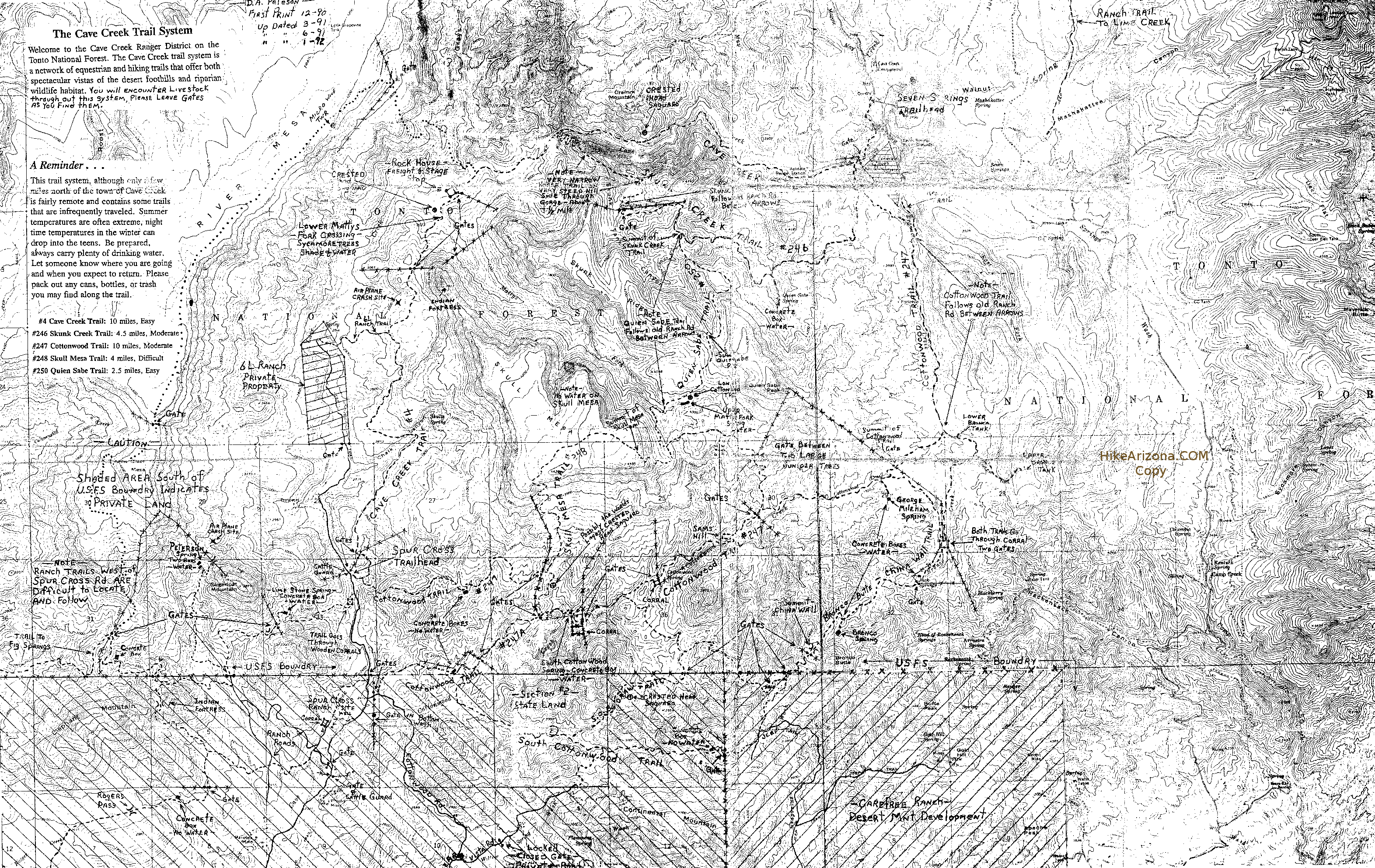
A spring in your step by kingsnake  Note NoteStatistics on this page reflect #252 one-way segment. The description below is a popular looping option, see this route for a 6.1mi / 580ft / 1045 aeg / 2.5-3 hour hike. Overview Trail 252 is a 2.9-mile connector trail between the Spur Cross and Elephant Mountain Trails. As I find the Spur Cross Trail -- or at least the section on Maricopa County Park land -- to be so boring, if you were traveling west-to-east, or vice-versa, say between Cave Creek Regional Park and Cave Creek Trail #4, Trail 252 combined with Elephant Mountain Trail would make a decent diversion, with more elevation gain. But that would be a long hike. What if you want to do something shorter, in Spur Cross, but (mostly) away from the dog walkers?
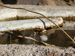
Take this lollipop. The loop is a tale of three segments: The out, the fun (Trail 252), and the back. As I hiked it, the out was from the drive-in port-a-potties, across Cave Creek, up Metate Trail, with a brief diversion into Towhee Trail, arriving at the Tonto National Forest gate in 1.2 total miles. Plenty of quail on Towhee Trail in winter, but very little vegetation beyond scattered orange berries. From there proceed north along FR 48 for about a mile to the old corral, which looks like it still gets occasional use. (Or, as I did, at 0.7 miles, where FR 48 crosses Cave Creek at a wash, get some minor rock-hopping in by going up Cave Creek to the old corral.) Trail 252 kicks off from the southwest corner of the old corral, there's a short, rocky climb out of the corral, then a slow steady climb on a decent track, towards Sugarloaf Mountain. (It looks like you will head north, around the mountain, but actually, you will end up turning south across its east slope.) There's lots of cactus in this area -- prickly pear, hedgehog, etc. -- but thankfully no cholla. At 2.5 total miles, you will cross to the south bank of the wash, and the trail will slope up a bit until you arrive at Limestone Spring in 2.9 total miles. (You can see where it gets its name from the scaling on the pipe.) The concrete tank was full, with a steady trickle. Probably okay with filtering. Quite a few bees, but not the aggressive kind. It is a bit confusing crossing south across a lush wash, before proceeding between Sugarloaf Mountain and Hill 2803. The highpoint of the hike, 3.3 miles in, is about 2900 feet, in the saddle between Sugarloaf Mountain and an unnamed 3100-foot hill. It is marked an old gate. It's not a government boundary, so must be from an old ranch. From there it is only a couple hundred yards to Page Spring, another concrete tank. (With, for some odd reason, a shovel hanging next to it.) It was also full and looked filterable. Both the north and south slopes of the saddle have several white rock runoffs that would make for an interesting exploratory diversion. So far the trail has been relatively benign, easy route finding, and not at all primitive like the park's map claims. However, from Page Spring south, the story changes. It gets very rocky, often hard to route find and, in the segment between the two perma-cairns, up and down across washes. Trail 252 is over, unless you continue south to the second perma-cairn, then back on Elephant Mountain Trail. Otherwise, as I did, dodge dog-walkers on the 2-mile trudge along Tortuga and Spur Cross back to the drive-in port-a-potties. (To make it interesting, I fantasized that I was skier moguling rocks with my hiking poles.) Gate Policy: If a gate is closed upon arrival, leave it closed after you go through. If it is open, leave it open. Leaving a closed gate open may put cattle in danger. Closing an open gate may cut them off from water. Please be respectful, leave gates as found. The exception is signage on the gate directing you otherwise.
Check out the Official Route and Triplogs. Leave No Trace and +Add a Triplog after your hike to support this local community. One-Way Notice This hike is listed as One-Way. When hiking several trails on a single "hike", log it with a generic name that describes the hike. Then link the trails traveled, check out the example. | ||||||||||||||||||||||||||||||||||||||||||||||||||||||||||||||||||||||||||||||||||||||||||||||||||||||||||||||||||||||||||||||||||||||||||||||||||||||||||||||||||||||||||||||||||||||||||


