 Route Editor

| Guide | ♦ | 3 Triplogs | 0 Topics |
details | drive | permit | forecast | 🔥 route |
stats |
photos | triplogs | topics | location |
| 11 | 3 | 0 |
Stripped of glory by PrestonSands  Overview OverviewThe High Peak Trail #300 is an unsigned and abandoned trail that once provided access to the summit of Mount Graham, locally known as "High Peak". While the designation of the upper reaches of Mount Graham as a refugium for the endangered red squirrel effectively closed the High Peak Trail in 1988, the Clark Peak Fire, along with the construction of telescopes and their associated service road, destroyed most of it. As a result, only the bottom one-half mile of the High Peak Trail is feasible and open to hiking, although there are a couple of short side trails to explore. The little information available on this trail from other sources is outdated, hence this write-up. State highway 366, which provides access to this hike, is closed yearly due to snow from November 15 through April 15 (or possibly later), about 6.3 miles before the trailhead.
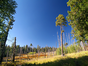
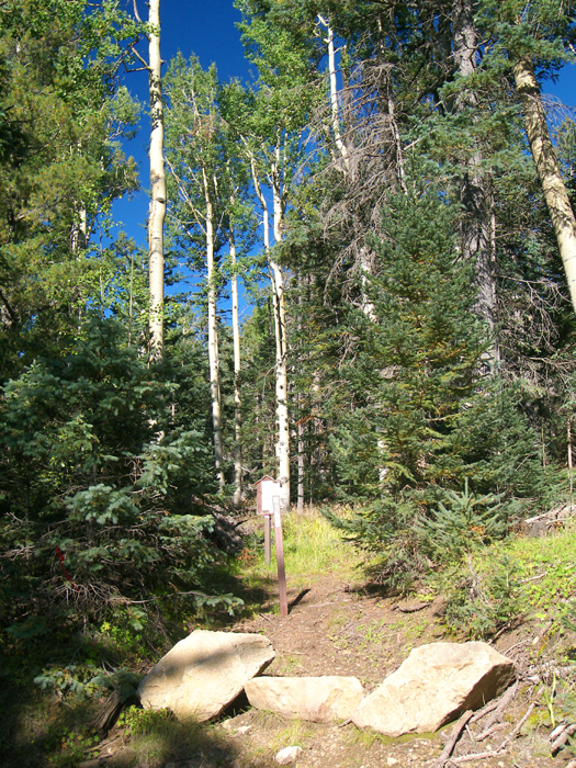
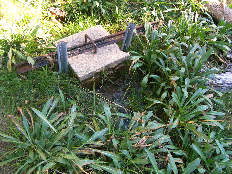
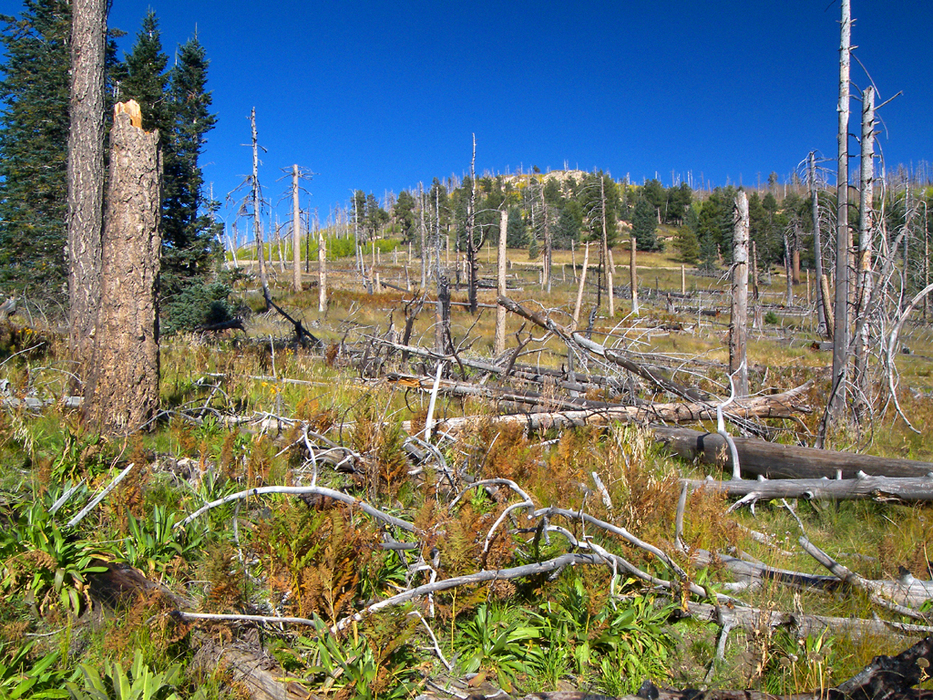
At the unsigned trailhead (32.70144 N, 109.91032 W) along the Swift Trail Highway, an obvious trail heads uphill to the east, away from the highway, marked only by a "closed to motor vehicles" signpost and a Refugium closure area map. This trail almost immediately comes to a fork among the tall aspens and spruce. The right fork is the trail, covered in deadfall. A left brings one to a water tank and shed, at which point one can make a right and catch the High Peak Trail within a short distance. Past the deadfall blockade, the High Peak Trail becomes a bit more obvious and is marked by ancient tree blazes and odd metal spikes in the ground. The trail soon comes to a spring bubbling out of a concrete block (32.70044 N, 109.90789 W), where a well-trodden side trail joins from the left. Make note of this junction for the return hike, as the side trail dead-ends in the forest. The High Peak Trail continues past the spring to enter a large, sloping meadow created by the 1996 Clark Peak Fire. Surprisingly, it is still possible to follow the High Peak Trail through the meadow along a decent footpath. At the far east end of the meadow, the High Peak Trail splits from the footpath and disappears into the tall grass. Instead of following the High Peak Trail, the better option is to continue straight along the footpath, which reenters the forest and turns south, before coming to a dead-end (32.69793 N, 109.90567 W) at several University Of Arizona structures located near the telescope road. If for some reason you want to follow the last bit of the High Peak Trail, return to the east end of the meadow (32.69924 N, 109.90605 W), where the High Peak Trail turns sharply to the northeast to climb uphill through tall grass and fallen trees. The trail, which exists only as a flagged route, crosses a switchback of the telescope road after a few hundred yards, near a sign that says "Celaeno 2". No trespassing signs located every few hundred feet along the road and the close proximity of the Red Squirrel Refugium boundary would seem to dissuade anyone wishing to continue on this fruitless hike. Return the way you came, as the U of A probably does not welcome strangers! Check out the Official Route and Triplogs. Leave No Trace and +Add a Triplog after your hike to support this local community. | ||||||||||||||||||||||||||||||||||||||||||||||||||||||||||||||||||||||||||||||||||||||||||||||||||||||


