Route Editor

| Guide | ♦ | 11 Triplogs | 0 Topics |
details | drive | no permit | forecast | 🔥 route |
stats |
photos | triplogs | topics | location |
| 135 | 11 | 0 |
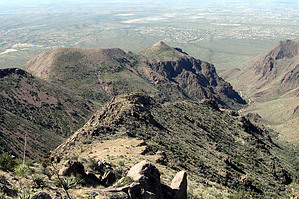
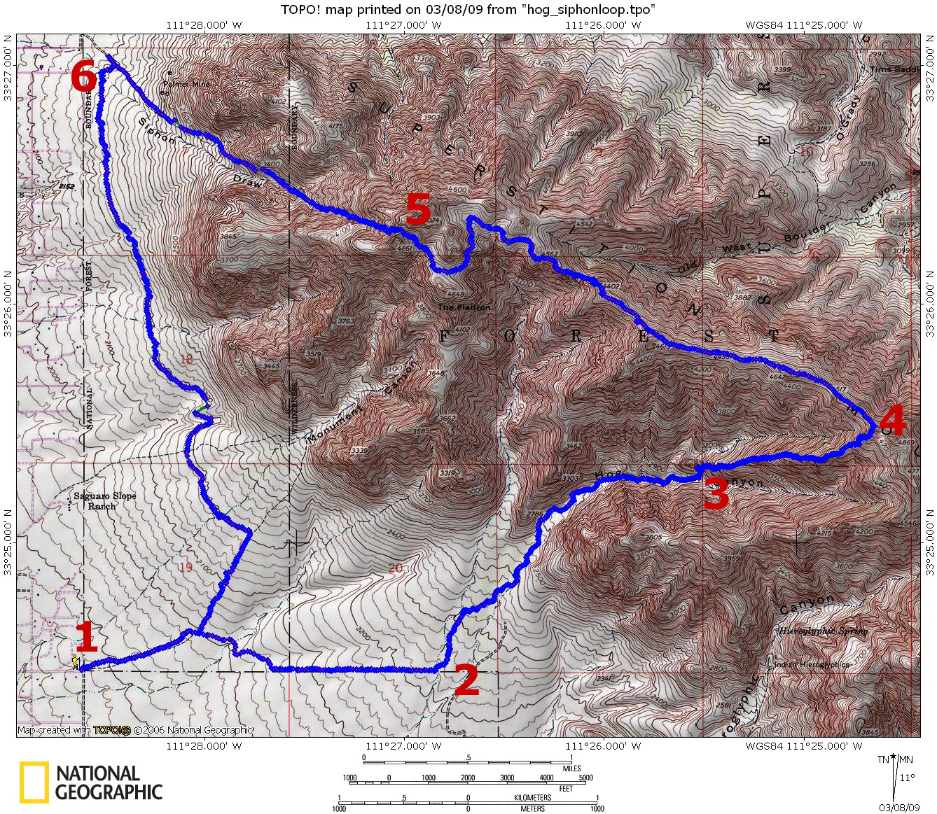
High on the Hog by Hansenaz  A few weeks ago, while thrashing around in the bottom of upper Hog Canyon in the Superstitions, it occurred to me that the central ridge (located between the two main branches of Hog Canyon) would make a better route. Ordinarily, I wouldn't go out of my way to test that idea. But I noticed something else about that time: the Broadway trailhead provides access to both Hog Canyon and Siphon Draw. Putting these together, I realized I could try out "Hog Ridge" and maybe make a nice loop. A few weeks ago, while thrashing around in the bottom of upper Hog Canyon in the Superstitions, it occurred to me that the central ridge (located between the two main branches of Hog Canyon) would make a better route. Ordinarily, I wouldn't go out of my way to test that idea. But I noticed something else about that time: the Broadway trailhead provides access to both Hog Canyon and Siphon Draw. Putting these together, I realized I could try out "Hog Ridge" and maybe make a nice loop.Broadway Trailhead seems to be a little bit obscure but is easily reached: From Hwy60, turn north on Mountain View to Broadway and turn right. Proceed to the end and park at the entrance to the subdivision. The trail soon reaches a junction: stay straight/right on the Lost Goldmine trail and cross the Hog drainage at 2 miles. Head up the drainage (either go through the fence or cross through the wash and head left to a small parking area and through a gate). It's rock hopping and sticker avoidance for the next 2 miles until you reach the nice waterfall area in a left spur of Hog Canyon (1hr 40min).
The Ridgeline is the nicest place in the greater PHX area and was a little crowded this day: I counted at least seven groups. Two more hours to the top of Siphon Draw, which was extremely crowded. The combination of my worn soles and dirt/rock dust kicked up on every surface made me feel like I was descending in roller skates. Anyway, it was a slow descent. As the trail starts to level out on the flat, there is a prominent intersection. There are no signposts, but to get back to the Broadway Trailhead, turn left: this is apparently Jacob's Crosscut. It's about 4 miles further to the trailhead through some lovely desert with amazing views of the Superstition Massif. This is a pretty nice loop. I wasn't moving very fast, so I don't think it would be hard to get it done a little quicker. The GPS had it at 3946' AEG: that must include all the ups and downs along the way. Gate Policy: If a gate is closed upon arrival, leave it closed after you go through. If it is open, leave it open. Leaving a closed gate open may put cattle in danger. Closing an open gate may cut them off from water. Please be respectful, leave gates as found. The exception is signage on the gate directing you otherwise.
Check out the Official Route and Triplogs. Note This is a more difficult hike. It would be unwise to attempt this without prior experience hiking. Leave No Trace and +Add a Triplog after your hike to support this local community. | ||||||||||||||||||||||||||||||||||||||||||||||||||||||||||||||||||||||||||||||||||||||||||||||||||||||||||||||||||||||||||||||||||||||||||||||||||||||||||||||||||||||||||||||||||||||||||||||||||||||||||