 Route Editor

| Guide | ♦ | 104 Triplogs | 2 Topics |
details | drive | no permit | forecast | route |
stats |
photos | triplogs | topics | location |
| 707 | 104 | 2 |
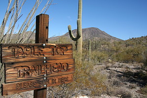
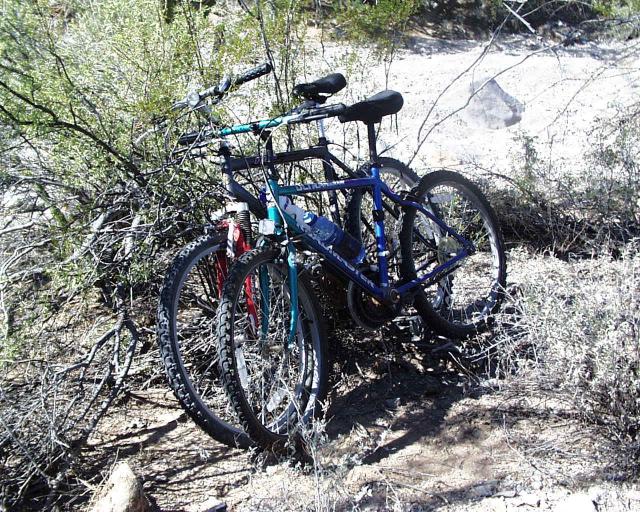
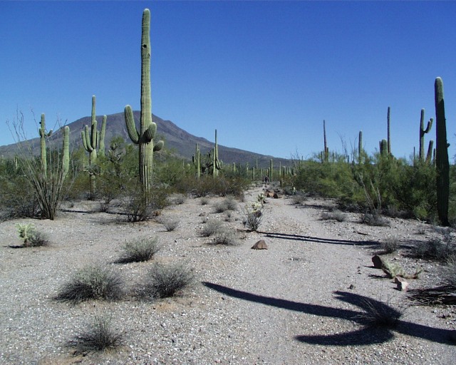
Got Switchbacks ??? by annette  When you first see Table Top Mountain and the surrounding desert from a distance, you might be deceived into thinking that this will be a boring hike. However within the last couple of miles, before approaching the trailhead parking area, you may be pleasantly surprised by the quantity of desert flora and the comforting feeling of the nearby mountains, especially the ones covered with black lava rock. When you first see Table Top Mountain and the surrounding desert from a distance, you might be deceived into thinking that this will be a boring hike. However within the last couple of miles, before approaching the trailhead parking area, you may be pleasantly surprised by the quantity of desert flora and the comforting feeling of the nearby mountains, especially the ones covered with black lava rock.As Rodney, Mike, and I stood near the trailhead and looked toward Table Top Mountain, we thought that this would be about a "difficulty 3" hike. Well, we misread this one! We later encountered two bikers who had early on abandoned their bikes and decided to proceed on foot. However, they made it only halfway up the face of the mountain before calling it quits.
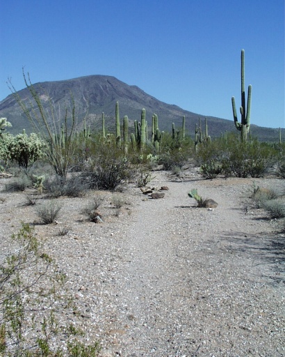
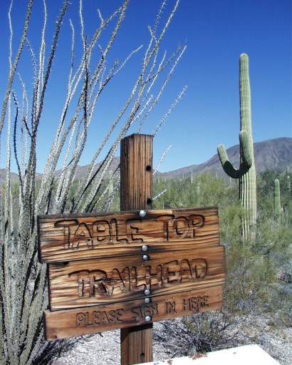
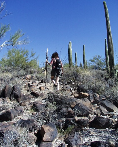
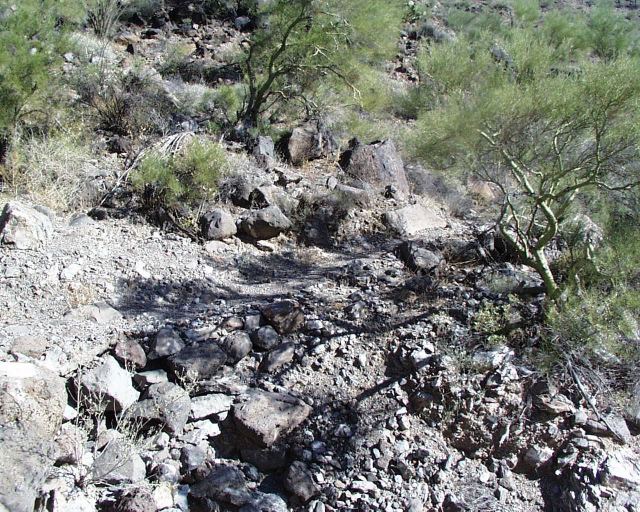
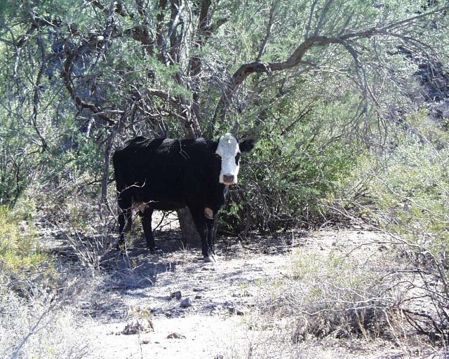
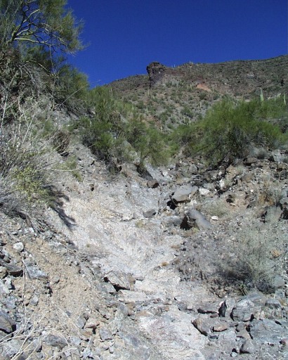
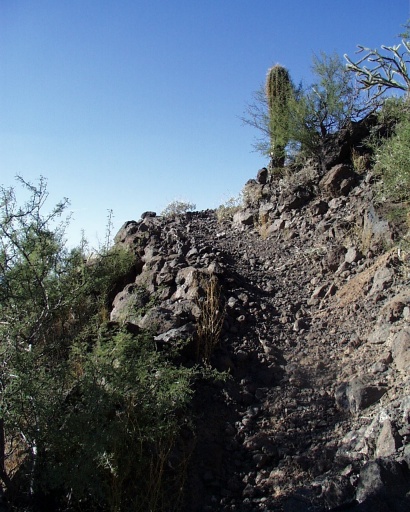
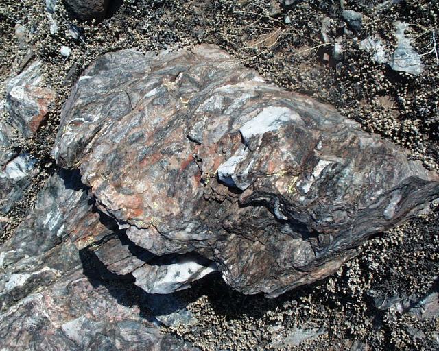
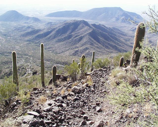
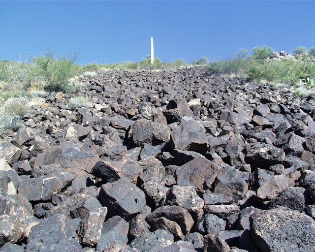
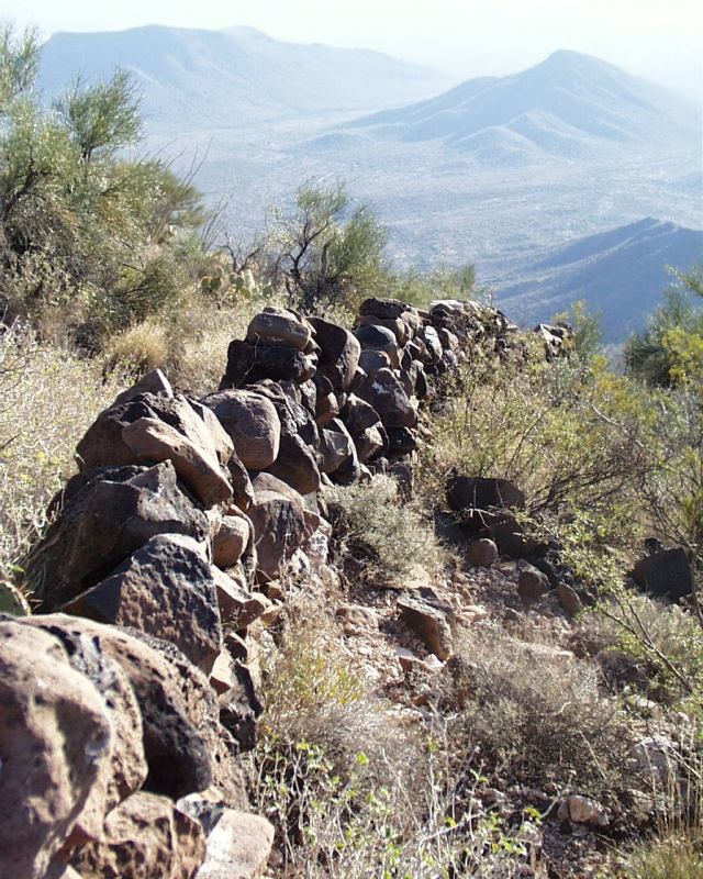
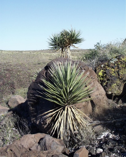
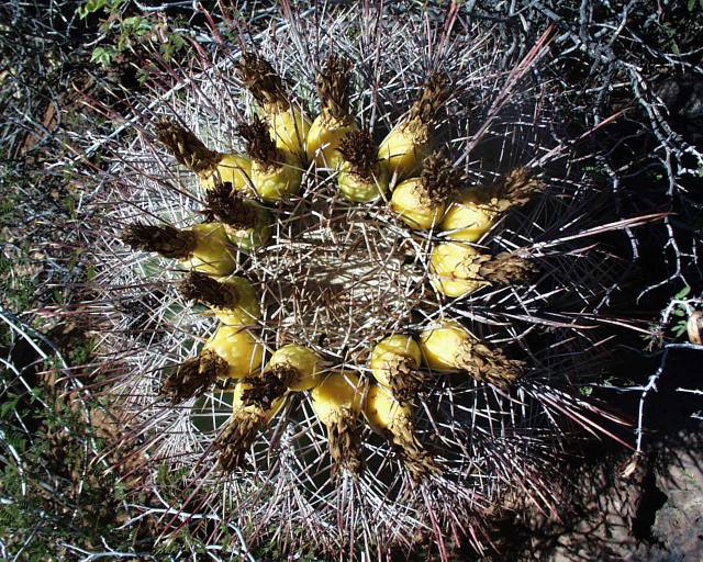
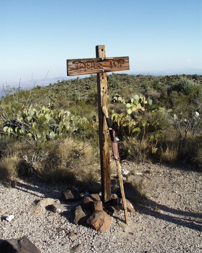
The most difficult obstacle you will face, this early in the hike, is just over a half-mile in where you will be expected to write your name in the trail register. That's pretty easy... isn't it? Good'as they say, "it's all uphill from here"!! The trail soon gives way to a series of gradual slopes that become increasingly rock-strewn. Keep an eye out for these types of rock: lava, banded gneiss, and a multitude of white quartz with some rosy, orange, and purple quartz thrown in once in a while for contrast. You will soon begin to ascend a ridgeline toward the mountain. The closer we hiked to the base of Table Top Mountain the higher it seemed to rise from the desert floor, taunting us, and daring us to make it to the top if we could. As we looked up, we could not make out any visible trails whatsoever (only a couple of washes). But the trail was there unfolding several feet at a time in front of us! At 1 3/4 miles in, we crossed the Vekol Wash. We looked down the wash to the right and spotted the only sizeable wildlife we were to see from the trail. She resembled a panda and was "utterly" beautiful. The trail follows a relatively straight ridge and then starts to climb through several rocky switchbacks before dropping into the big wash. On the other side, the climb to the top begins in earnest through even more switchbacks than any of us would like to imagine. Along these, you will find some beautiful large rocks with quartz extrusions. Fantastic! Sometimes the rocks that comprise the trail seem cemented together, at other times dangerous scree, but usually just lots of rocks. This was where Mike described his descent of the mountain as "Scree Surfing". As you ascend the mountainside, you will find a field of lava rock, approximately 25 feet wide and 100 feet long. Near the lava field, two or three walls (about 3 to 4 feet high) had been constructed of lava and other rock. The purpose of these walls was unclear. anonymous wrote: Civil war soldiers who occupied the mountain long ago built the walls for protection from invading soldiers from below. Plant life seen in this area are aloe, century plants, yucca, and some additional types of cacti that were not seen in the lower elevations. Upon attaining the summit of the mountain, we saw the Table Top Trail post signifying the end of the trail. We were rather dismayed that there was no cowboy steak dinner or at least a pizza awaiting our arrival. We did, however, find a couple of lava seats to go with the "table". Nearby we found most of a bovine skull and two jawbones that still had some teeth attached. Guess someone or something else beat us to the meal we thought we so richly deserved! The views from on top are awesome. We could see South Mountain, the Estrellas, Eagletail Mountains, the Barry M. Goldwater Air Force Range, Vekol Mountains, Picacho Peak, Mount Lemon, Lake Saint Clair, Casa Grande, I-8, and I-10. The day we chose to hike turned out to be pretty hazy, so if you know how to pick a day that won't be, then go for it and add your pictures to the site.
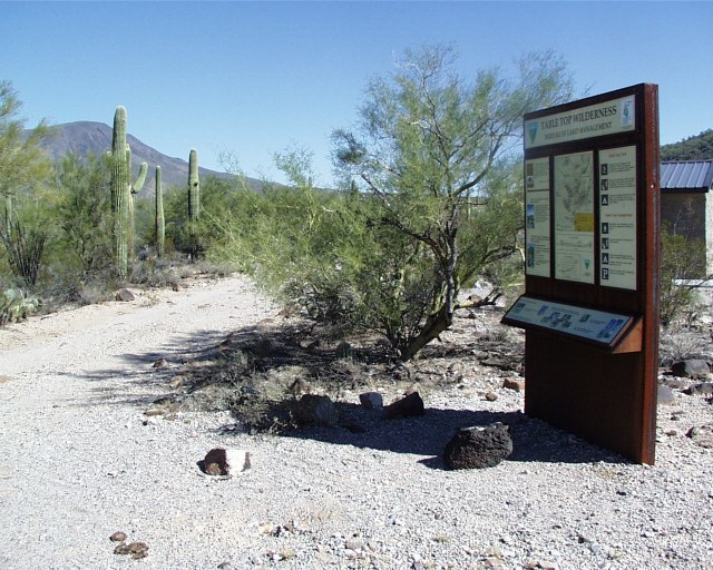
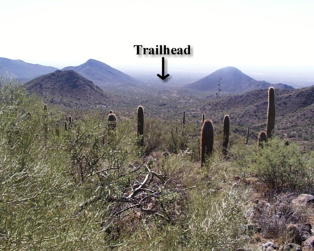
BLM Division Details Table Top Trail, in the 34,400-acre Table Top Wilderness, takes visitors from the floor of Vekol Valley (elevation 2,299 feet) to the summit of Table Top Mountain (elevation 4,356 feet) in just 3.5 miles. Along the way, visitors are treated to a variety of Sonoran Desert plants and wildlife, scenic vistas, and evidence of the area's volcanic history. The view from atop the summit is a dramatic panorama of rugged mountain ranges and desert plains. The tail begins by crossing several small washes and bajadas (desert outwash plains), and winds northeasterly toward Table Top Mountain through forests of saguaro, cholla, prickly pear, paloverde, and ironwood. At the base of the mountain, the trail begins a series of switchbacks on its steep ascent to the summit. Near the summit the trail is bordered by four-foot-tall walls of loosely piled stones, the origin and purpose form which are unknown. Vegetation on the summit includes an unusual 40-acre island of desert grassland. ACCESS: Exit Interstate 8 at the Vekol Valley Interchange (Exit 144) approximately 26 miles east of Gila Bend and 34 miles west of Casa Grande. Travel south on Vekol Valley Road 2.1 miles to the Vekol Ranch turnoff and continue south on the dirt- surfaced road to the right, using the schematic map below. It is 15.3 miles from I-8 to Table Top Trailhead. FACILITIES: Table Top Trailhead includes a small, three-site campground with picnic tables, fire-rings, a vault toilet, and day-use parking for approximately 10 vehicles. No water or trash collection is provided. MAPS: Table Top Trail is depicted on the USGS 7.5-minute topographic map entitled "Little Table Top, Ariz." The remainder of the Table Top Wilderness is depicted on USGS 7.5-minute topographic maps "Antelope Peak, Ariz.," "Indian Butte, Ariz.," and "Vekol Mts., NE, Ariz." NOTES:
Check out the Official Route and Triplogs. Note This is a moderately difficult hike. Leave No Trace and +Add a Triplog after your hike to support this local community. | |||||||||||||||||||||||||||||||||||||||||||||||||||||||||||||||||||||||||||||||||||||||||||||||||


