 Route Editor

| Guide | ♦ | 6 Triplogs | 0 Topics |
details | drive | permit | forecast | route |
stats |
photos | triplogs | topics | location |
| 75 | 6 | 0 |
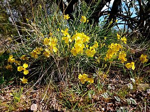
 You walk 100 yards south, to the north end of Pipeline Canyon Trail, then turn northwest for a little over a mile. Then head back. Anyone not using a walker could do it. You walk 100 yards south, to the north end of Pipeline Canyon Trail, then turn northwest for a little over a mile. Then head back. Anyone not using a walker could do it.Cottonwood Trail is again decent trail surface. It crosses several sandy, gravelly, washes. It is lined by the usual desert shrubbery: Yellow Paloverde, creosote, brittlebush, etc.
Check out the Official Route and Triplogs. Leave No Trace and +Add a Triplog after your hike to support this local community. One-Way Notice This hike is listed as One-Way. When hiking several trails on a single "hike", log it with a generic name that describes the hike. Then link the trails traveled, check out the example. | ||||||||||||||||||||||||||||||||||||||||||||||||||||||||||||||||||||||||||


