Route Editor

| Guide | ♦ | 12 Triplogs | 0 Topics |
details | drive | no permit | forecast | 🔥 route |
stats |
photos | triplogs | topics | location |
| 206 | 12 | 0 |
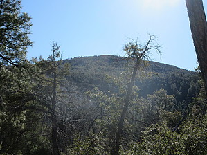
Horsing Around in the Sierra Ancha by DixieFlyer   Overview OverviewAt an elevation of 7,510', McFadden Horse Mountain (not to be confused with nearby McFadden Peak) is one of 6 summits in the Sierra Ancha that are over 7,500'. History From the guide for the McFadden Horse Trail #146: "McFadden Horse Mountain derives its name from William McFadden, who had been a part of a vigilante group during the Pleasant Valley War. McFadden later settled in the Sierra Ancha, founding the Circle Ranch on McFadden Creek, at the western foot of the mountain that bears his name."
Hike The hike begins by taking McFadden Horse Trail #146 south from the trailhead. You'll start going uphill almost immediately, and the trail is a bit steep and is rocky in places. After about 1 mile and 600' in elevation gain, you'll come to a junction with the Cienega Trail #145. At the junction, if you were to continue straight you'd be on the Cienega Trail; instead, turn left (there is a trail sign there indicating that the McFadden Horse Trail goes left). From the junction, the trail steepens and you'll gain about 1,000' in elevation in about a mile. The trail is not maintained regularly, but it is mostly relatively easy to follow, and there are quite a few cairns along the way. You'll be passing through a burn area, and there are several downed trees across the trail. The deadfall isn't too severe, but it can be an annoyance to get around, over, or under it. Once you get to about 7,300' in elevation, the trail flattens out and you'll be above the burn area. This is a nice part of the hike -- you'll be hiking among tall pine trees that aren't too dense, and there are lots of huge cairns that guide the way. The mountain is relatively flat at the top, and no summit is easily recognizable. The high point is just west of the trail -- I turned off of the trail next to a large cairn at these coordinates: 33.88055, -110.94254. This is about the easiest off-trail hiking that you will ever do. I walked a short distance to an area that clearly looked to the highest point on the mountain. However, there is no summit cairn or benchmark that I could find. After walking around a bit and measuring the elevation at various places with my Garmin GPS, I marked the high point at these coordinates: 33,88018, -110.94367. It could easily be argued that this is not the exact high point, but I could not see another point that looked to be higher. In any event, if you walked around a bit in this vicinity, I think that you can legitimately claim to have bagged the McFadden Horse Mountain High Point! Check out the Official Route and Triplogs. Leave No Trace and +Add a Triplog after your hike to support this local community. | |||||||||||||||||||||||||||||||||||||||||||||||||||||||||||||||||||||||||||||||||||||||||||||||||||||||||||||||||||||||||||||||||||||||||||||||||||||||||||||||||||||||||||||||||||||||||||||||||||||||||||||