 Route Editor

| Guide | 0 Triplogs | 0 Topics |
details | drive | no permit | forecast | 🔥 route |
stats |
photos | triplogs | topics | location |
| 10 | 0 | 0 |
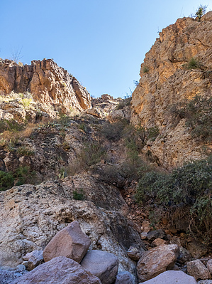
Why go through it when you can go over it?? by eru  Warning WarningThere is some initial steep class 2 with some short moderate class 3 (use both hands climbing). While route-finding should be pretty self-evident, you can cliff out and get in danger, so pay attention to your surroundings. The GPS route is just pieced together from the waypoints I marked, so it should be taken in a somewhat general manner. Overview You climb out of Upper Peter's Canyon near the junction with Bushwhack/Pistol Canyon (B/P canyon from here on), gain the ridge, then traverse high until you find an appropriate place to drop, avoiding all bushwhacking.
Hike Follow along with the photoset slideshow, noting that photo 4 for Follow along some reason has whacked out GPS coordinates on it. All directions are going from Peter's Canyon to the top of Bushwhack/Pistol. Just east of the junction between upper peter's and bushwhack/pistol, there's a gully heading towards an obvious notch. We chose to go up the knobby rock in the middle of it, but you can choose to go on either side if you're more comfortable (less climby, more spiky things). The gully will reach a minor wall. You can go to the right and try and scramble up without climbing (or be too lazy to do that and just climb 5-6 feet up that wall like we did if you find a spot that looks safe. :) Once above that, you'll be facing a much more significant face - at this point, I was pondering having to cut left and do some significant climbing, but went to the right where you can walk to the top of the ridge overlooking B/P canyon for the view. It turns out you can go from this to an easy gentle grassy slope alongside the canyon! I forgot to take photos of the face/approach here as the view was more interesting, but hopefully, it'll be apparent once you get to it. After that, it's pretty simple, aim for a large outcropping mid-point on the ridge, then keep traversing, staying above the cliff bands until you find a comfortable place to drop. We passed a few that'd look doable if a little steep but decided they weren't worth the effort of dropping then regaining elevation in the canyon, so stayed high until a very easy drop near the end presented itself. This would be a bit slower than dropping early, as you're following the counter above gulches, but it's probably more pleasant. Once at the top of the canyon, we followed the side of Peter's Mesa - straightforward but annoying with cacti to avoid and a slope to walk on. Some cairns and a deer path, but pretty CYA until you meet back up with the trail. Check out the Official Route. Leave No Trace and +Add a Triplog after your hike to support this local community. One-Way Notice This hike is listed as One-Way. When hiking several trails on a single "hike", log it with a generic name that describes the hike. Then link the trails traveled, check out the example. | |||||||||||||||||||||||||||||||||||||||||||||||||||||||||||||||||||||||||||||||||||||||||||||||||||||||||


