username
X
password
register
for free!
help
   🔥

Tatanka Trail #735, AZ

Guide 5 Triplogs  0 Topics
  4 of 5  
Fav
Wish
0
details
drive
permit
forecast
🔥
route  
stats
photos
triplogs
topics
location
2 5 0
Statistics
tap row or icons for details
Difficulty 0.5 of 5
Distance One Way 2.03 miles
Trailhead Elevation 5,845 feet
Elevation Gain -147 feet
Accumulated Gain 168 feet
Kokopelli Seeds 2.59
unreported if dogs are allowed
editedit > ops > dogs to adjust
feature photo
Photos Viewed All MineFollowing
1  2025-01-25
Tunnel -Russ-Link-Italy-Willowy Loop
Whiffer
4  2022-08-06
Javelina-West Side Story Loop
Whiffer
1  2022-01-15
Javelina-West Side Story Loop
Whiffer
2  2021-04-17 Whiffer
Author
author avatar Guides 3
Routes 161
Photos 477
Trips 147 map ( 805 miles )
Age 70 Male Gender
Location Prescott, AZ
Co-Author
co-author avatarGuides 16,843
Routes 17,472
Photos 24
Trips 1 map (6 Miles)
Age 28 Male Gender
Location HAZ, TrailDEX
Associated Areas
list map done
Prescott Region
Historical Weather
Trailhead Forecast
Radar Map
Expand Map
Preferred Oct, Apr, May, Nov
Sun  6:05am - 6:53pm
Official Route & 1 Rt
 
3 Alternative
 
Historic Fire Perimeteracres
🔥 2018 Stubbs Fire34.7 mi**


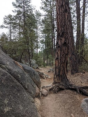
Unlike most of the trails in the Spence Springs Basin, Tatanka Trail is most easily accessed from the Iron Springs Trailhead via West Side Story Trail #725, provided you are willing to hike uphill to return to the trailhead.


The Iron Springs Trailhead is 1.3 miles past the 45 mph sign on Iron Springs Road heading west from Prescott, AZ. Javelina Trail crosses Iron Springs Road at the Iron Springs Trailhead and (when hiking south) begins to follow the Iron Springs Railway right-of-way. West Side Story Trail #725 is just west of the north-south portion of Javelina Trail along the Iron Springs Railway right-of-way, while Tatanka Trail is squiggly parallel to the northwest to the southeast portion of Javelina Trail.
remove free decal offer
The combination of West Side Story Trail and Tatanka Trail provides a 4.5 miles of natural trail alternative to the portion of Javelina Trail along the Iron Springs Railway right-of-way. Tatanka Trail connects with six other trails (listed West to East) in the Spence Springs Basin: Tunnel Vision Trail #714, Waterline Trail #733, Sidekick Trail #721, Russ T. Fender Trail #728, Rocky Top Trail #727, and Missing Link Trail #724.

2021-04-17 Whiffer & HAZ_Hikebot


    Check out the Official Route and Triplogs.
    Leave No Trace and +Add a Triplog after your hike to support this local community.

    One-Way Notice
    This hike is listed as One-Way.

    When hiking several trails on a single "hike", log it with a generic name that describes the hike. Then link the trails traveled, check out the example.
    WARNING! Hiking and outdoor related sports can be dangerous. Be responsible and prepare for the trip. Study the area you are entering and plan accordingly. Dress for the current and unexpected weather changes. Take plenty of water. Never go alone. Make an itinerary with your plan(s), route(s), destination(s) and expected return time. Give your itinerary to trusted family and/or friends.

     Permit $$
    no fees or permits reported

    if incorrect tell us about it

    Prescott Forest
    Prescott National Forest Pass

    Only trailheads with six "amenities" have fees. Amenities are picnic tables, trash, toilet, parking, interpretive signing and security.


     Directions
    or
     Road


    To hike
    page created by joebartels on Apr 17 2021 8:06 pm
     90+° 8am - 6pm kills
    helpcorrectionissue

    end of page marker