 Route Editor

| Guide | ♦ | 1 Triplog | 0 Topics |
details | drive | no permit | forecast | 🔥 route |
stats |
photos | triplog | topics | location |
| 2 | 1 | 0 |
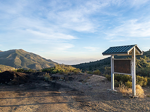
this is not the path to conner canyon by eru  This hike is at the large pullout with the former sign near conner canyon. It starts as an ATV track-sized path (with some significant bumps) then gradually dwindles to a single-track path that heads up to the top of a hill, then fragments and disappears into the brush. This hike is at the large pullout with the former sign near conner canyon. It starts as an ATV track-sized path (with some significant bumps) then gradually dwindles to a single-track path that heads up to the top of a hill, then fragments and disappears into the brush.You can camp on top of it, and there's an old fire ring, but it's not a great view and it sort of baffles me. A view of where Parker Creek Trail #160 goes is the only vaguely interesting thing about it.
The route and guide are here solely to make it clear what it is - we accidentally went up this due to it being near the Conner Canyon trail/jeep road. It wasn't going in the right direction, but seldom used older USGS trails (this shows up on 1980 maps) are often vaguely aspirational in their accuracy. Check out the Official Route and Triplog. Leave No Trace and +Add a Triplog after your hike to support this local community. One-Way Notice This hike is listed as One-Way. When hiking several trails on a single "hike", log it with a generic name that describes the hike. Then link the trails traveled, check out the example. | ||||||||||||||||||||||||||||||||||||||||||||||||||||||||||||||||||||||||||||||||||||||||||||||||||


