 Route Editor

| Guide | ♦ | 196 Triplogs | 8 Topics |
details | drive | permit | forecast | route |
stats |
photos | triplogs | topics | location |
| 2k | 196 | 8 |
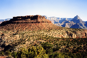
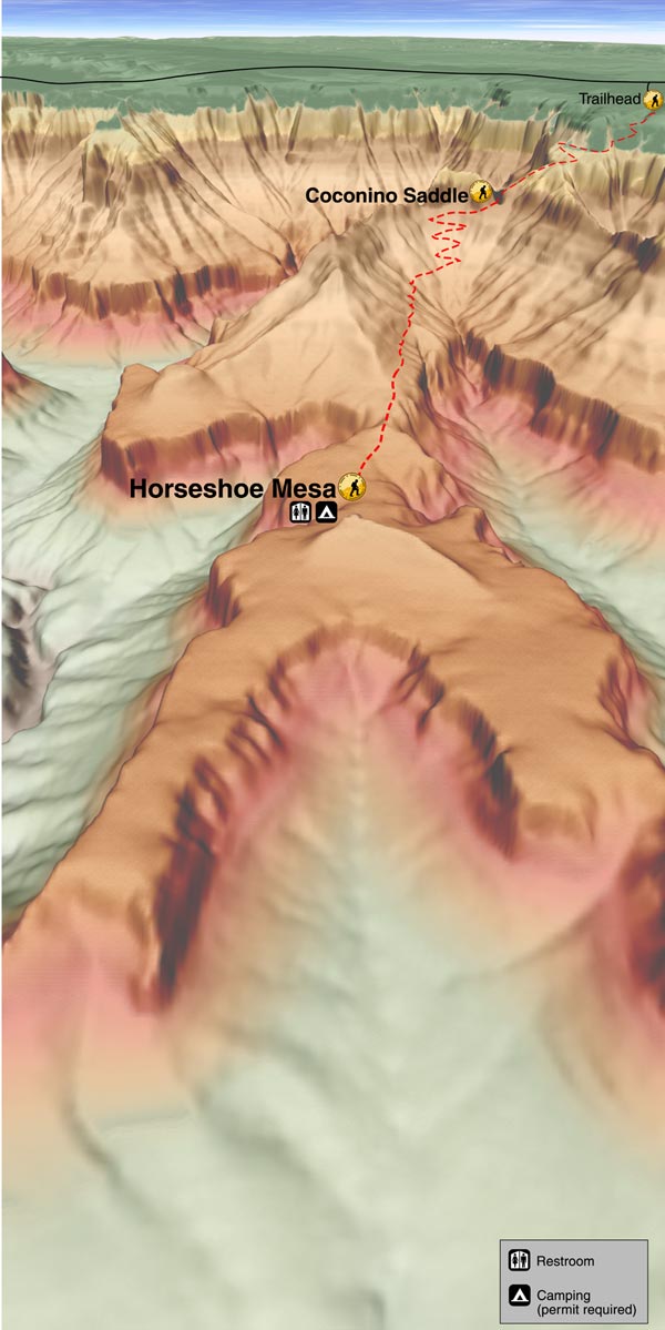
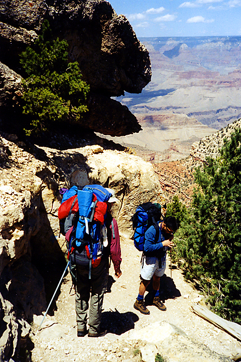
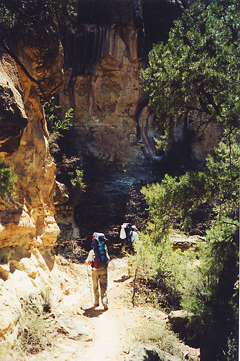
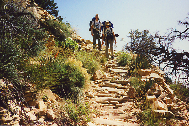
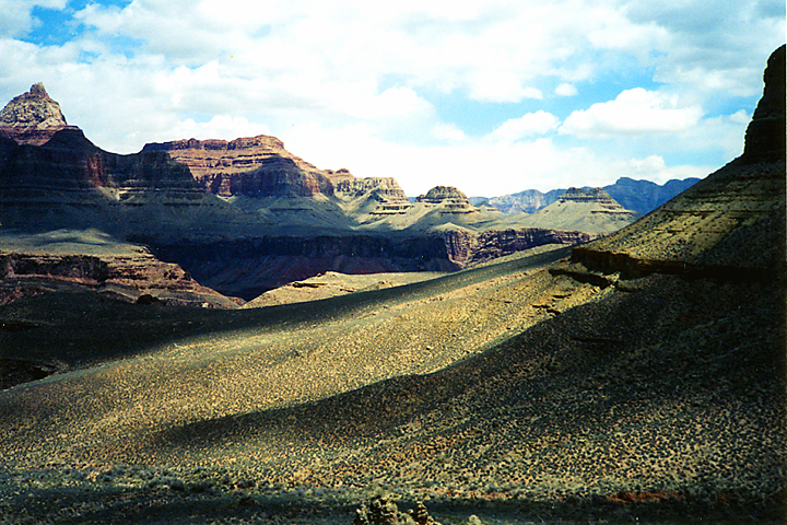
Caves, Mines, and History by PrestonSands   The Grandview Trail was built in 1892 to reach the rich "Last Chance" copper mine on Horseshoe Mesa. Much of this steep trail was covered in tightly fitted cobblestones, some of which can still be seen today. Mule trains would bring copper ore up to Grandview Point, where there was a processing mill. Horseshoe Mesa makes a great destination for either a day hike or a backpacking trip; I was 12 years old when I first hiked this trail with my dad. The Grandview Trail was built in 1892 to reach the rich "Last Chance" copper mine on Horseshoe Mesa. Much of this steep trail was covered in tightly fitted cobblestones, some of which can still be seen today. Mule trains would bring copper ore up to Grandview Point, where there was a processing mill. Horseshoe Mesa makes a great destination for either a day hike or a backpacking trip; I was 12 years old when I first hiked this trail with my dad.The trail begins at Grandview Point on the south rim of the Grand Canyon, about 10 miles east of Grand Canyon Village. The trail immediately begins descending the Kaibab Limestone cliff through a series of switchbacks blasted into the rock. Stacked wooden logs support some parts of the trail. At the base of the Kaibab wall, the trail levels off for a way as it wraps its way around an island of rock. Once on the east face of the island, the trail drops through the Coconino Sandstone via cobblestone covered switchbacks. At the base of the switchbacks is Coconino Saddle, a notch in the cliffs that makes a fine rest stop. To your right (south), there is a nice view of Sinking Ship and upper Hance Creek canyon. Below Coconino Saddle, the trail descends into the red rocks of the Hermit Shale and the Supai Formations. Enjoy the shade on these next switchbacks; soon after, you will leave most of the trees behind. Along the next couple of miles to Horseshoe Mesa, the original trail has been covered over by rock slides, but the trail is not hard to follow.
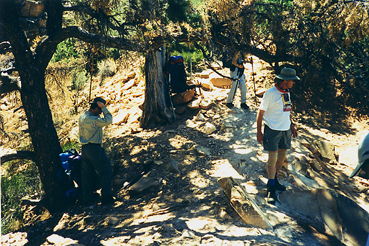
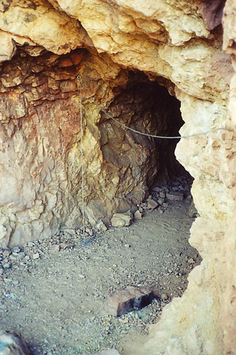
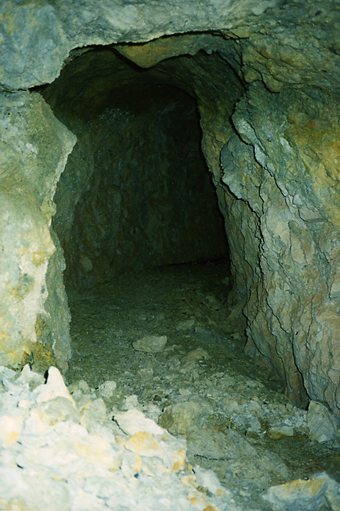
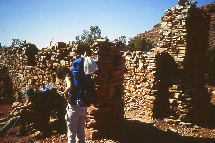
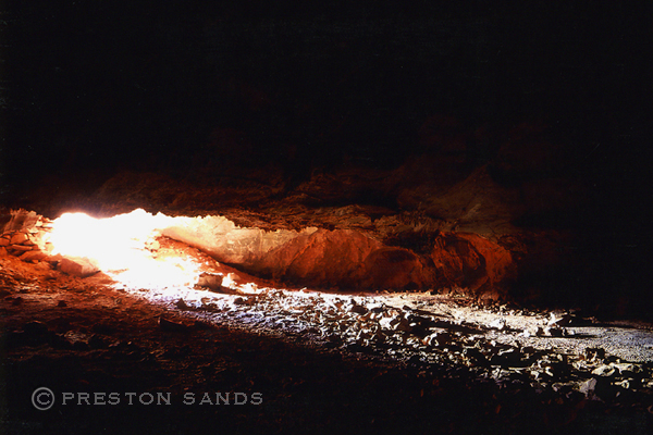
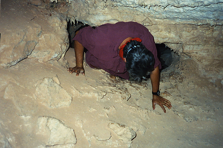
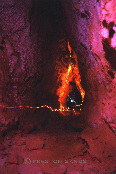
After passing the junction with the Miner's Spring Trail, the Grandview Trail arrives at the old stone miner's dining hall. The campgrounds are near here, just east of the trail. There were several cabins on this mesa during the mining days, and there are rusty relics scattered everywhere. The Grandview Trail continues northwest from the old stone building, passing on the west side of the rocky butte at the center of Horseshoe Mesa. Where the trail crosses a small drainage due west of the butte, you will see a faint side trail following the drainage down to the edge of the cliff. This is the trail to The Cave Of The Domes (Horseshoe Mesa Cave). At the cliff's edge, the side trail turns right (north) and quickly arrives at the entrance to the cave. This is a fairly good-sized cave, characterized by short sections of crawl spaces, which open up into dome-shaped rooms. Many of the caves' stalactites were broken off by early 20th century tourists and brought up to the South Rim. Some formations are still there, though. Towards the back of the cave, there is a large 30 foot tall hallway, with some bacon-like formations on the walls. Beyond the junction with the cave trail, the Grandview Trail continues out to the northwest arm of Horseshoe Mesa. It was on this stretch where we encountered some fierce winds on a 2002 backpacking trip. I was carrying a 70-pound pack and was almost blown off the trail. Now at the edge of Horseshoe Mesa, the trail begins a mile-long descent through the Redwall Limestone to the Tonto Trail below. This is the official end of the Grandview Trail. However, I have read that the trail originally continued down to the Colorado River in the early 1900s. History: Impressions of the dazzling topography of Grand Canyon have changed and shifted since that day in the summer of 1540 when Garcia Lopez de Cardenas gazed out from the South Rim. The conquistador saw a worthless desert wasteland, nothing more than a barrier to political expansion. At the opposite extreme, the modern view tends toward the romantic, reveling in what we today perceive as the remarkable spirituality of the gorge. Products of the age in which they lived, American pioneers arriving in the 1890s were more practical and utilitarian: they assumed with so much exposed bedrock inevitably there had to be mineral riches waiting to be claimed by those willing to go below and look. Would-be miners fanned out across the inner canyon, probing everywhere, and at a place called Horseshoe Mesa found what they sought. Rich copper deposits initially averaging 30% pure promised wealth, but only if transported from the depths. Optimism reigned supreme, a route was scratched out, and in February 1893, an endless succession of mule trains began moving raw ore to the rim along a rough canyon track originally known as the Berry Trail, more recently as the Grandview Trail. More than any other canyon trail, the Grandview is steeped in the legacy of the mining days at Grand Canyon. Numerous small artifacts associated with these halcyon days are scattered across the top of Horseshoe Mesa, providing a link across the years. Hikers can inspect the physical remains of this bygone era while enjoying canyon scenery at its finest.
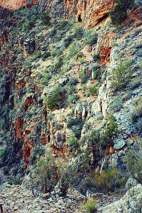
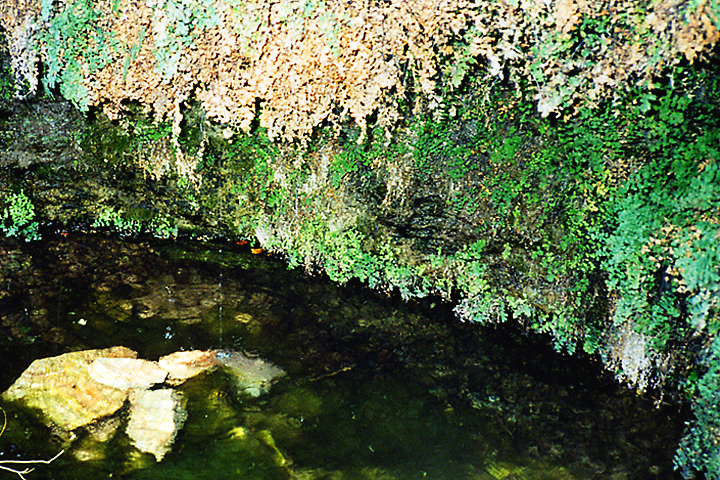
Grand Canyon NPS Details The original Grandview Trail was created to connect the rim with the copper mines on Horseshoe Mesa. The well built trail eventually provided access to more tourists than miners, as the Grandview trail provided one of the best access routes into the canyon for its time. The undamaged segments of the pioneer trail in the upper half of the canyon testify to the engineering prowess of the builders as they devised solution after creative solution to the problems posed by the landscape. Start off the rim from the established Grandview Point overlook. The Kaibab/Toroweap section traverses steep ground and the old trail is eroded so attention to the problems at hand is essential. Vertical steps were surmounted by construction of log "cribs" that were chained or pinned to the cliff face to provide a foundation for the trail where nature provided none. The exposure here impresses some hikers as hazardous. Unfortunately, several of the historic cribs were swept away by landslides during the winter of 2005. Trail crews restored the trail, but not the historical context of the old logs. A series of sloping ledges at the top of the Coconino cliff demands caution especially when icy or wet. Be careful throughout the Kaibab and Toroweap - a fall here could have catastrophic consequences. Original "cobblestone riprap" trail construction shows throughout most of the Coconino. Large slabs of sandstone placed edgewise provided a durable (albeit labor intensive) walking surface. The trail comes to the top of a dramatic east-facing gully at Coconino/Hermit contact (known locally as Coconino Saddle) that offers tantalizing views into the upper valley of Hance Creek. Steep cobblestone switchbacks below Coconino Saddle dispense with most of the Supai Formation before the walking moderates and the trail begins a gradually descending traverse across the slope to Horseshoe Mesa. Horseshoe Mesa offers a myriad of attractions. The campsites are located east of the historic masonry structure. Remnants of mining operations, including rusty cans, nails, tools and structures are protected as archeological resources. Please leave these objects as you found them, where you found them. Backpackers headed deeper into the canyon can choose between three trails that link the rim of Horseshoe Mesa and the Tonto Trail. The northernmost trail that descends the east side of the western arm of the "horseshoe" is the most civilized of these options. Most of the original switchbacks have survived so this route is relatively straightforward, intersecting the Tonto Trail north of Horseshoe Mesa. Hikers can continue along the Tonto about 1.5 miles west to Cottonwood Creek or about 2.2 miles east to Hance Creek. The trail down the west side of the mesa is more demanding, severely washed out in the Tonto Group above the bed of Cottonwood Creek. The path off the east side to Page Spring and Hance Creek is probably the most difficult and exposed. Recent trail work has rendered the hardest place a bit easier, but the potential for a nasty fall exists throughout the Redwall descent. Watch for the spur trail to Page (aka Miners) Spring near the bottom of the Redwall. Modern backpackers use the Tonto Trail to connect the Grandview Trail with points beyond. An established trail follows the bed of Cottonwood Creek to the top of the Tapeats Formation where the Tonto heads west toward the South Kaibab Trail. Hikers walking east from Hance Creek can follow the Tonto Trail toward Mineral Canyon. The Tonto Platform starts breaking down near the west rim of Mineral Canyon causing the trail to drop below the Tapeats Sandstone to descend Supergroup slopes to the bed of Mineral Canyon. Exiting at the mouth of Mineral Canyon on the east side is a bit tricky. The trail splits as it rounds the point before starting down the slope to Hance Rapids. The upper trail is straightforward, but the lower option requires walkers to bend low and traverse a narrow and exposed ledge. There are a couple of ways across the talus to the shoreline at Hance Rapids and the foot of the New Hance Trail. Water Sources: Hance Creek and Page Spring (aka Miners Spring) are permanent, year-round water sources. The southernmost spring in Cottonwood Creek is reliable during cooler seasons but occasionally runs dry during hot weather. O'Neill Spring and the northern spring in Cottonwood are undependable at best. There is no water available between the rim and Horseshoe Mesa, nor between Hance Creek and Hance Rapids. Campsites: Backpackers camping on Horseshoe Mesa (BF5) must camp in the designated campsites. Three small group sites are located east of the standing masonry structure. The large group site is further north, east of the little butte that caps Horseshoe Mesa. Toilet facilities are located at both areas. Camping is not allowed in or near the historic mines or structures. Camping in the Cottonwood (BG9) and Hance Creek (BE9) Use Areas is "at-large". All hikers should bring animal proof food containers; mice and ravens are especially adept at stealing food and opening packs and bags in this area. Check out the Official Route and Triplogs. Leave No Trace and +Add a Triplog after your hike to support this local community. One-Way Notice This hike is listed as One-Way. When hiking several trails on a single "hike", log it with a generic name that describes the hike. Then link the trails traveled, check out the example. | ||||||||||||||||||||||||||||||||||||||||||||||||||||||||||||||||||||||||||||||||||||||||||||||||||||||||||||||||||||||||||||||||||||||||||||||||||||||||||||||||||||||||||||||||||||||||||||||||||||||||


