| Supai Group |
| Supai Group | 18 locations | Sedimentary |
|
|||||||||||
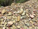
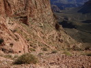
The Supai Group was deposited in Pennsylvanian and early Permian time in swampy and riparian environments from clastic sediment mostly derived from the Ancestral Rocky Mountains (the average age of this group is 285 million years). The Supai in the western part of the canyon contains limestone, indicative of a warm, shallow sea, while the eastern part was likely a muddy river delta. This formation consists of red siltstones and shale capped by tan-colored sandstone beds that together reach a thickness of 600 to 700 feet (180 to 210 m). Shale in the early Permian formations in this group was oxidized to a bright red color. Fossils include amphibian footprints, reptiles, and plentiful plant material in the eastern part and increasing numbers of marine fossils in the western part. The formations of the Supai Group are (from oldest to youngest; an unconformity is present at the top of each): Watahomigi: Slope-forming gray limestone with some red chert bands, sandstone, and purple siltstone that is 90 to 175 feet (30 to 50 m) thick. Manakacha: Cliff- and slope-forming pale red sandstone and red shale that is 200 to 275 feet (60 to 85 m) thick. Wescogame: Ledge- and slope-forming pale red sandstone and siltstone that is 100 to 225 feet (30 to 70 m) thick. Esplanade: Ledge- and cliff-forming pale red sandstone and siltstone that is 225 to 300 feet (70 to 90 m) thick.[9] An unconformity marks the top of the Supai Group. Source Wikipedia |
|||||||||||
| .: chumley :. | |
 |
|
Salt Trail Canyon to LCR Gorge | |
| .: John9L :. | |
 |
|
South Bass to Silver Bell via the Tonto Trail | |
| .: John9L :. | |
 |
|
South Bass to Silver Bell via the Tonto Trail | |
| .: BiFrost :. | |
 |
|
Boucher Hermit Loop | |
| .: Crzy4AZ :. | |
 |
|
North Kaibab Trail | |
| .: joebartels :. | |
 |
|
Brahma via Sumner Canyon - Freezer Foray | |
| .: John9L :. | |
 |
|
Nankoweap Trail | |
| .: BiFrost :. | |
 |
|
Nankoweap Trail | |
| .: zukerrach :. | |
 |
|
Granite Rapid via Hermits Rest | |
| .: rwstorm :. | |
 |
|
Verde Canyon Railroad | |
| .: Al_HikesAZ :. | |
 |
|
Bright Angel Point Trail | |
| .: mlandman :. | |
 |
|
Tonto Trail: Grandview Trail to South Kaibab | |
| .: mlandman :. | |
 |
|
Tonto Trail: Grandview Trail to South Kaibab | |
| .: John9L :. | |
 |
|
Bright Angel Trail | |
| .: John9L :. | |
 |
|
Bright Angel Trail | |
| .: John9L :. | |
 |
|
Bright Angel Trail | |
| .: hippiepunkpirate :. | |
 |
|
Grandview Trail | |
| .: hippiepunkpirate :. | |
 |
|
Grand Canyon Fieldtrip - GLG 304 | |
| page 1, 2, 3 |
|
|
|
|

| Information on this page has been gathered from member submissions. Effort has been made to avoid any infringement of copyright. Additionally, any use is anticipated to be within the "fair use" doctrine. If any copyright has been infringed, please notify the webmaster. The disputed information will be removed and your issue will be resolved. If you are a submitting member, please inform and discuss with HAZ if you think you are submitting any copyright issue. Please help us stay with the law. |