Route Editor

| Guide | ♦ | 7 Triplogs | 0 Topics |
details | drive | permit | forecast | 🔥 route |
stats |
photo | triplogs | topics | location |
| 1 | 7 | 0 |
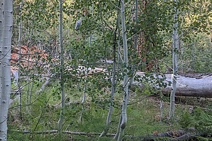
Point Sublime's ** Alternate return by pseudalpine  Overview OverviewThis is the alternate northern entrance to GCNP via FR268B that also accesses Swamp Ridge and Point. There's a gate at the boundary that closes similarly as the main North Rim entrance in the winter season. This access point has become popular with side-by-side and/or four-wheeler groups, who often trailer camp in the adjacent Kaibab National Forest during the hotter months and during the fall hunting season. Drive After gapping the park gate, one will drive less than two-tenths of a mile before reaching a three-way junction. Swamp Ridge is straight and Kanabownits is left (east), where the road steeply drops into Tipover Canyon. Continuing south on the often rough, rooty, sandy, possibly snowy and muddy track, one will cross Big Spring Canyon at about two miles. Between 3.5 and 4.5-miles, the road tracks through Kanab Canyon along Crescent Ridge, eventually reaching the Kanabownits fire tower and cabin junctions at about 5.8-miles. The road ultimately transects the Point Sublime Road at Walla Valley. Left (east) is the direction to Harvey Meadow, right (west) terminates at Point Sublime.
An alternate approach for Point Sublime, but mainly this road is utilized to ingress two other common inner canyon access routes, specifically Lancelot and Galahad Points. Also attainable from Kanabownits are several peaks in this section of Grand Canyon, which would be Excalibur, plus Elaine, Guinevere and King Arthur Castles. Gate Policy: If a gate is closed upon arrival, leave it closed after you go through. If it is open, leave it open. Leaving a closed gate open may put cattle in danger. Closing an open gate may cut them off from water. Please be respectful, leave gates as found. The exception is signage on the gate directing you otherwise. Check out the Official Route and Triplogs. Leave No Trace and +Add a Triplog after your scenic drive to support this local community. | |||||||||||||||||||||||||||||||||||||||||||||||||||||||||||||||||||||||||||||||||||||||||||||||||||||||||