 Route Editor

| Guide | ♦ | 23 Triplogs | 2 Topics |
details | drive | permit | forecast | 🔥 route |
stats |
photos | triplogs | topics | location |
| 441 | 23 | 2 |
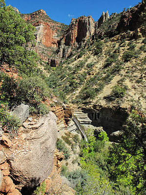
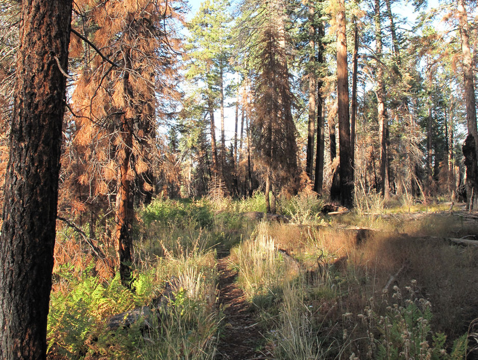
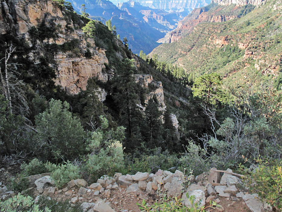
World Class Hike by joebartels  Overview OverviewOriginally posted as a loop, now the page data reflects one-way so that you may create your own hike. Loop Option Ken Patrick Trail 3.65mi to Old BA and down 5.25mi, then back up North Kaibab 4.9mi. Crossing over just before the heliport at the easiest point. It isn't much further to the bridge connecting the North Kaibab. approx 12.75mi / 4045ft / 4800 AEG
This old route is not maintained. It may be extremely overgrown. Route finding may be tricky. Temps may vary from freezing to frying. Few people hike this route. History Francois Emile Matthes created this route. He is most famous for surveying the area for the USGS in 1902. Upon completion of the North Kaibab Trail, this route fell somewhat into disrepair. Hike From the North Kaibab Trailhead head out on the Ken Patrick Trail. This trail is maintained with a traildozer up until the Uncle Jim Trail. Then it turns into a single track continuing to 3.6mi where it meets the Old Bright Angel Trail. As of this writing, it's signed and well-maintained for the first mile or two. Others state it can get severely overgrown. With New Mexican Locust in the mix pants and a long sleeve shirt are recommended along with short sleeves and possibly shorts for the lower portions. Read the triplogs for the most current conditions. The descent from the Ken Patrick Trail to Bright Angel Creek is about 3.5mi. The grade at 22% is slightly less arduous than the 23% humpback up the North Kaibab. It's just not maintained here and feels steeper in sections. As mentioned, the first ~2.0 miles are down through the woods. With an early morning start you'll be in the shade. You're trekking down the side of a ridge that makes up the northern tributary to Bright Angel Canyon. 2.0mi down or 5.6mi from the start you cross a seasonal creek. It was running well on my trip. The next ~1.5mi to BA Creek is beautiful desert. The views heading down the entire way are awesome. Keep an eye on your backside. If the seasonal creek was running, there's a killer waterfall. When you reach Bright Angel Creek, you may have trouble finding the route after the creek. You may have to hump it up the southeast side to find the route. I didn't bother as the stream felt so inviting. This turned out to be a mistake. What felt good initially turned numbing for well over an hour and taxing with the current. I made two failed attempts to get out of the creek but couldn't find the trail. Then finally merged with the other side where it comes down close to the creek. This 0.7mi through the creek took almost two hours. It ranged from a foot to waist-deep with a swift current. My Leki rippled like a rubber band from the force. The southeast side trail isn't much of a path but certainly ten times faster than the creek. It gets down to only inches wide on steep sections and occasionally washed out. With the North Kaibab Trail in view, you can cross in three worthy places. The first is just below the confluence with Roaring Springs and take the side trail up. The Old BA Trail does go past the heliport to the footbridge. I simply took an in-between route where the Old BA and North Kaibab get close to the creek bottom. You only save a half-mile or so. On the North Kaibab, it's almost 5 miles to the top and a relentless 3600 feet. Overview On my mid-September hike, I started at 34 degrees. It almost reached 90 degrees down by the heliport. I figured 6-7 hours. It took nearly 9 hours as I missed the route out of Bright Angel Creek. Following the frigid creek drained my energy. The upper reaches were phenomenal, combined with the creeks and full loop. Up until now, the Grand Canyon has been a yawner for me. Old BA was my eye-opener. The section from Ken Patrick Trail down to Bright Angel Creek could only be defined as world-class. The upper mile of the North Kaibab is as disgusting as hell, but you take the good with the bad. Check out the Official Route and Triplogs. Note This is a more difficult hike. It would be unwise to attempt this without prior experience hiking. Leave No Trace and +Add a Triplog after your hike to support this local community. | |||||||||||||||||||||||||||||||||||||||||||||||||||||||||||||||||||||||||||||||||||||||||||||||||||||||||||||||||||||||||||||||||||||||||||||||||||||||||||||||||||||||||||||||||||||||||||


