 Route Editor

| Guide | ♦ | 23 Triplogs | 0 Topics |
details | drive | no permit | forecast | route |
stats |
photos | triplogs | topics | location |
| 0 | 23 | 0 |
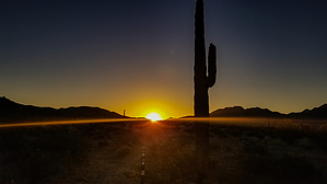
No safe harbor from pirates or vandals by mt98dew  Warning WarningThere is some confusion on whether these trails are open to the public. There are signs posted at the Copper State Bike and Hike TH, as well as random locations along the trails stating that this is for residents and their guests only. However, I have reached out to the City of Goodyear and they have said that this is not the case. Overview The Jolly Roger (JR) Trail is one of 24 trails that make up the Estrella Foothills Trail System. This stretches (primarily) south to north playing in the foothills that border the Estrella Community. The Jolly Roger meanders along the base of the hills at the extreme southern edge of this system. There are currently two THs for this system. The Copper State Bike and Hike and the Estrella Foothills Community Park. The EFC Park is the best trailhead to hike the JR Trail. In addition to being a TH for some of the EF trails, the park also has picnic tables, baseball and soccer fields, a “pump track” (a hilly jump section for bikes), a playground, bathrooms, and a drinking fountain. There is enough parking for 30 cars. The TH is a bit removed from the parking area so one must walk about 0.2 miles to the northeast, circumventing a baseball field. There is an old whiteboard that will help identify the TH. At the TH there will be a carsonite marker with several abbreviations on it. One is the PA (Park Ave) Trail.
The Jolly Roger Trail is considered to be an interior trail so some additional hiking is required. To best access this trail hike the Park Ave (PA) Trail 0.84 miles to where it junctures with the Rum Runner (RR) Trail and then take the RR Trail 0.5 miles to where it comes to a trail juncture known as “The Circle of Brethren”. Several trails leave from this juncture, one of which is the Jolly Roger. The (JR) is a solid single track that is annoyingly rocky with marble-sized stones that will have brief stretches of compact dirt intermixed. The trail leaves the circle heading in a southeast direction. At 0.13 miles there will be an unsigned split. Stay to the right (south). This will take you along the top of a saddle with gently receding slopes to the east and west. At 0.32 there will be another unsigned split in the trail. Once again, stay to the right. The trail will do a sweeping switchback from this upper saddle to a lower saddle to the west. At 0.62 the JR meets another unsigned trail. (This is a “lazy-man connector”. A short trail that connects the 0.32 and 0.62 splits and avoids the 0.3-mile switchback). At 0.66 another unsigned split. Stay left (east). The right fork swings south and connects back to the Park Ave Trail. At this split the trail is at its low point and will slowly curve back towards the hills gaining elevation slowly. At 0.86 miles the trail crosses a dirt road. For the next 0.40 miles, the JR plays along the lowest elevation of the foothills gaining maybe 40 feet. During this time you get some unimpeded views of the flat desert to the south and on clear days the mountains beyond. The Estrella Mountains are always looming to the east, though it never feels as if you are getting any nearer. The foothills to the north are your rolling canvas and will continually change as the trail works its way east. At 1.09 the trail junctures with the Queen Anne’s Revenge (QA) Trail. This juncture is unsigned, but this is an official trail connection. At 1.28 the JR trail comes abreast to the fencing for the Estrella Mountain Regional Park (EMRP) and turns to the south. The trail will switchback, crossing a few washes and topping a hill before ending at 1.83 miles when it junctures with the PA Trail. Options are fairly limited at this point. You can take the PA west for a 4-mile lasso or you can turn east and head into the EMRP. Be aware trails in that direction can be lengthy. Synopsis The Jolly Roger is a pleasant trail that offers a glimpse of what this trail system has to offer. This trail offers sweeping curves with a few switchbacks and just a minimal amount of elevation change. Just enough variety to keep the trail interesting. It has some nice open views to the south with a constantly changing landscape to the north. Due to its location, the JR Trail doesn’t connect easily to the rest of the system, but the PA Trail makes an obvious loop option and the QA Trail offers an excellent opportunity to re-enter the trail system.
Check out the Official Route and Triplogs. Leave No Trace and +Add a Triplog after your hike to support this local community. One-Way Notice This hike is listed as One-Way. When hiking several trails on a single "hike", log it with a generic name that describes the hike. Then link the trails traveled, check out the example. | |||||||||||||||||||||||||||||||||||||||||||||||||||||||||||||||||||||||||||||||||||||||||||||||||||||||||||||||||||||||||||||||||||||||||||||||||||||||||||||||||||||||||||||||||


