 Route Editor

| Guide | ♦ | 1 Triplog | 0 Topics |
details | drive | permit | forecast | route |
stats |
photos | triplog | topics | location |
| 0 | 1 | 0 |
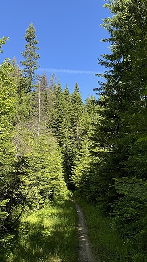
Carlin - Caribou Mixer by LindaAnn Hike: Trail 258 can be hiked in either direction, but is described here from east to west, starting from the Beauty Carlin side, and finishing on Caribou Ridge. To get to the start of the trail, hike up Beauty Carlin for approx 1.50 miles, where the trail reaches an old logging road. While not marked, the road leading to the right is the eastern start of Trail 258. The road initially heads to the northeast, before soon curving around to the northwest, where it traverses the northeast slope of Mount Coeur d'Alene, reaching Caribou Ridge on the north side of the mountain.
After crossing the creek, the trail begins to gradually gain elevation, more notably than the first half of the trail. As you approach Caribou Ridge, the trail leaves the old logging road and begins climbing more steeply up several switchbacks to the spine of the ridge. Again, the intersection with Caribou Ridge Trail is not well marked, but is distinct. There was a small piece of wood marked with 258 affixed to an old log, but it was not easily noticed. Check out the Official Route and Triplog. Leave No Trace and +Add a Triplog after your hike to support this local community. One-Way Notice This hike is listed as One-Way. When hiking several trails on a single "hike", log it with a generic name that describes the hike. Then link the trails traveled, check out the example. | |||||||||||||||||||||||||||||||||||||||||||||||||||||||||||||||||||||||||||||||||||||||||


