Route Editor

| Guide | ♦ | 26 Triplogs | 0 Topics |
details | drive | no permit | forecast | route |
stats |
photos | triplogs | topics | location |
| 57 | 26 | 0 |
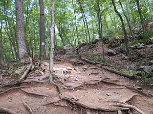
Camelback of the East by Jim This hike is very popular in NJ and I have read that many consider it to be the best hike in the state. In terms of elevation gain for the mileage, it seems to be the best. Statistically, it resembles some of the finest training mountains of Arizona, and it is about as popular during busy times. I don't know that it sees night hikers, though.
The hike is very well marked with a painted red dot on a white rectangular background. It basically looks like the Japanese Flag. It is very easy to follow the wide established path, and typically the line of hikers, but if you need to use them, the red dots also show the way. The hike's difficulty comes from the numerous rocky sections that might be class 2 for YDS users, and the elevation gain which is not common for most of the area. Not from what I have found. There are several viewpoints along the trail, and once you reach the top there is a viewpoint that extends down from the end of the trail. Most people consider this the "summit" and will spend time here. The actual summit does not have much of a view, and the easy-to-reach high area just above the trail's end does not, either. The end of the Red Dot is at the top of the rocky viewpoint. Just past the end, you encounter an old signboard attached to a tree which is also covered in irrelevant stickers. Here after the trail is the Blue Blaze, as is reflected in the blue paint marks on the trees. Descend the way you came for the Red Dot. For information on descending using the blue blaze or the loop, see the earlier linked description. Alternately, you can hike out on the Tammany Fire Loop, and return the Red Dot. Check out the Official Route and Triplogs. Leave No Trace and +Add a Triplog after your hike to support this local community. | |||||||||||||||||||||||||||||||||||||||||||||||||||||||||||||||||||||||||||||||||||||||||||||