From Hope Camp, the trail heads north/northwest to the Quilter Trail junction. It follows this trail north and then east over several drainages, reaches a high saddle, and then drops down to the junction with the Manning Camp Trail. From here the trail climbs steadily for several miles, passes a trail junction, and then drops down into the Grass Shack Campground.
It then climbs continuously for several more miles to the northeast, passes another trail junction, crosses Chimenea Creek, and then comes to Manning Camp. From Manning Camp, the trail goes through several trail junctions on the way to Mica Mountain and then it starts down the other side of the Rincon Mountains. It passes Italian Spring and begins dropping fairly steeply through an old burn area. After passing the wilderness boundary the trail works its way along a ridgeline and then descends to the Italian Trap Trailhead.
When hiking several trails on a single "hike", log it with a generic name that describes the hike. Then link the trails traveled, check out the example.
WARNING! Hiking and outdoor related sports can be dangerous. Be responsible and prepare for the trip. Study the area you are entering and plan accordingly. Dress for the current and unexpected weather changes. Take plenty of water. Never go alone. Make an itinerary with your plan(s), route(s), destination(s) and expected return time. Give your itinerary to trusted family and/or friends.
Permit $$
no fees or permits reported
if incorrect tell us about it
Saguaro National Park 2022 $25 vehicle • $20 motorcycle • $15 individual on foot or bicycle
Receipt is valid for 7 days
$45 Annual Park Pass View All
No fee required from Miller Creek Trailhead off Mescal Rd.
Directions
Road
To hike
page created by joebartels on Jan 09 2010 12:41 am
 Route Editor

 From Hope Camp, the trail heads north/northwest to the Quilter Trail junction. It follows this trail north and then east over several drainages, reaches a high saddle, and then drops down to the junction with the Manning Camp Trail. From here the trail climbs steadily for several miles, passes a trail junction, and then drops down into the Grass Shack Campground.
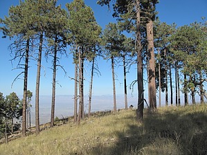


