 Route Editor

| Guide | ♦ | 39 Triplogs | 0 Topics |
details | drive | no permit | forecast | 🔥 route |
stats |
photos | triplogs | topics | location |
| 399 | 39 | 0 |
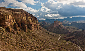
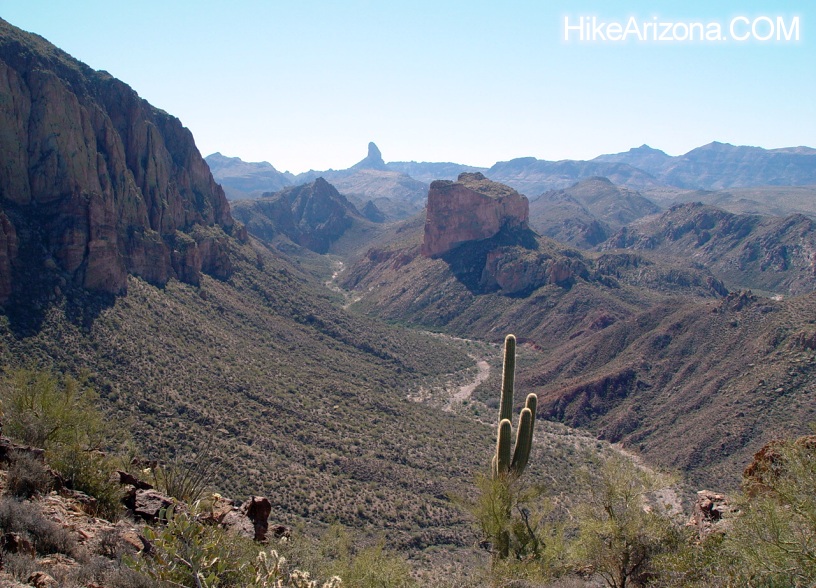
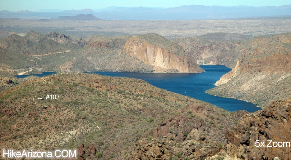
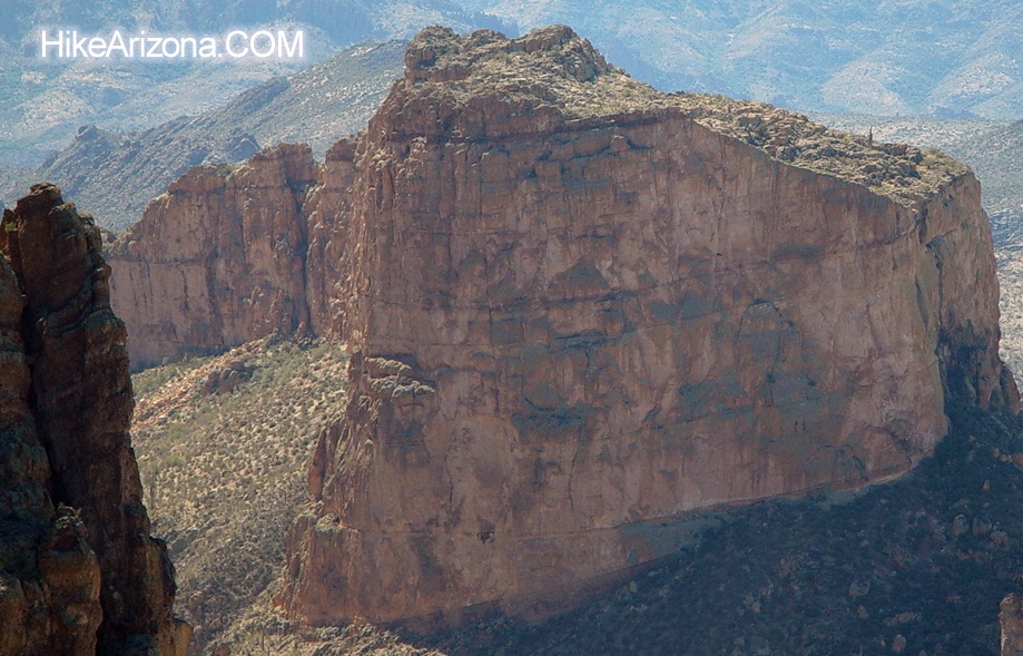
Battleship View by joebartels  Ever hike Boulder Canyon Trail #103 from Canyon Lake Trailhead to La Barge Creek just in front of Battleship Mountain? It's a popular hike in the Superstitions. That's a great hike too. However, from my experience, La Barge Creek is rarely running. If you're searching for something new from the ordinary then give this hike a try. Instead of going down to the creek let's go up further and take in some real views! Ever hike Boulder Canyon Trail #103 from Canyon Lake Trailhead to La Barge Creek just in front of Battleship Mountain? It's a popular hike in the Superstitions. That's a great hike too. However, from my experience, La Barge Creek is rarely running. If you're searching for something new from the ordinary then give this hike a try. Instead of going down to the creek let's go up further and take in some real views!This out-and-back hike involves some easy-to-moderate off-trail travel. Route finding is necessary but nothing to get excited about. From the Canyon Lake Trailhead, follow the #103 trail for 1.8 miles. This is about 0.2 miles before the trail starts descending into La Barge Canyon. First, check out the map. From approximately the 1.8 mile mark which is roughly 33.519143, -111.40842, take a left off the trail. You need to get up on this little ridge.
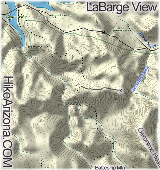 done any off-trail hiking. The only bushwhacking is gaining the ridge. I did this in shorts without incident. Please note I'm calling this an easy to moderate off-trail experience... it may be tougher depending on your experience. Just be sure to study a topographical map and know where you're going. done any off-trail hiking. The only bushwhacking is gaining the ridge. I did this in shorts without incident. Please note I'm calling this an easy to moderate off-trail experience... it may be tougher depending on your experience. Just be sure to study a topographical map and know where you're going.Midway along the ridge is a view straight into lower La Barge Canyon. Be careful as it's probably a 300-foot drop off the edge. From here the going is easy but please use extreme caution. Much of the ground is covered in resurrection plants. If you step on it you'll kill nature's erosion control. Furthermore, the ghost of Geronimo will haunt you until death! Take a look behind and you'll be rewarded with an even broader view of Canyon Lake. This hike ends at the high point just before dropping into the ravine below. It's unnamed but I refer to it onsite here as Geronimo's Ravine. Great views fan off in all directions. Including a killer head-on overview of Battleship Mountain. Check out the Official Route and Triplogs. Leave No Trace and +Add a Triplog after your hike to support this local community. | ||||||||||||||||||||||||||||||||||||||||||||||||||||||||||||||||||||||||||||||||||||||||||||||||||||||||||||||||||||||||||||||||||||||||||||||||||||||||||||||||||||||||||||||||||||||||||||||||||||||||||


