 Route Editor

| Guide | ♦ | 76 Triplogs | 0 Topics |
details | drive | no permit | forecast | 🔥 route |
stats |
photos | triplogs | topics | location |
| 1.1k | 76 | 0 |
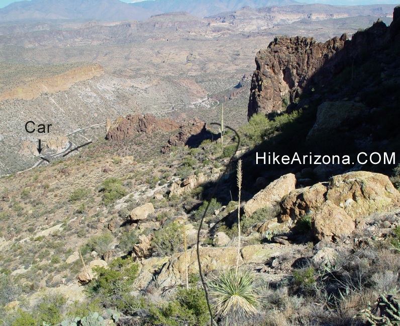
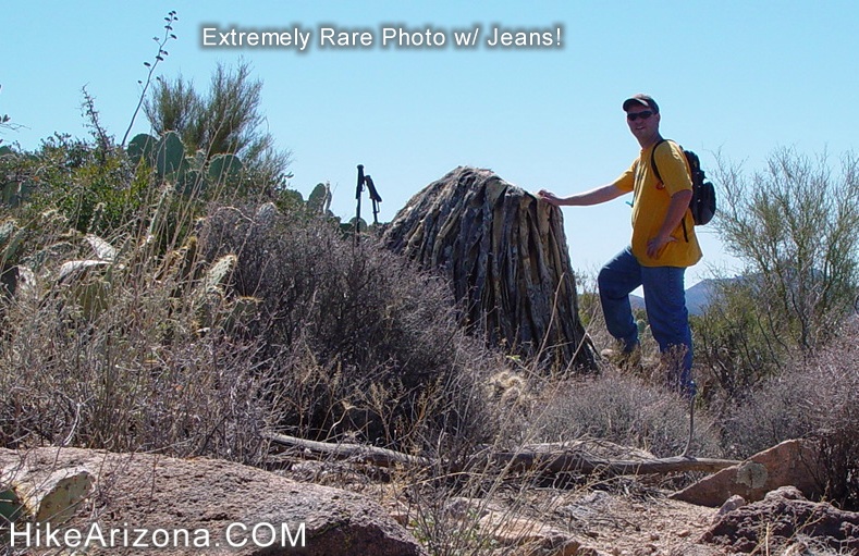
Next stop... MALAPAIS! by joebartels  Access is now via the Tortilla Flat Trailhead constructed in early 2008. Directions have been updated; the summary has not as it's still all off-trail. I do recommend looping a tad east to stay away from the town to be courteous. Access is now via the Tortilla Flat Trailhead constructed in early 2008. Directions have been updated; the summary has not as it's still all off-trail. I do recommend looping a tad east to stay away from the town to be courteous.Hike Here is an out-and-back hike from Tortilla Flat to Geronimo Head, topo elevation mark 3479. This is a great hike. However, the rewards verse effort is something to think about. This is serious off-trail hiking through rugged country. Boots and jeans are a must. First, you'll want to grab a copy of the book "Hiker's Guide to the Superstition Wilderness", which I'll refer to as "The Guide". The map on page 204 is worth the price of the book alone. I've tried to find a better route and didn't come close in six attempts. With that in mind, stick to their route. Basically, follow "Trip 37" in "The Guide" backward for a little over two miles. Personally, I prefer to park closer to Tortilla Flat. This is really more of a "you must figure it out" type of hike, but I'll do my best...
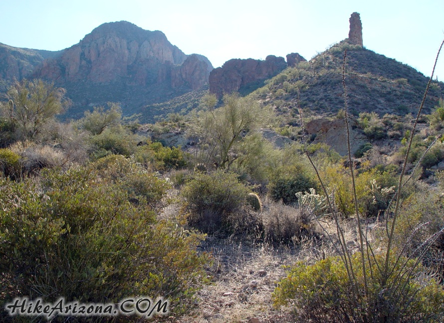
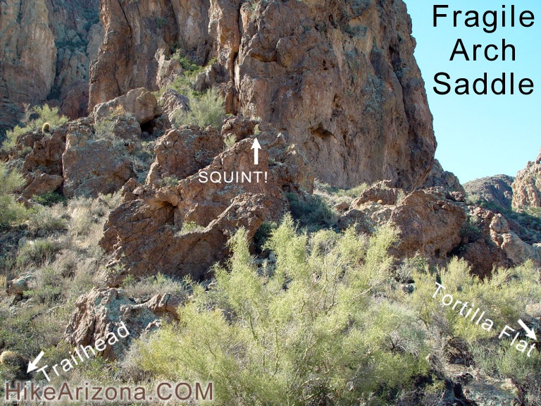
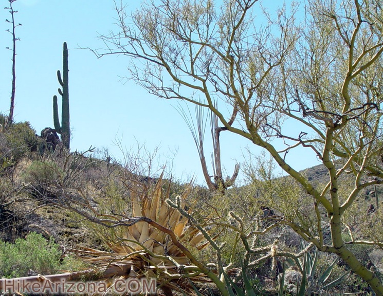
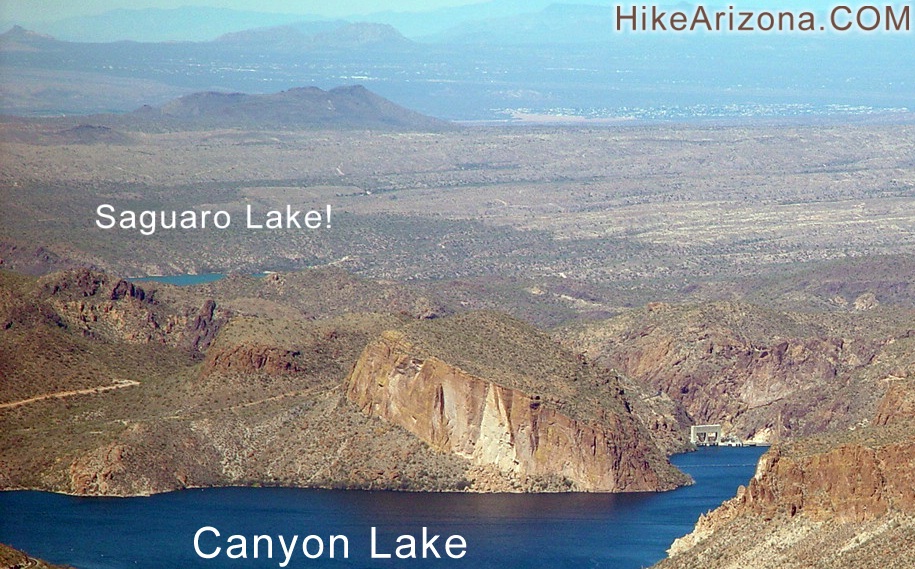
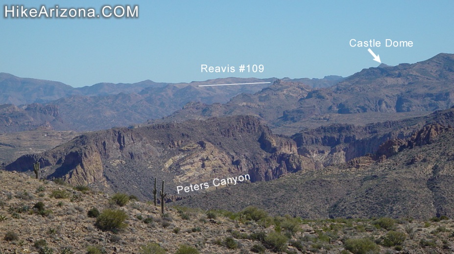
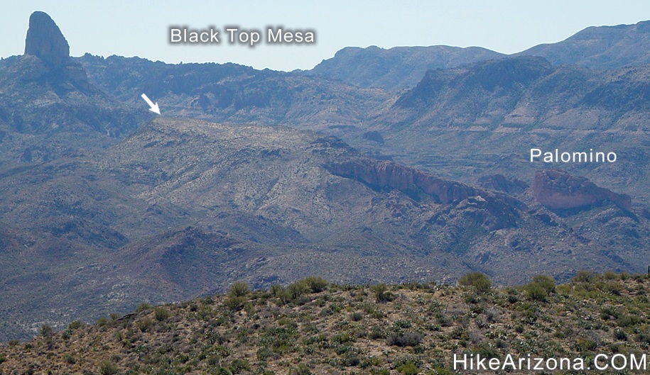
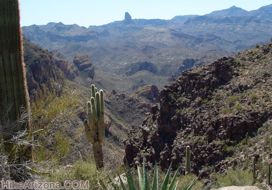
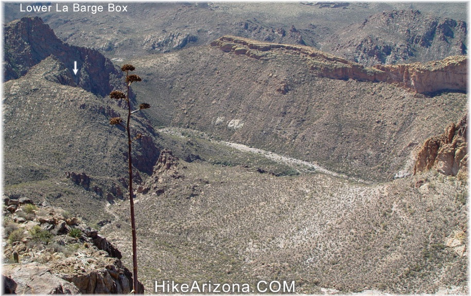
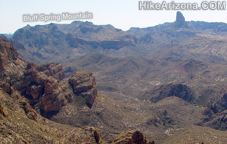
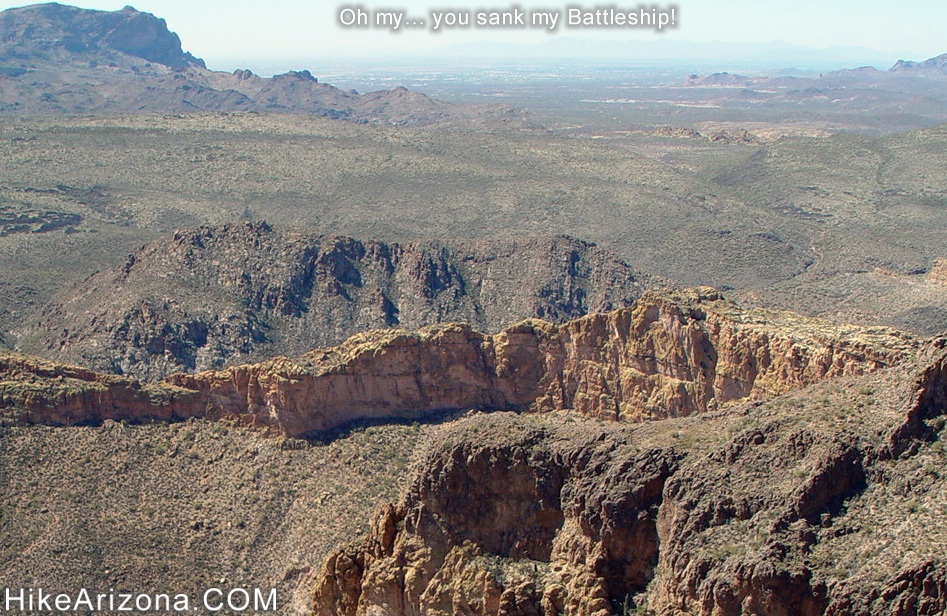
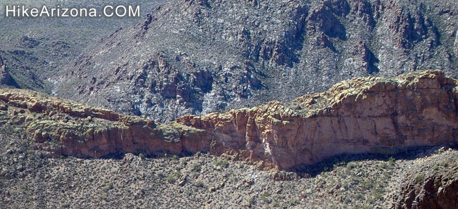
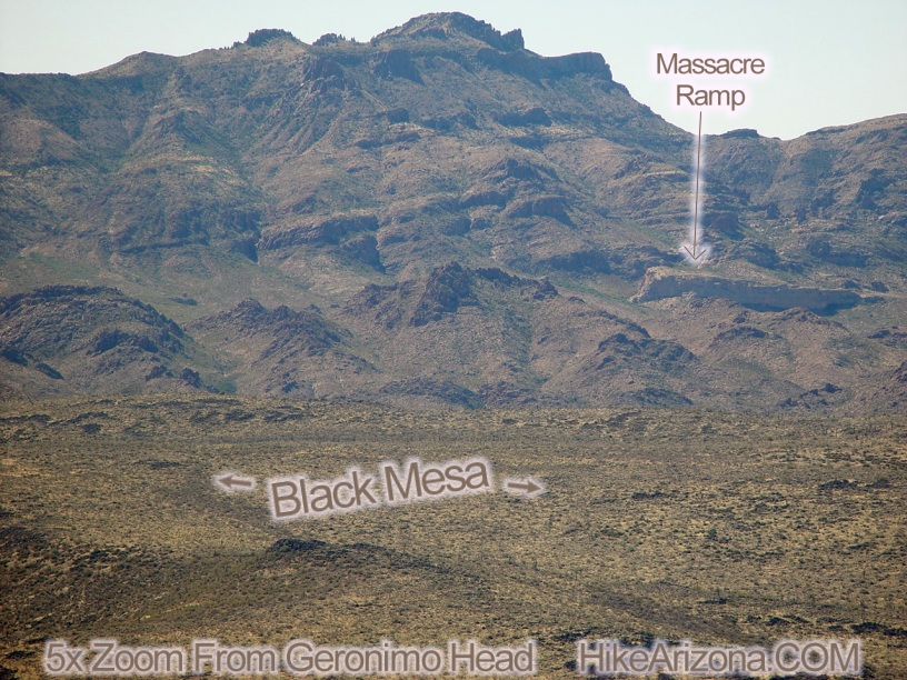
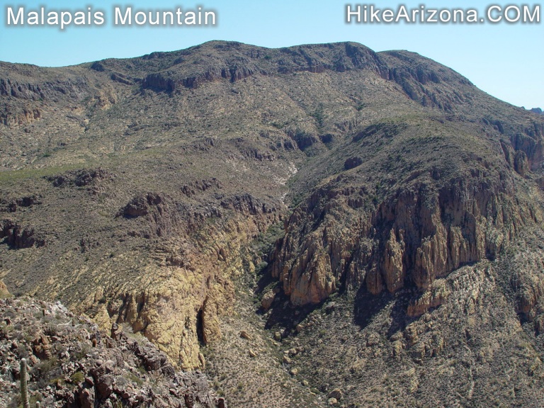
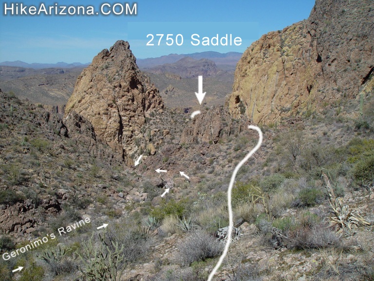
Luckily the first destination is easy to spot. I call it "Fragile Arch Saddle". The arch isn't much, but it's a good reference point. The hike from the ravine up to the saddle is steep but short-lived. From here, we play saddle hopscotch. The terrain is steep, so be careful not to slide on down to Tortilla Flat! I've hiked this trip a few times now, and it doesn't seem that steep anymore. Johnny Cash is usually echoing below from the tourist trap. 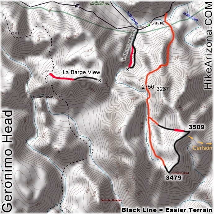 My best advice going from saddle to saddle is to dip down a tad then come back up. It's much faster than trying to battle straight across. I feel obligated to mention... beware of the agaves, more so the possibility of sliding into one on a back step. I did this on a ruin search in Boynton Canyon many years ago. The bloodshot out like a water sprinkler. Do your best to make out these "subtle" saddles on a topo map. Rock formations, shear walls, and such typical of this area don't show up on a map. Once again, "The Guide" shows the best route in these tricky areas. My best advice going from saddle to saddle is to dip down a tad then come back up. It's much faster than trying to battle straight across. I feel obligated to mention... beware of the agaves, more so the possibility of sliding into one on a back step. I did this on a ruin search in Boynton Canyon many years ago. The bloodshot out like a water sprinkler. Do your best to make out these "subtle" saddles on a topo map. Rock formations, shear walls, and such typical of this area don't show up on a map. Once again, "The Guide" shows the best route in these tricky areas.The second saddle is nondescript, and calling it a saddle is an overstatement. Just go with it! Okay... We'll refer to the third saddle as "Saddle 2750". This is your ticket to Geronimo Head, Malapais, and whatever floats your boat. When you take your first peek over the other side, you'll be saying NO WAY! This is the point where Geronimo's Ravine makes a nose-dive turn to the west. Trust me, this is the easy section. A use trail actually exists! First you'll pass some high dryfalls. The trail is overgrown but just be happy it's there period. You're only in the actual water-path of the ravine for a short time. During which you'll need to do a little hand-rock-contact and squeeze under a tree. The minute the terrain eases up, the trail disappears. Soon after I passed a nice saguaro skeleton. Get out of the ravine and follow just above to the east. Follow until a side ravine/canyon shoots in from the east (your left). Here we'll make a loop on this end to get in some better views. Geronimo Head sits at 3479, but the high point is NE at Peak 3509. So...take a left and follow this side ravine for a short while. Soon the terrain eases up. The going quickens as there isn't heavy brush. Your biggest concern in this region is dodging cactus. Peak 3509 is clearly the point you'll want to head for. Forge ahead and on up. It is kind of steep, but you'll probably be so happy the pace has quickened you won't care much. You'll just be happy to finally be moving at normal speed again! Once atop Peak 3509, the views are endless. If you bring some binoculars, you might catch a glimpse of Saguaro Lake. To the east and a tad south is the heart of Peters Canyon. Squint really hard, and you might even make out Castle Dome in the far distance. Swing to the west and a tad south with those binoculars, and you'll see the top of Black Top Mesa. Palomino Mountain never looked so small! Now follow the "S" shaped ridge down to Geronimo Head, Peak 3479. Along the way, watch out for a century plant stump that's been sucking on miracle grow. Continue down to Peak 3479. On the south edge of Geronimo Head you will experience the shear drop off excitement looking down at La Barge Creek. Lower La Barge Box is down there if you know where to look. Far out to the SE is is Bluff Spring Mountain. On the east edge of Geronimo Head is the spectacular finned ridge of Battleship Mountain. Including an obscured view of the summit. Far out to the SW you can even make out the Massacre Ramp! Far out the the east is Black Cross Butte snuggled tightly between Fish Creek Peak and Fish Creek Mountain. Directly SE, Malapais sits proud. After you've absorbed enough of the countless views start heading back. Follow Geronimo's Ravine down to Saddle 2750. From here you know the saddle hopscotch route back home. Check out the Official Route and Triplogs. Note This is a moderately difficult hike. Leave No Trace and +Add a Triplog after your hike to support this local community. | ||||||||||||||||||||||||||||||||||||||||||||||||||||||||||||||||||||||||||||||||||||||||||||||||||||||||||||||||||||||||||||||||||||||||||||||||||||||||||||||||||||||||||||||||||||||||||||||||||||


