 Route Editor

| Guide | ♦ | 11 Triplogs | 1 Topic |
details | drive | no permit | forecast | 🔥 route |
stats |
photos | triplogs | topic | location |
| 52 | 11 | 1 |
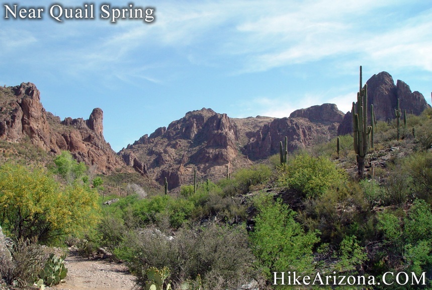
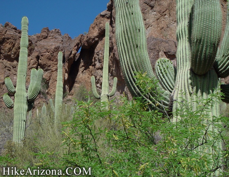
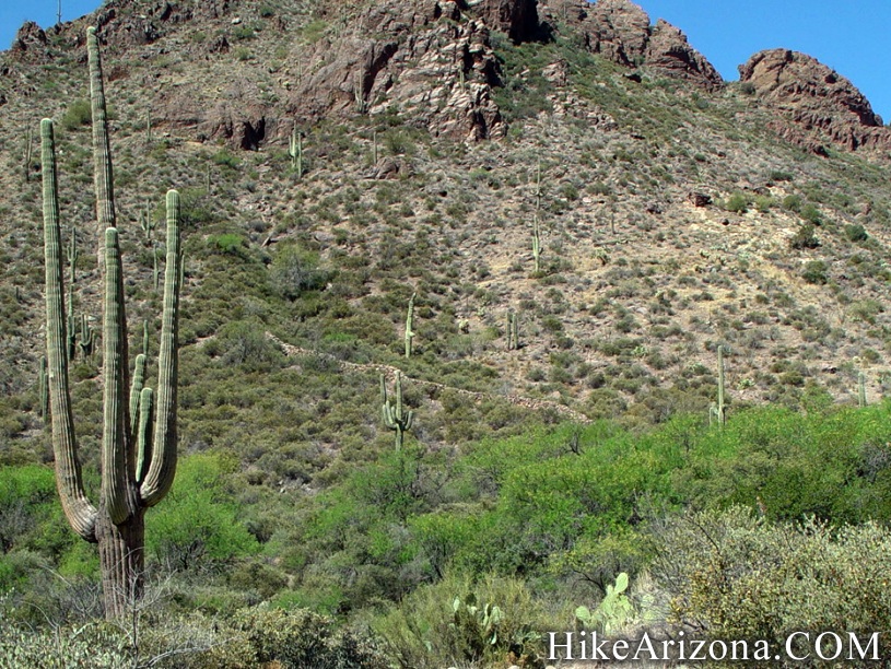
Killer Forest Road by joebartels  Overview OverviewJust south of the Superstition Wilderness boundary this forest road hike is from Quail Spring to Eagle Spring. It starts at the scenic southern end of Mill Site Canyon. Then easily climbs out to an elevated overview. Introduction Possibly a better alternative to the cow patty strewn trails nearby to the north. Saguaros are abundant and healthy. Low, wide canyon scenery is visually pleasing similar to White Canyon Wilderness. A minor variation by forking right near Rattlesnake Spring will take you to views of the Superstition Arches.
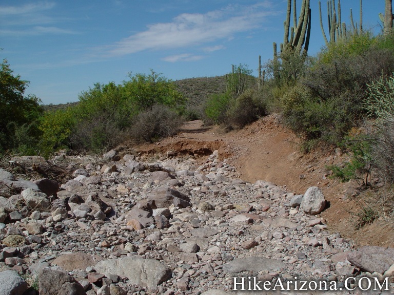
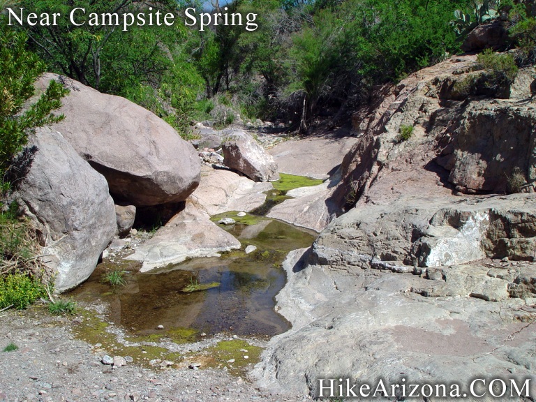
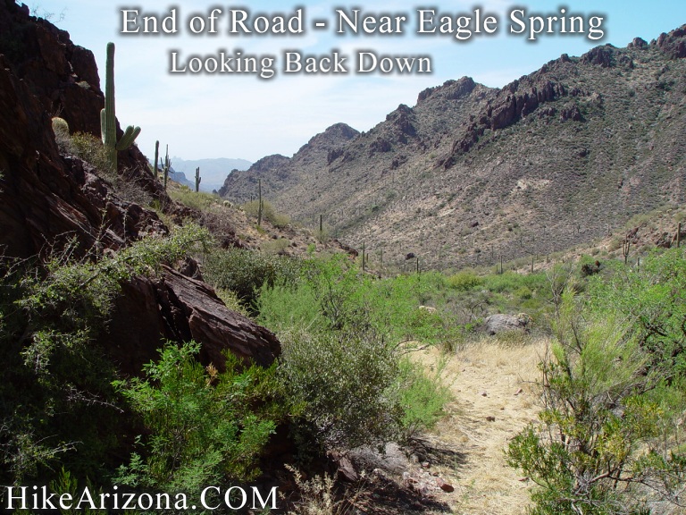
 Hike HikeNear Quail Spring on FR 1900 continue on a short distance to the first road junction. The main road appears to go straight into Peacock Canyon and might very well be the continuation of FR 1900. I simply don't know for sure. At any rate we want to take the right fork and head into Mill Site Canyon. Surrounding scenery is simply outstanding. This is one beautiful section of desert. The road gets progressively worse from a driving perspective. (0.5 miles) Approaching the Campsite Spring area you'll soon realize you couldn't have driven much further anyhow. That is unless you own a monster truck. The creek near Campsite Spring was a trickle. Which believe it or not was encouraging during the drought conditions of April 2002. Continue through the beautiful canyon to the Rattlesnake Spring area. (1.2 miles) How a truck could make it to this point, yet further on, is amazing. I simply haven't had the opportunity to ride in such a machine. Here you are confronted with another fork in the road. A right will take you up Mill Site Canyon. Within a mile, you can see the Superstition Arches. (not featured here) Instead hang a left. The road immediately pulls out of the bottom of Mill Site Canyon. The scenery is still good but the best has passed at this point. Continue to the end of this road which is near the Eagle Spring area. Along the way you pass a stone wall slithering up the slope on your left. I look forward to hearing the history of this wall. However, I haven't a clue. Maybe a shield? There is a smaller wall earlier on that I didn't see until the return trip. Guess I wouldn't have escaped the enemy as I walked right by it...lol The road ends in a high-grass rock-strewn area. Views back out are good. Return the way you came. It is possible to continue with good boots and jeans. A little further over the pass and back down would take you to Burro Basin. Which leads down to cow patty country. Check out the Official Route and Triplogs. Leave No Trace and +Add a Triplog after your hike to support this local community. | |||||||||||||||||||||||||||||||||||||||||||||||||||||||||||||||||||||||||||||||||||||||||||||||||||||||||||||||||||||||||||||||||||||||||||||||||||||||||||||||||||||||||||||||||||||||||||||||||||


