 Route Editor

| Guide | ♦ | 14 Triplogs | 0 Topics |
details | drive | permit | forecast | 🔥 route |
stats |
photos | triplogs | topics | location |
| 119 | 14 | 0 |
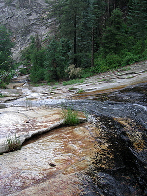
Graham Diversity by blisterfree  GET Segment 10 overview GET Segment 10 overviewThe Pinaleños is a range defined by their considerable prominence. Rising to a height of nearly 11,000 feet above the sea, they are by a respectable margin the tallest of the authentic Southwestern Sky Islands. The range culminates atop Mount Graham, with a vertical relief of nearly 8000 feet the most prominent peak in the state of Arizona. According to the Nature Conservancy, the Pinaleños traverse five ecological communities and "contain the highest diversity of habitats in the shortest vertical distance of any mountain range in North America." Prickly pear and agave are at home here, only a few trail miles below an old-growth forest of spruce and fir, the southernmost such forest on the continent. Our route traverses a portion of this remarkable range in this segment, often nicknamed simply "the Grahams." Using a combination of foot trails and pleasant forest roads, the GET follows the main northwest-southeast trending ridgeline, passing near scenic Riggs Lake, climbing forested Webb Peak (10,030'), and passing within range of the historic summer cabins at Old Columbine, before descending sharply along the range's dramatic east face toward the Gila Valley. The route bypasses the summit of Mount Graham itself, as the trails, there are presently off-limits to protect one of the mountain's rare fauna, the Mount Graham red squirrel found only here. For nearly two decades the mountain and its endangered red squirrels have been the subject of unlikely controversy between wildlife conservationists and the astronomical community, since the Pinaleños are also now home to the Mt Graham International Observatory, and indeed the dark, clear skies atop the range make this among the world's premier locations for stargazing. Nature and science appear to coexist for now; however, harmoniously, hikers will note the telescope housing atop one of Mt Graham's sub-peaks from several vantages along the route.
The spring season snowpack potentially poses another challenge. Snow on the Pinaleños often lingers above 9000 feet well into April or later following an especially wet winter. As such, hikers at that time of year can expect to encounter at least some snowpack between mile points 9 and 21 in this segment and may want to remain open to the idea of detouring to avoid some or all of it. The primary concerns are the labor of post-holing through saturated spring snow and the challenge of following the snowbound trail. Although slope exposure may also be of concern near Clark Peak, it is largely avoidable with care. Refer to the route details in the GET guidebook for more specific info, as well as the Snow Travel chapter of the GET Trek Planner. NOTE: Hikers intending to traverse this entire segment may prefer to make use of the FR 286 Alternate in the segment's early miles. This alternate route avoids Johns Canyon Ridge Trail 313, which in places can be very difficult to follow due to the ill-defined and overgrown trail. A detailed, mile-by-mile description of this segment is available in the official GET guidebook. See https://simblissity.net/get-home.shtml This segment of the GET forms part of a longer trip option between resupply locations, as described below: GET Segments 6 - 11, Mammoth to Safford East of AZ Hwy 77 the Grand Enchantment Trail heads into the Sonoran desert foothills of the sky-island Galiuro Mountains, wherein lies the entrance to spectacular Aravaipa Canyon (BLM Wilderness). Sheer canyon walls rise a thousand feet above the lush, deciduous banks of perennial Aravaipa Creek, where we linger, wet feet and broad smiles, for some 12 unforgettable miles. Quiet dirt roads resume east of the canyon, leading within range of the remote outpost of Klondyke - another potential maildrop resupply location - before our route turns northeast to climb into the extremely rugged terrain of the Santa Teresa Wilderness (Coronado National Forest). Little-used trails provide supreme solitude as we navigate the adventurous granite-domed wonderland of Holdout Canyon, then over 7000-foot Cottonwood Mountain near well-named Pinnacle Ridge, and south to reach Klondyke Road. A fun yet challenging cross-country connection culminates at Tripp Canyon, where the GET soon rejoins the foot trail to climb high into the forested Pinaleño Mountains (Coronado NF), passing serene Riggs Lake and the view full fire tower atop 10,000-foot Webb Peak, where snow may linger well into spring. The desert heat seems as far away as the distant horizon atop this tallest of Arizona's Sky Island ranges, where broad panoramas reveal such distinguished neighbors as the Rincons, Huachucas, Chiricahuas, as well as the Mogollon Mountains in New Mexico farther along the GET. Leaving the high country by and by, we follow the magnificent craggy defile of forested Ash Creek Canyon down toward the open desert nearly a vertical mile-and-a-half below, passing through an astonishing range of life zones in only a few miles of travel. Finally, the route joins quiet greasewood-flanked dirt roads to reach the outskirts of bustling Safford, with most services available. Check out the Official Route and Triplogs. Leave No Trace and +Add a Triplog after your hike to support this local community. One-Way Notice This hike is listed as One-Way. When hiking several trails on a single "hike", log it with a generic name that describes the hike. Then link the trails traveled, check out the example. | |||||||||||||||||||||||||||||||||||||||||||||||||||||||||||||||||||||||||||||||||||||||||||||||||||||||||||||||||||||||||||||||||||||||||||||||||||||||||||||||||||||||||||||||||||||||||||||||||||||||||||||||||||||


