Overview
San Juan "Road" Trailhead onto the National Trail from marker 51 up past marker 38. Ending at the high point of the Gila Range which is Goat Hill. Trail data here is for an out and back trip. If wildflowers are in season go a little further and make a loop out of this with the Ranger & Bajada trails. Please Note: San Juan Road is only open from sunrise to sunset. You need to be out of the park by sunset or risk getting towed. The gates as of this writing opened at 5 am, okay 5:12 to be exact.
Hike
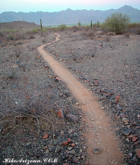
San Juan "Road" Trailhead is located between the Bajada and West Alta trailheads. From the trailhead follow San Juan road west a couple hundred feet and you'll see the National Trail crossing the road. Pick up the National Trail on the left/south side of the road. Within a few steps, you'll pass marker 51 which is the Bajada Trail junction. Continue right on the National. The trail is flat as a pancake. In the old days, the trail trudged straight up to the ridge. Now it takes a lazy approach shooting wide to gain a low saddle at the tail end of the range. I'm not sure why but maybe to accommodate mountain bikes. It might also have something to do with all the mine activity in the area. So maybe it was to divert the public from troubled spots.
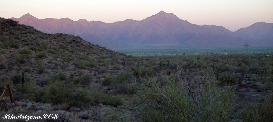
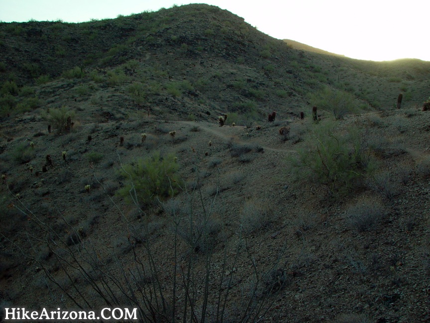
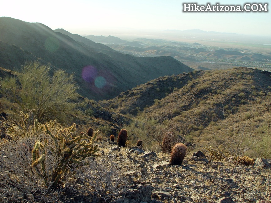
Continuing on there seems to be a marker at every little jag in the trail. 50 you make a minor turn. 49 you approach a wash. You'll see what looks like a gauging station to your right. My first thoughts were, damn, if this entire valley fills up with enough water to make a noticeable difference on that water gauge I'd be impressed! Post 48 is immediately across the wash. 47 comes by quick too. At which point I realized it was more of a weather station as opposed to a creek/river water gauge. Little rocks line the trail. This isn't spectacular desert. It appears to be an old 4x4 romping grounds. What is spectacular is the morning sunhitting on the ever close Estrella Range! At marker 46 you just start gaining elevation. You go over this low saddle on the ridge thinking you'll be heading straight up. However, at marker 45 you turn left and head back down the other side? The trail shoots through a mini valley and instead ascends on a fork ridge. Marker 44 is down in the little valley. Looking west towards the Estrella Range you notice homes or something very nearby. Mountain biking up to this point would be a breeze. The trail now turns gravelly, thick, and loose. Personally, I wouldn't mountain bike up this trail ever, maybe down, but I doubt it. Anyhow, marker 44 is down in the little valley at one side of a ravine. You cross this ravine and marker 43 greets you. Basically, the trail follows the fork ridge above the ravine up to the main ridge. Lots of Palo Verde grow in this area, due to the ravine. Nearing July it was rather warm even at daybreak, you'd be best off tackling this in December. Of course, you know strange things happen in the desert. I encountered the world's largest wasp (I think). The thing was huge it could have eaten a bat!
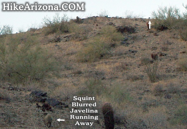
Marker 42 is a bend in the trail or something. I remember it best by the ten plus javelina scattering every which way. They're fun to watch. They kind of gallop aimlessly. I took a couple of quick photos. I was putting the camera away when another one jolted right beside me. It wasn't until the return trip that I noticed what they were doing. Also saw one skinny rabbit which made me wonder how in the world they get by without water.
Marker 41 is in the middle of the connector ridge. Between here and 40 is a section of trail fairly tough for a hiker, forget mountain biking it. It's steep loose gravel. Got me thinking, you know, you'd think there'd be a large bare spot at the top cause this gravel is only going DOWN! At any rate, by marker 40 you're getting to the good stuff. The trail zigs all over the place. This isn't a clean-cut point A to point B clothesline ridge. It's wide, then narrow, then who knows. If you did make it to this point on a bike it's joyriding from here to the Mormon trail.
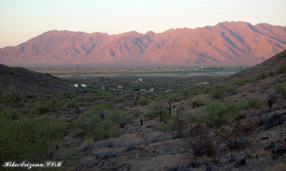
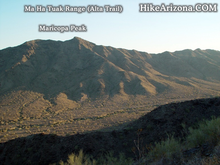
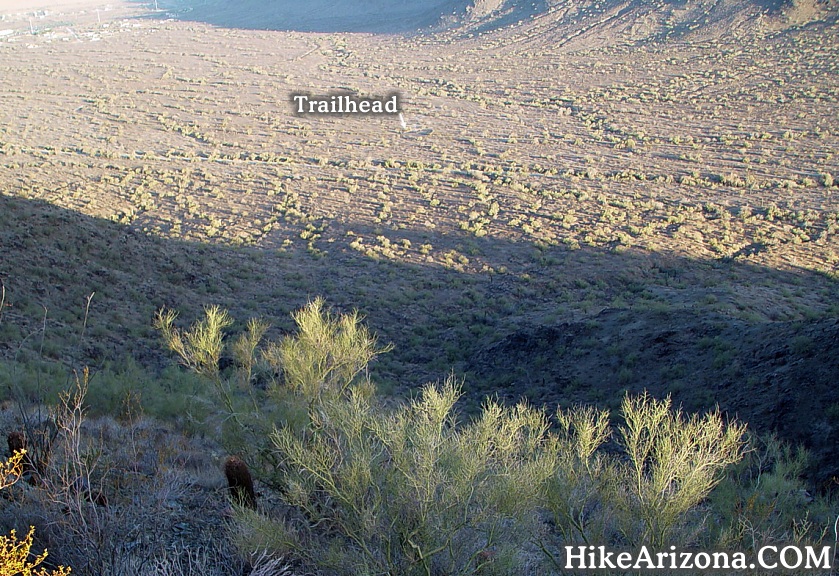
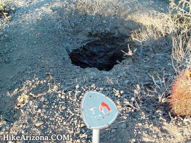
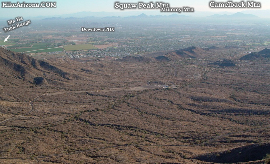
Most notably first is the Ma Ha Tuak Range to the north. The pointy peak is Maricopa Peak. It kind of resembles Browns Peak as viewed from Roosevelt Lake. Next, you'll notice the valley you just came from is flat! Good luck finding the trailhead down below without a zoom lens. Along the way are several mines. Looking at a topographical map it's evident this whole area was scoured. These are, for the most part, shallow holes. One did appear to tunnel down. The only thing really interesting is the thought of the work involved hauling your butt up here then digging into rock, ugh.
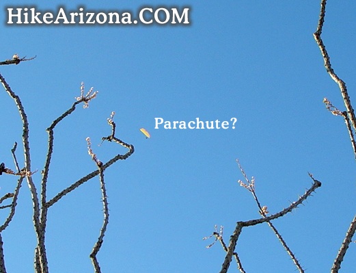
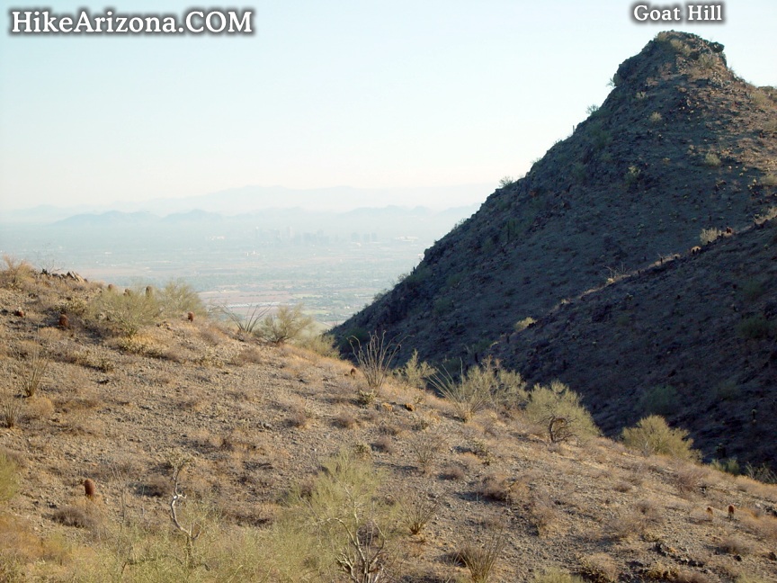
Awatukee can be seen to the south. The rolling hills depict why this area is "too good" to just be called Phoenix, even though that's what it is. Somebody was coming down in a parachute from above. However, as he or she came closer I could hear a motor. Seemed odd that that would be allowed in the middle of a city? Hmmm. Anyhow, enjoy the stroll over to Goat Hill. This is the high point of the Gila Range not to be confused with the Guadalupe Range you might be more familiar with. Goat Hill juts up from its surroundings so it's easy to spot. It's a little ways past marker 38. Guess I forgot 39, it was missing the number plate and signified the trail was turning at some point. If you need to be rescued it won't seem so useless.
The views atop Goat Hill are pretty good. You have a nice wide view of the valley. The radio towers are due east. Return the way you came. You might also opt to make this a loop trip. Continue on the National Trail 0.3 miles further and head on down to the Bajada Trail. Which as you recall goes back to marker 51.
Gate Policy: If a gate is closed upon arrival, leave it closed after you go through. If it is open, leave it open. Leaving a closed gate open may put cattle in danger. Closing an open gate may cut them off from water. Please be respectful, leave gates as found. The exception is signage on the gate directing you otherwise.
WARNING! Hiking and outdoor related sports can be dangerous. Be responsible and prepare for the trip. Study the area you are entering and plan accordingly. Dress for the current and unexpected weather changes. Take plenty of water. Never go alone. Make an itinerary with your plan(s), route(s), destination(s) and expected return time. Give your itinerary to trusted family and/or friends.
Permit $$
None
Directions
Road
Paved - Car Okay
To hike From Phoenix, head straight down Central, keep going and going until it hits South Mountain. The road curves west passing an entrance gate. Keep going to the information/bathroom center. Continue on about 3.7 miles. Basically, San Juan 'Road' Trailhead is 1.7 miles past the Bajada Trailhead. If you go too far you'll curve right to the Alta Trailhead.
 Route Editor

 Overview


