 Route Editor

| Guide | ♦ | 89 Triplogs | 0 Topics |
details | drive | permit | forecast | route |
stats |
photos | triplogs | topics | location |
| 110 | 89 | 0 |
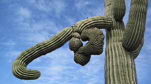
The Rainbow Connection by Moovyoaz  2013 Notice 2013 NoticePark trails have changed, hence why this is no longer included in the Estrella Mapped Area. Overview This scenic loop incorporates parts of the Rainbow Valley, Toothaker, Pedersen, and Coldwater Trails as it loops around the western side of Estrella Mountain Regional Park. Much of the loop is flat and easy, but there are several rough, steep sections along the Rainbow Valley Trail.
The hike begins at the Estrella Mountain Regional Park Rainbow Valley trailhead located on the west side of the park's Rodeo Arena. About 50 yards beyond the trailhead, the signed Toothaker Trail branches off to the left. Ignore it and head straight west on the Rainbow Valley Trail which winds into the hills through scattered ironwoods, paloverdes, saguaro, and cholla. As the trail climbs gradually into the mountains, it offers nice views of the old Estrella Golf Course and the Gila River in the distance below. Soon the Rainbow Valley Trail turns to the south and leaves all traces of civilization behind as it wanders up and down through the Estrellas. After 1.5 miles, the trail makes a steep, rocky descent into a valley where it meets the signed junction with Dysart Trail at about 2.1 miles. For a shorter hike, one can take it 0.7 miles east to the Toothaker Trail, which leads northeast back to the trailhead, completing a 4.5-mile loop. Continue south on the Rainbow Valley Trail. After a mile, it bends east and ends at the Toothaker Trail, 3.4 miles from the trailhead. Again, for a shorter hike, take the Toothaker Trail north about 2 miles back to the trailhead, completing a 5.4-mile loop. The longer loop now continues south on the Toothaker Trail, winding another 1.5 miles down to its junction with the Pedersen Trail. Go northeast .2 mile on the Pedersen Trail to the junction with the Coldwater Trail. The loop then proceeds north, passing through several washes. After about 1.6 miles the Coldwater Trail arrives at what is known as the 'Staging Area', which was apparently once a trailhead. Here are two choices for the return to the starting trailhead: One can head east on the Dysart Trail to the Toothaker Trail, and then north, or continue north on the Coldwater Trail, which follows an old road to the parking area on the east side of the Rodeo Arena. Then go west 0.2 miles to the starting TH and parking area on the west side of the arena. Either route north makes for an 8.4-mile loop. Note In 2009, what was once the eastern leg of the Rainbow Valley Trail has been renamed, and is known as the Butterfield Trail. Check the maps below.
Check out the Official Route and Triplogs. Leave No Trace and +Add a Triplog after your hike to support this local community. One-Way Notice This hike is listed as One-Way. When hiking several trails on a single "hike", log it with a generic name that describes the hike. Then link the trails traveled, check out the example. | |||||||||||||||||||||||||||||||||||||||||||||||||||||||||||||||||||||||||||||||||||||||||||||||||||||||||||||||||||||||||||||||||||||||||||||||||||||||||||||||||||||||||||||||


