 Route Editor

| Guide | ♦ | 24 Triplogs | 0 Topics |
details | drive | permit | forecast | 🔥 route |
stats |
photos | triplogs | topics | location |
| 64 | 24 | 0 |
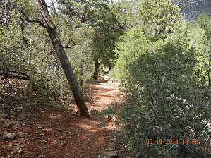
Rocky by aimeeclimbs   This hike is not for the weak-ankled or thin-skinned. It is very rocky and requires bushwacking through scrub oak. Long sleeves and pants are highly recommended. The trail is in the sun, with little shade, so it's best to do it on a cool day. It's a steep climb, with not terribly spectacular views from the top, but it's good exercise. This hike is not for the weak-ankled or thin-skinned. It is very rocky and requires bushwacking through scrub oak. Long sleeves and pants are highly recommended. The trail is in the sun, with little shade, so it's best to do it on a cool day. It's a steep climb, with not terribly spectacular views from the top, but it's good exercise.Park at Grasshopper Point (or somewhere nearby, if you don't want to pay the fee). From the parking, the trail starts to the north where you will see a metal sign for Allen's Bend Trail #111. Take this trail for 0.5 miles until you see a sign for Casner Canyon. At this point head east toward the creek. When you reach the creek, look upstream for a crossing made up of 3 logs lashed together. (This was in place in Jan. 2006.) It was quite stable and I didn't get my feet wet at all. It's 0.03 miles upstream from the mouth of Casner Canyon, so once you cross, be sure to hike downstream and start at the mouth of the canyon. There is a faint trail that leads up the hill directly across from the crossing, but don't take this- it peters out after about 0.4 miles).
Sorry I have no pictures. I brought my husband's camera, only to discover it had no batteries. I even wore my HAZ tank top for a nice summit shot! Oh well. Maybe next time. Gate Policy: If a gate is closed upon arrival, leave it closed after you go through. If it is open, leave it open. Leaving a closed gate open may put cattle in danger. Closing an open gate may cut them off from water. Please be respectful, leave gates as found. The exception is signage on the gate directing you otherwise.
Coconino FS Details Bring your wading shoes for this one. You'll be wading clear, cool Oak Creek early in the hike. According to historians, this trail was built to provide cattle grazers a means of getting their stock from water on the canyon floor to pastures on the canyon rim. Today, it is used by hikers and horseback for access into the heart of a landscape most people see only through their telephoto lens. After crossing Oak Creek, the trail leads a short way up the floor of Casner Canyon before turning up the canyon's north slope. It then continues a long and sometimes steep climb to the canyon rim about a half-mile north of the Schnebly Hill Road overlook. The route it follows is a scenic one, right through the middle of some of the rock formations that make up the spectacular view from Sedona and Highway 89. Because the shade is sparse, this can be a hard, hot climb on a sunny day. Bring lots of water along with your camera. USGS Map: Munds Park Check out the Official Route and Triplogs. Note This is a moderately difficult hike. Leave No Trace and +Add a Triplog after your hike to support this local community. One-Way Notice This hike is listed as One-Way. When hiking several trails on a single "hike", log it with a generic name that describes the hike. Then link the trails traveled, check out the example. | |||||||||||||||||||||||||||||||||||||||||||||||||||||||||||||||||||||||||||||||||||||||||||||||||||||||||||||||||||||||||||||||||||||||||||||||||||||||||||||||||||||||||||||||||||||||||||||||||||||||||||||||||||


