username
X
password
register
for free!
help
ArticlesGuidesRoutes
 
Photosets
 
 Comments
triplogs   photosets   labels comments more
1, 2  Next
23 triplogs
login for filter options
Mar 18 2007
avatar

 Guides 2
 Photos 8
 Triplogs 23

female
 Joined Sep 06 2005
 Flagstaf, AZ
Ledges Trail #138Flagstaff, AZ
Flagstaff, AZ
Hiking avatar Mar 18 2007
aimeeclimbsTriplogs 23
Hiking1.50 Miles 100 AEG
Hiking1.50 Miles      45 Mns   2.00 mph
100 ft AEG
 no routesno photosets
1st trip
Linked   none no linked trail guides
Partners none no partners
This trail starts out from a cute campground, goes behind a bunch of summer cabins and ends up with a great view over Mormon Lake on some neat basalt formations.
_____________________
 
Mar 17 2007
avatar

 Guides 2
 Photos 8
 Triplogs 23

female
 Joined Sep 06 2005
 Flagstaf, AZ
Oldham Trail #1Flagstaff, AZ
Flagstaff, AZ
Hiking avatar Mar 17 2007
aimeeclimbsTriplogs 23
Hiking1.00 Miles 2,000 AEG
Hiking1.00 Miles      30 Mns   2.00 mph
2,000 ft AEG
 no routesno photosets
1st trip
Linked   none no linked trail guides
Partners none no partners
I do various parts of this trail almost every day since it is accessable from my neighborhood. Hopefully one day I'll go all the way to the top of elden. That would be quite a hike!
_____________________
 
Mar 04 2007
avatar

 Guides 2
 Photos 8
 Triplogs 23

female
 Joined Sep 06 2005
 Flagstaf, AZ
Red Mountain Trail #159Flagstaff, AZ
Flagstaff, AZ
Hiking avatar Mar 04 2007
aimeeclimbsTriplogs 23
Hiking2.50 Miles 400 AEG
Hiking2.50 Miles   1 Hour   30 Mns   1.67 mph
400 ft AEG
 no routesno photosets
1st trip
Linked   none no linked trail guides
Partners none no partners
My birthday hike. Nice and mellow cause I was 8.5 months pregnant.
_____________________
 
Feb 15 2007
avatar

 Guides 2
 Photos 8
 Triplogs 23

female
 Joined Sep 06 2005
 Flagstaf, AZ
Bear Mountain Trail #54Sedona, AZ
Sedona, AZ
Hiking avatar Feb 15 2007
aimeeclimbsTriplogs 23
Hiking5.00 Miles 2,100 AEG
Hiking5.00 Miles   3 Hrs      1.67 mph
2,100 ft AEG
 no routesno photosets
1st trip
Linked   none no linked trail guides
Partners none no partners
This was an awesome hike. I can't believe I did it 8 months pregnant!
_____________________
 
Aug 18 2006
avatar

 Guides 2
 Photos 8
 Triplogs 23

female
 Joined Sep 06 2005
 Flagstaf, AZ
Rocky Ridge Trail #153Flagstaff, AZ
Flagstaff, AZ
Mtn Biking avatar Aug 18 2006
aimeeclimbsTriplogs 23
Mtn Biking2.20 Miles 100 AEG
Mtn Biking2.20 Miles   1 Hour      2.20 mph
100 ft AEG
 no routesno photosets
1st trip
Linked   none no linked trail guides
Partners none no partners
Rode my bike from my house to Elden Lookout Road where the Schultz pass trail starts and thought I'd ride home on this trail. Bad idea! They call it "Rocky Ridge" for a good reason! It's super rocky. Not so good if you're a weenie bike rider, like me.
_____________________
 
Jul 13 2006
avatar

 Guides 2
 Photos 8
 Triplogs 23

female
 Joined Sep 06 2005
 Flagstaf, AZ
Sunset Trail #23 - FlagstaffFlagstaff, AZ
Flagstaff, AZ
Hiking avatar Jul 13 2006
aimeeclimbsTriplogs 23
Hiking4.00 Miles 1,275 AEG
Hiking4.00 Miles   2 Hrs      2.00 mph
1,275 ft AEG
 no routesno photosets
1st trip
Linked   none no linked trail guides
Partners none no partners
This is a beautiful hike. It's kind of a long drive up Schultz Pass, but it is so peaceful up there. It's nice in the summer, but you'd better get an early start.
_____________________
 
Apr 14 2006
avatar

 Guides 2
 Photos 8
 Triplogs 23

female
 Joined Sep 06 2005
 Flagstaf, AZ
Capitol Butte South Face aka Thunder MtnSedona, AZ
Sedona, AZ
Hiking avatar Apr 14 2006
aimeeclimbsTriplogs 23
Hiking2.20 Miles 1,700 AEG
Hiking2.20 Miles
1,700 ft AEG
 no routes
1st trip
Linked   none no linked trail guides
Partners none no partners
Thunder Mountain is a sunny, hot hike straight up the side of a mountain. The trail is fairly straightforward until you start hiking uphill quickly.

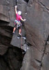
From the parking, hike east on a small trail about a quarter of a mile until a larger trail heads north. Follow this trail north until you see a big boulder, about another quarter of a mile. From this boulder, look for a big juniper tree growing out of the mountain. Head straight up the mountain aiming for a rock ramp to the right of this juniper. You should be at a short 4th Class (this means you must use hands and feet to ascend, but don't need a rope) section. After this, bushy ramps head back to the right and then it's cross country trail to the summit. We didn't actually get past the little scramble because our dog wasn't willing to do it, so that's definitely something to keep in mind if you have a dog. The scramble drops off on one side, and some dogs get a little troubled by this.

Again, this is a difficult, steep hike. Bring plenty of water and make sure you are sure footed. A wrong step could be disastrous. This hike is difficult and does not follow much of a trail to the rocky ramp. Apparently it also does not follow a trail after the rocky ramp either. Be sure to tread lightly and spread out to minimize impact if there is no trail. Also, realize that although I may have felt comfortable climbing the aforementioned rocky ramp ropeless, this sentiment may not be shared by all.

This trail should not be attempted in wet weather or if thunderstorms are expected.
_____________________
 
Apr 08 2006
avatar

 Guides 2
 Photos 8
 Triplogs 23

female
 Joined Sep 06 2005
 Flagstaf, AZ
Thumb Butte Trail #33Prescott, AZ
Prescott, AZ
Hiking avatar Apr 08 2006
aimeeclimbsTriplogs 23
Hiking1.70 Miles 600 AEG
Hiking1.70 Miles      26 Mns   3.92 mph
600 ft AEG
 no routesno photosets
Linked   none no linked trail guides
Partners none no partners
16 minutes up and 10 down, going up the dirt and down the paved (although I wish I would have done it the other way and saved my knees!)
_____________________
 
Mar 20 2006
avatar

 Guides 2
 Photos 8
 Triplogs 23

female
 Joined Sep 06 2005
 Flagstaf, AZ
Inner Basin Trail #29Flagstaff, AZ
Flagstaff, AZ
Hiking avatar Mar 20 2006
aimeeclimbsTriplogs 23
Hiking6.90 Miles 2,398 AEG
Hiking6.90 Miles   4 Hrs      1.73 mph
2,398 ft AEG
 no routesno photosets
1st trip
Linked   none no linked trail guides
Partners none no partners
The traditional Fall hike. It can't be beat.
_____________________
 
Mar 19 2006
avatar

 Guides 2
 Photos 8
 Triplogs 23

female
 Joined Sep 06 2005
 Flagstaf, AZ
Brins Mesa Trail #119Sedona, AZ
Sedona, AZ
Hiking avatar Mar 19 2006
aimeeclimbsTriplogs 23
Hiking3.60 Miles 600 AEG
Hiking3.60 Miles   3 Hrs      1.20 mph
600 ft AEG
 no routesno photosets
1st trip
Linked   none no linked trail guides
Partners none no partners
We took the right hand trail out of the parking lot that supposedly leads to Lost Canyon, but we went up to the rim above the ruins. We followed this rim around until we were opposite Devil's Bridge. We then dropped down from a saddle and followed the trail around back to the parking lot. It was a great loop. Maybe 4-5 miles.
_____________________
 
Feb 18 2006
avatar

 Guides 2
 Photos 8
 Triplogs 23

female
 Joined Sep 06 2005
 Flagstaf, AZ
Thunder Mountain, AZ 
Thunder Mountain, AZ
 
Hiking avatar Feb 18 2006
aimeeclimbsTriplogs 23
Hiking2.20 Miles
Hiking2.20 Miles      40 Mns   3.30 mph
 no routesno photosets
1st trip
Linked   none no linked trail guides
Partners none no partners
Drive through uptown sedona and stay right. Turn right on Andante Dr. and park at the end of it. Then hike east until you hit another trail with a cairn in wire mesh. Head left and start hiking straight up the mountain. Look for a large juniper tree to the left when the hiking gets really steep and find a small rock ramp that heads from right to left to the juniper. That's as far as we got, cause the dog didn't want to go up the ramp, but I plan to go back and finish the hike and then I can do a real trip description.
_____________________
 
Jan 28 2006
avatar

 Guides 2
 Photos 8
 Triplogs 23

female
 Joined Sep 06 2005
 Flagstaf, AZ
Casner Canyon Trail #11Sedona, AZ
Sedona, AZ
Hiking avatar Jan 28 2006
aimeeclimbsTriplogs 23
Hiking4.00 Miles 1,800 AEG
Hiking4.00 Miles   2 Hrs      2.00 mph
1,800 ft AEG
 no routesno photosets
1st trip
Linked   none no linked trail guides
Partners none no partners
Lots of rocks and bushwacking, but good exercise. I like AB Young better though. Better trail and better views.
_____________________
 
Jan 06 2006
avatar

 Guides 2
 Photos 8
 Triplogs 23

female
 Joined Sep 06 2005
 Flagstaf, AZ
A.B. Young Trail #100Sedona, AZ
Sedona, AZ
Hiking avatar Jan 06 2006
aimeeclimbsTriplogs 23
Hiking4.80 Miles 2,025 AEG
Hiking4.80 Miles   1 Hour   15 Mns   3.84 mph
2,025 ft AEG
 no routesno photosets
1st trip
Linked   none no linked trail guides
Partners none no partners
The description for the beginning of the trail led us a bit astray. We hiked up a steep hill to a bushwack when really you just hike under the powerlines until you find the sign. The start of the trail is almost directly opposite the campground, maybe 500 feet upstream from the stairs. Hiking up from the creek to the power lines is not at all like a "steep ravine".

It was a great hike though. Thoroughly enjoyable and crazy to be able to do it in the middle of winter with no snow!
_____________________
 
Sep 19 2005
avatar

 Guides 2
 Photos 8
 Triplogs 23

female
 Joined Sep 06 2005
 Flagstaf, AZ
Jug Trail #61 - Salome WildernessGlobe, AZ
Globe, AZ
Hiking avatar Sep 19 2005
aimeeclimbsTriplogs 23
Hiking3.50 Miles 500 AEG
Hiking3.50 Miles   3 Hrs      1.17 mph
500 ft AEG
 no routesno photosets
1st trip
Linked   none no linked trail guides
Partners none no partners
Super fun. I would recommend hiking as far upstream until you can get to the water. Then swim along until you get to the drop. You can either rappel (if you know how and have the equipment) or jump, if the water is high enough. I was too scared and shivery to do the jump, but it did look possible.

This is a truely beautiful canyon. Do not swim it in the spring if the water is high and fast moving. It can be very dangerous.
_____________________
 
Sep 06 2005
avatar

 Guides 2
 Photos 8
 Triplogs 23

female
 Joined Sep 06 2005
 Flagstaf, AZ
Weatherford Trail #102Flagstaff, AZ
Flagstaff, AZ
Hiking avatar Sep 06 2005
aimeeclimbsTriplogs 23
Hiking17.40 Miles 4,609 AEG
Hiking17.40 Miles   8 Hrs      2.18 mph
4,609 ft AEG
 no routesno photosets
1st trip
Linked   none no linked trail guides
Partners none no partners
Great trail, especially when done with 2 vehicles. Leave one at Snowbowl and do it as a through hike with a summit of Mt. Humphries along the way.
_____________________
 
Sep 06 2005
avatar

 Guides 2
 Photos 8
 Triplogs 23

female
 Joined Sep 06 2005
 Flagstaf, AZ
West Fork Oak Creek Trail #108Sedona, AZ
Sedona, AZ
Hiking avatar Sep 06 2005
aimeeclimbsTriplogs 23
Hiking4.00 Miles 200 AEG
Hiking4.00 Miles   1 Hour      4.00 mph
200 ft AEG
 no routesno photosets
1st trip
Linked   none no linked trail guides
Partners none no partners
One of our all time favorites, though we have to do it during the week because our dog likes to swim in the water.
_____________________
 
Oct 28 2004
avatar

 Guides 2
 Photos 8
 Triplogs 23

female
 Joined Sep 06 2005
 Flagstaf, AZ
Thumb Butte Trail #33Prescott, AZ
Prescott, AZ
Hiking avatar Oct 28 2004
aimeeclimbsTriplogs 23
Hiking1.70 Miles 600 AEG
Hiking1.70 Miles      30 Mns   3.40 mph
600 ft AEG
 no routesno photosets
Linked   none no linked trail guides
Partners none no partners
_____________________
 
Aug 13 2004
avatar

 Guides 2
 Photos 8
 Triplogs 23

female
 Joined Sep 06 2005
 Flagstaf, AZ
Elden Lookout Trail #4Flagstaff, AZ
Flagstaff, AZ
Hiking avatar Aug 13 2004
aimeeclimbsTriplogs 23
Hiking6.00 Miles 2,400 AEG
Hiking6.00 Miles   1 Hour   3 Mns   5.71 mph
2,400 ft AEG
 no routesno photosets
1st trip
Linked   none no linked trail guides
Partners none no partners
Another good training run/hike for the Imogene.
_____________________
 
Aug 13 2004
avatar

 Guides 2
 Photos 8
 Triplogs 23

female
 Joined Sep 06 2005
 Flagstaf, AZ
Humphreys Summit Trail #151Flagstaff, AZ
Flagstaff, AZ
Hiking avatar Aug 13 2004
aimeeclimbsTriplogs 23
Hiking9.00 Miles 3,313 AEG
Hiking9.00 Miles   4 Hrs      2.25 mph
3,313 ft AEG
 no routesno photosets
1st trip
Linked   none no linked trail guides
Partners none no partners
Have done the trail 3 times and haven't made it to the summit yet. Been training for the Imogene each time and by the time I get to the Saddle, my hubby has already been up to the summit and is waiting at the saddle to hike down with me. Maybe next time!
_____________________
 
Mar 10 2004
avatar

 Guides 2
 Photos 8
 Triplogs 23

female
 Joined Sep 06 2005
 Flagstaf, AZ
Hermit Trail - Grand CanyonNorthwest, AZ
Northwest, AZ
Hiking avatar Mar 10 2004
aimeeclimbsTriplogs 23
Hiking3.50 Miles 3,800 AEG
Hiking3.50 Miles   2 Hrs      1.75 mph
3,800 ft AEG
 no routesno photosets
1st trip
Linked   none no linked trail guides
Partners none no partners
Just hike to Cedar Ridge. Some serious lightning strikes convinced us to turn around. Amazing views!
_____________________
 
average hiking speed 1.83 mph
1, 2  Next

WARNING! Hiking and outdoor related sports can be dangerous. Be responsible and prepare for the trip. Study the area you are entering and plan accordingly. Dress for the current and unexpected weather changes. Take plenty of water. Never go alone. Make an itinerary with your plan(s), route(s), destination(s) and expected return time. Give your itinerary to trusted family and/or friends.

helpcommentissue

end of page marker