 Route Editor

| Guide | ♦ | 18 Triplogs | 0 Topics |
details | drive | permit | forecast | 🔥 route |
stats |
photos | triplogs | topics | location |
| 144 | 18 | 0 |
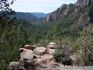
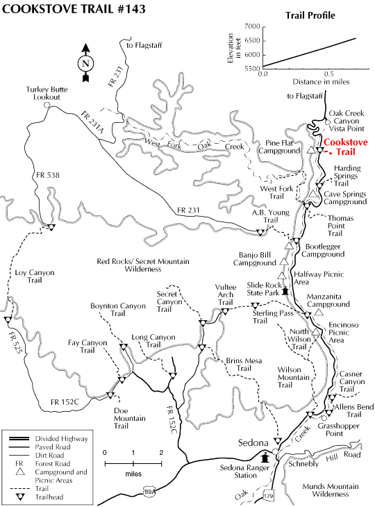
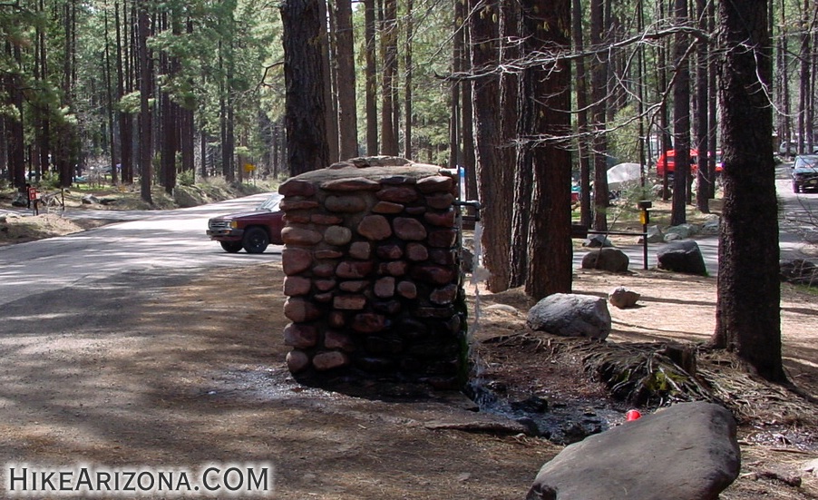
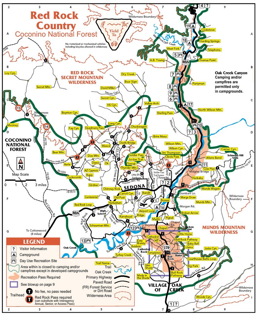
Great workout w/ views by joebartels   Cookstove Trail #143 takes off from the north end of Pine Flat Campgrounds on the east side of Highway 89A. I passed on this trail several times in the past. I'm sorry I did as this is a great little trail. There's a spring on the west side of the road gushing water from a human-made thingy-ma-bob/doohicky. Cars continuously pull over and fill water bottles from the natural spring. The trail takes off across Highway 89A from the spring. It wastes no time in ascending the east wall of Oak Creek Canyon, going up quickly. Scrawny pines densely populate the lower slopes. Cookstove Trail #143 takes off from the north end of Pine Flat Campgrounds on the east side of Highway 89A. I passed on this trail several times in the past. I'm sorry I did as this is a great little trail. There's a spring on the west side of the road gushing water from a human-made thingy-ma-bob/doohicky. Cars continuously pull over and fill water bottles from the natural spring. The trail takes off across Highway 89A from the spring. It wastes no time in ascending the east wall of Oak Creek Canyon, going up quickly. Scrawny pines densely populate the lower slopes.The trail comes up to the edge of Cookstove Draw. Here it gets even steeper, and steps are encountered in several sections. If there have been recent rains, you can hear the water running down the draw. I read you could see a good size falls in the near distance. The foliage was too dense to see anything on this trip. I did hear the tumbling sound of the falls!
I hiked down this trail on a loop as my first attempt, then hiked up and down later. Campfires below fill the cool spring breezes, which adds a lovely setting. On the rim, I heard woodpeckers in the near distance. I really enjoyed this hike. Sedona continues to inspire me. Camping Based on the 2018 FS map, camping is allowed off-trail east of the rim outside the green line. That said, it's not for newbies or anyone looking for a resort experience.
Coconino FS Details Originally built to provide access for forest firefighters to Oak Creek Canyon's wooded slopes, Cookstove Trail now offers nature lovers a scenic route to the canyon rim. The trail starts from the north end of Pine Flat Campground and immediately begins switchbacking up the steep slope of the canyon's east wall. It climbs through an area forested with stands of mixed conifers, Gambel Oaks and both Utah and alligator junipers. The trees part at a number of points along the trail offering good views of the buff- colored cliffs of Coconino Sandstone and the remnants of an old volcano across Oak Creek. There are also some good views of the Route 89A switchbacks that lead into the canyon. At the top of the climb, an outcrop of volcanic basalt provides a lunch stop where you can enjoy the view before heading back down the trail or continuing south along the canyon rim to the Harding Springs Trail for an alternate descent back to the highway.
Check out the Official Route and Triplogs. Leave No Trace and +Add a Triplog after your hike to support this local community. One-Way Notice This hike is listed as One-Way. When hiking several trails on a single "hike", log it with a generic name that describes the hike. Then link the trails traveled, check out the example. | ||||||||||||||||||||||||||||||||||||||||||||||||||||||||||||||||||||||||||||||||||||||||||||||||||||||||||||||||||||||||||||||||||||||||||||||||||||||||||||||||||||||||||||||||||||||||


