Here's a trail just a few minutes outside Flagstaff that offers good photo opportunities, interesting geology, great views, and access to a longer trail that stretches all the way across Arizona. Sandys Canyon Trail starts by skirting the rim of Walnut Canyon, a scenic rift in the same rock layers that form the Grand Canyon's upper cliffs. From the trailhead, you get a great view of the San Francisco Peaks with the cliffs of Walnut Canyon in the foreground - time to reach for the camera
The trail heads north from the trailhead following the Walnut Canyon Rim for a short distance before it drops down Sandys Canyon into the main gorge. Sandys Canyon Trail then continues along the Walnut Canyon floor on an old jeep track to an intersection with the Arizona Trail. Here you'll find more Grand Canyon style cliffs complete with the same bright colors of that World Heritage Site. The pronounced cross-bedding and deep red hue of these petrified Permian Age sand dunes will have you reaching for your camera again.
This trail is best suited for hiking or horseback. If you don't have your own steed, a nearby concessionaire provides guided rides into these scenic canyonlands. If you'd like to turn your Sandy's Canyon venture into a longer hike you can follow the Arizona Trail either north, down canyon to Fisher Point or east along Walnut toward Marshall Lake.
When hiking several trails on a single "hike", log it with a generic name that describes the hike. Then link the trails traveled, check out the example.
WARNING! Hiking and outdoor related sports can be dangerous. Be responsible and prepare for the trip. Study the area you are entering and plan accordingly. Dress for the current and unexpected weather changes. Take plenty of water. Never go alone. Make an itinerary with your plan(s), route(s), destination(s) and expected return time. Give your itinerary to trusted family and/or friends.
Permit $$
None
Directions
Road
Paved - Car Okay
To hike Location: Just south of Flagstaff near Lower Lake Mary on paved forest roads.
Access: Drive southeast out of Flagstaff 6 miles on Lake Mary Road (Forest Highway 3). Just past the second cattle guard turn north (left) to the trailhead.
 Route Editor


 Here's a trail just a few minutes outside Flagstaff that offers good photo opportunities, interesting geology, great views, and access to a longer trail that stretches all the way across Arizona. Sandys Canyon Trail starts by skirting the rim of Walnut Canyon, a scenic rift in the same rock layers that form the Grand Canyon's upper cliffs. From the trailhead, you get a great view of the San Francisco Peaks with the cliffs of Walnut Canyon in the foreground - time to reach for the camera
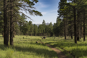


