 Route Editor

| Guide | ♦ | 29 Triplogs | 0 Topics |
details | drive | permit | forecast | 🔥 route |
stats |
photos | triplogs | topics | location |
| 41 | 29 | 0 |
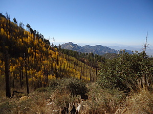
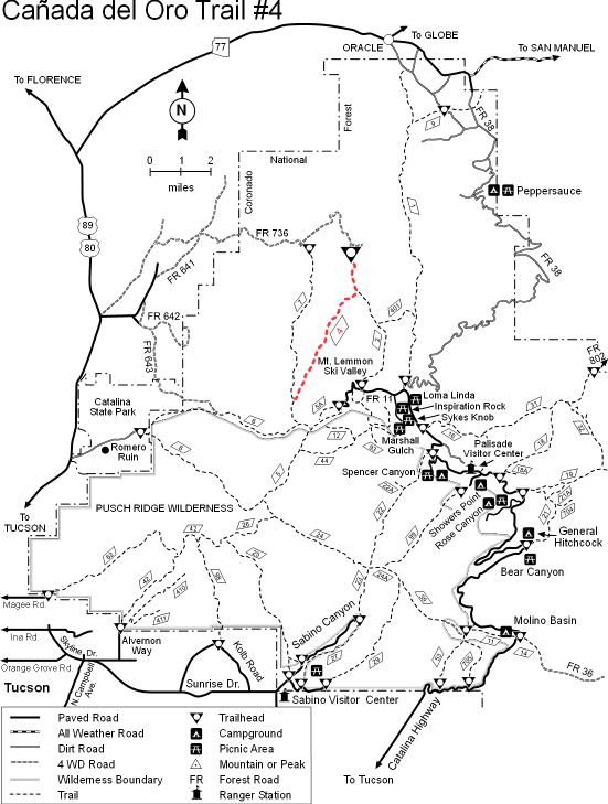
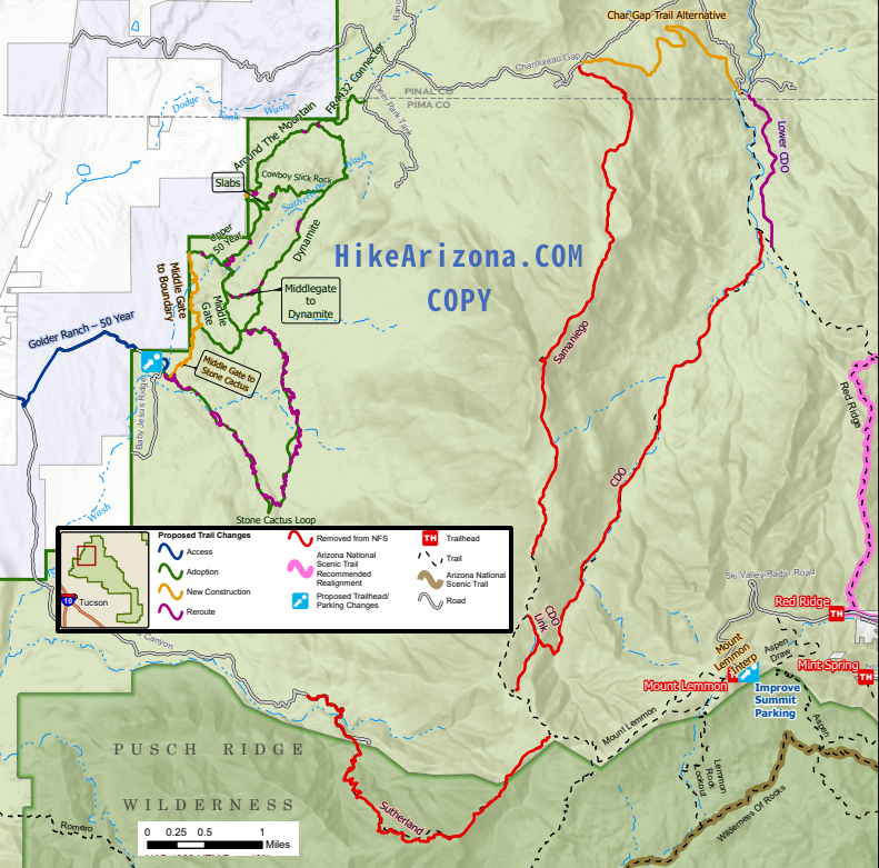
Bye bye Maple Leafs by HAZ_Hikebot  Bushwhackers beware, the National Forest manages by abandonment. Bushwhackers beware, the National Forest manages by abandonment.June 2023 - Decommissioning 5.25-miles Notes: Heavily impacted by Bighorn Fire, previously growing into a destination backcountry mountain bike ride Proposed: Reroute lower 1.4 mi out of drainage, and rename Red Ridge. Remove 5.25 mi portion between Samaniego and Red Ridge from NFS. Rename upper portion Samaniego. Overview This old trail follows the drainage of the Canada del Oro, or Canyon of Gold, down the north slopes of Mt. Lemmon toward the town of Oracle. Besides being the site of a legendary lost gold mine, this canyon seems a bit lost itself. Down the slopes of Mt. Lemmon, it flows almost due north toward Oracle, but after Canada breaks out onto the broad flat valley at the mountain's base, it turns south and heads towards Tucson.
The usual way of accessing this trail is via a maintenance road along the underground powerline, which supplies electricity to the ski resort and observatory at the top of Mt. Lemmon. The trail leaves the powerline right-of-way in the vicinity of Shovel Spring and drops into the West Fork of the Canada del Oro. Once it reaches the broad canyon floor, the trail follows the gentle gradient of the streambed in the shade of the stately old sycamores and cottonwoods. Samaniego Ridge to the west and the Reef of Rocks to the east form the rims of the canyon and frame the view of the canyon's lower reaches and the Black Hills north of Oracle. Where the east fork of the canyon joins the west, the Red Ridge Trail #2 branches off towards an old outpost named Catalina Camp. A similar group of mining digs and an old adobe outbuilding are located along the canyon floor at Coronado Camp. A common destination for travelers along this trail is the 4-wheel drive road (FR 736) which drops down into the canyon from Charoleau Gap. Some hikers continue all the way to the Burney Mines area. Though there is ample evidence of human activity here, this area, in some ways, is more remote than the wilderness nearer to Tucson. Fewer trails lead into it, and fewer people visit it. Attractions: Big canyon, sycamores, and cottonwoods, old mines and shacks, views to the north, and mountain to desert diversity.
Check out the Official Route and Triplogs. Note This is a moderately difficult hike. Leave No Trace and +Add a Triplog after your hike to support this local community. One-Way Notice This hike is listed as One-Way. When hiking several trails on a single "hike", log it with a generic name that describes the hike. Then link the trails traveled, check out the example. | |||||||||||||||||||||||||||||||||||||||||||||||||||||||||||||||||||||||||||||||||||||||||||||||||||||||||||||||||||||||||||||||||||||||||||||||||||||||||||||||||||||||||||||||||||||||||||||||||||||||||||


