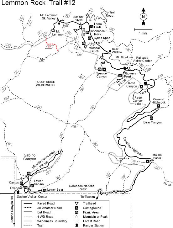
This trail extends from a trailhead just below Mt. Lemmon's summit and the Wilderness of Rock deep within that picturesque area of the Pusch Ridge Wilderness. It is a very steep trail, earning its most difficult rating by dropping 2,000 feet in a short two miles. The views are worth it, though, especially since the most expansive of them can be seen from a rocky overlook at the top of Lemmon Rock at the end of a short spur off the main trail. From this overlook, which also serves as the location for a historic Forest Service lookout cabin, you can see much of southeastern Arizona and northern Sonora Mexico.
Closer at hand, the views are just as impressive. Rappel Rock, the saw-toothed edge of Pusch Ridge, and the upper reaches of Sabino Canyon are some of the features that make up the panorama.
The point at which the spur to the lookout and the main trail part company is plainly marked. From this junction, the Lemmon Rock Trail drops steeply through a shady stand of ponderosa pines. At various points, the tree canopy opens to provide views of the spectacular rock formations which form the upper limit of the Wilderness of Rock. Included are close-up views of Rappel Rock and the Ravens. The trail becomes eroded and rocky as it nears its junction with the Wilderness of Rock Trail #44 at Lemmon Creek, which offers the only dependable water along this route.
Attractions: Marvelous views, accessible overlook, challenging trail, and access to Wilderness of Rock!
When hiking several trails on a single "hike", log it with a generic name that describes the hike. Then link the trails traveled, check out the example.
WARNING! Hiking and outdoor related sports can be dangerous. Be responsible and prepare for the trip. Study the area you are entering and plan accordingly. Dress for the current and unexpected weather changes. Take plenty of water. Never go alone. Make an itinerary with your plan(s), route(s), destination(s) and expected return time. Give your itinerary to trusted family and/or friends.
Four specific day-use areas require a Coronado Recreational Pass or a National Pass/America the Beautiful Pass.
1) Sabino Canyon - located on the Santa Catalina Ranger District (520)749-8700
2) Madera Canyon - located on the Nogales Ranger District (520)281-2296
3) Cave Creek - located on the Douglas Ranger District (520)364-3468
4) Mt. Lemmon at 11 day-use sites.
2025Catalina State Park
Per vehicle (1 person): $10.00
Per vehicle (2-4 people): $20.00
Individual/bicycle: $5.00
Coronado Forest MVUMs are rarely necessary to review unless mentioned in the description or directions Coronado Motor Vehicle Use Maps (MVUMs)
Directions
Road
Paved - Car Okay
To hike Take the Catalina Highway off Tanque Verde Road in Tucson. Drive 4.2 miles to the Forest boundary and continue 28 miles, past Mt. Lemmon Ski Valley, to the power substation on Radio Ridge. Hike west on the trail to a dirt road. Hike down the road to the trail junction.
The Catalina Highway is paved and suitable for passenger cars. Observatory Road is an all-weather graveled road. Both roads may be snow-covered in winter; when conditions suck, you may require chains or 4-wheel drive. Observatory Road beyond Mt. Lemmon Ski Valley is not maintained for public use during the winter. It is closed when snow-covered or icy.
 Route Editor

 This trail extends from a trailhead just below Mt. Lemmon's summit and the Wilderness of Rock deep within that picturesque area of the Pusch Ridge Wilderness. It is a very steep trail, earning its most difficult rating by dropping 2,000 feet in a short two miles. The views are worth it, though, especially since the most expansive of them can be seen from a rocky overlook at the top of Lemmon Rock at the end of a short spur off the main trail. From this overlook, which also serves as the location for a historic Forest Service lookout cabin, you can see much of southeastern Arizona and northern Sonora Mexico.


