 Route Editor

| Guide | ♦ | 50 Triplogs | 2 Topics |
details | drive | permit | forecast | 🔥 route |
stats |
photos | triplogs | topics | location |
| 581 | 50 | 2 |
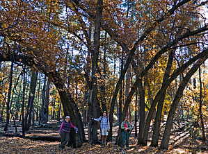
Visit the largest bears in Arizona by HAZ_Hikebot   This trail was originally and still serves as a service trail for the livestock industry. It does serve as part of the network of trails traversing the Pine Mountain Wilderness. It connects with the Willow Springs Trail #12, the Verde Rim Trail #161, and the Pine Flat Trail #165. The lower portions of the trail stay mainly in chaparral vegetation. There is considerable ponderosa pine on the portion of the trail from the trailhead near the Nelson Place to Bishop Spring. This trail was originally and still serves as a service trail for the livestock industry. It does serve as part of the network of trails traversing the Pine Mountain Wilderness. It connects with the Willow Springs Trail #12, the Verde Rim Trail #161, and the Pine Flat Trail #165. The lower portions of the trail stay mainly in chaparral vegetation. There is considerable ponderosa pine on the portion of the trail from the trailhead near the Nelson Place to Bishop Spring.Hike The trail enters the wilderness just beyond the Nelson Place Spring and stays within the Sycamore Creek drainage for about 1.75 miles. The trail then turns southeast, climbing steadily to its intersection with TR #12. From TR #12 to TR #14, the climb is short but steep. The intersection of TR #159 and TR #14 is known as the "Cloverleaf." The trail from here descends to the southwest along Bishop Creek. At about mile 4.5, the trail intersects with TR #161 coming down from the Verde Rim. At about mile 6.2, the trail intersects with TR #165 coming in from the north. The trail then continues almost due west to the wilderness area boundary where it ends on Forest Road 677A. This road is not recommended for travel, although it is passable to high clearance 4WD vehicles. Check out the Official Route and Triplogs. Leave No Trace and +Add a Triplog after your hike to support this local community. One-Way Notice This hike is listed as One-Way. When hiking several trails on a single "hike", log it with a generic name that describes the hike. Then link the trails traveled, check out the example. | ||||||||||||||||||||||||||||||||||||||||||||||||||||||||||||||||||||||||||||||||||||||||||||||||||||||||||||||||||||||||||||||||||||||||||||||||||||||||||||||||||||||||||||||||||||||||||||||||||||||||


