 Route Editor

| Guide | ♦ | 36 Triplogs | 0 Topics |
details | drive | permit | forecast | route |
stats |
photos | triplogs | topics | location |
| 196 | 36 | 0 |
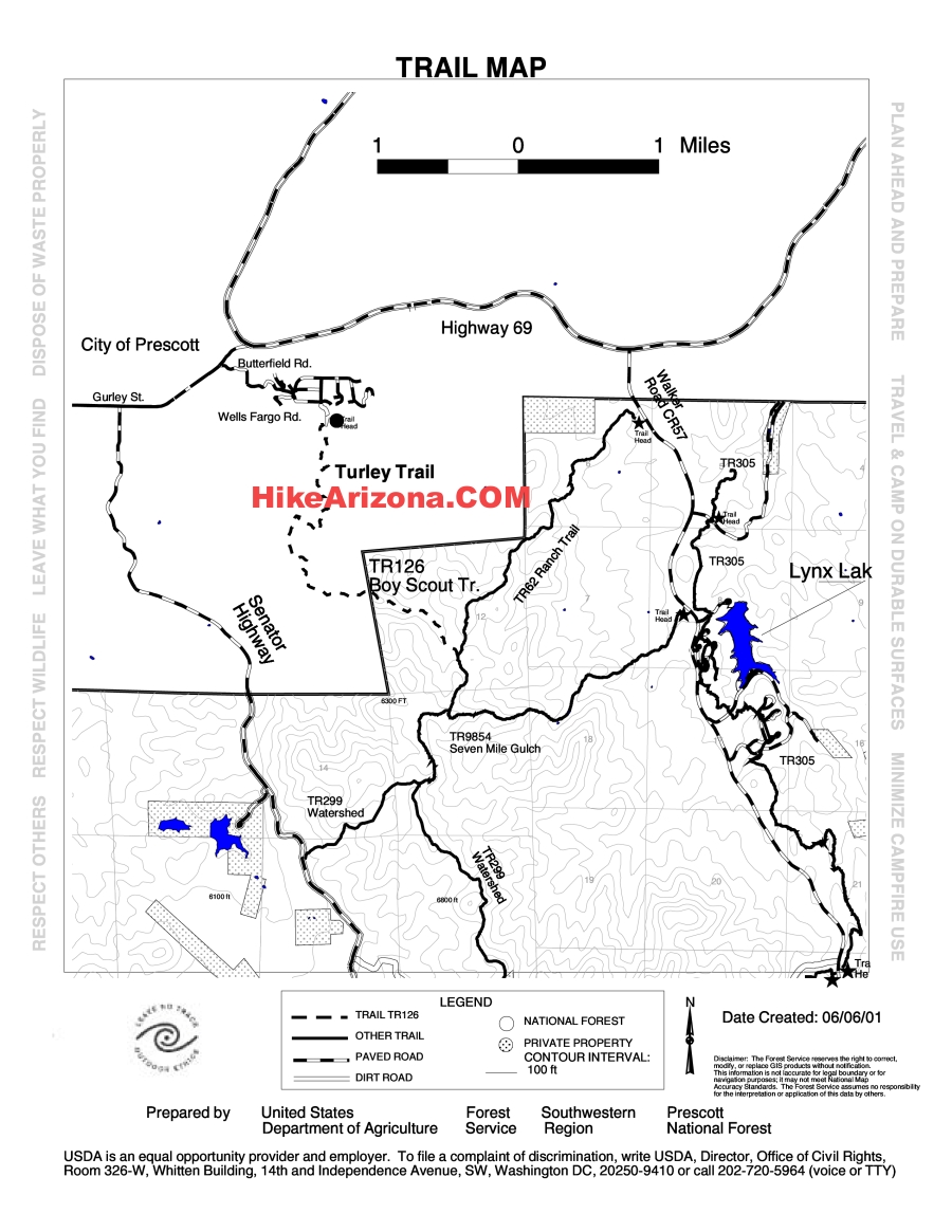
  Note NoteThis trail has changed over the years. Check out the Official Route for the current route as of 2018. 2003 I have avoided this trail for many years because I have considered it too close to civilization. Or should I say sprawling civilization finally growing and butting up against the national forest. However, it is time I post my summary on my favorite hiking site after having hiked Trail 62 this afternoon.
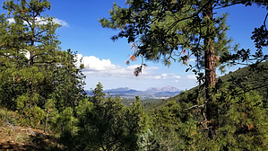
Once you pass the gate, the trail is wide open for about 2/3 of the way. Pinon pines, scrub oak, manzanita bushes, and homes dot the landscape; the traffic noise from State Highway 69 I found annoying. There does come the point when you go around a little hill, all the nuisance of homes on hillsides, homes sprawling on the semi-flat terrain, Gateway Mall, traffic noise will disappear for a short time. Then you can look east and see the nice open vista of the forest below. And your hike continues into a draw which is covered with scattered pockets of snow. Ponderosa pines, dead, dying, and struggling, providing shade. And then, after about three miles, you reach the trail end where it meets Seven Mile Gulch Trail #9854. Break time for trail mix and water. In closing, I do not care for Trail 62. But I will rate it as a two because it does not allow for motorized recreation. It is a trail close enough to Prescott, should anyone visit the area and would like a quick hike. And on the way down, you will see some nice views of Thumb Butte, Granite Mountain, the Granite Dells, Mingus, and the San Francisco Peaks. Gate Policy: If a gate is closed upon arrival, leave it closed after you go through. If it is open, leave it open. Leaving a closed gate open may put cattle in danger. Closing an open gate may cut them off from water. Please be respectful, leave gates as found. The exception is signage on the gate directing you otherwise.
Check out the Official Route and Triplogs. Leave No Trace and +Add a Triplog after your hike to support this local community. One-Way Notice This hike is listed as One-Way. When hiking several trails on a single "hike", log it with a generic name that describes the hike. Then link the trails traveled, check out the example. | |||||||||||||||||||||||||||||||||||||||||||||||||||||||||||||||||||||||||||||||||||||||||||||||||||||||||||||||||||||||||||||||||||||||||||||||||||||||||||||||||||||||||||||||||||


