 Route Editor

| Guide | ♦ | 6 Triplogs | 0 Topics |
details | drive | permit | forecast | route |
stats |
photos | triplogs | topics | location |
| 5 | 6 | 0 |
Harsh by Abe   Note NoteThe summary here represents one leg of a three-trail loop, hiked in the following order: 1) Juniper Springs Trail #2, 3.7 mi 2) Juniper Mesa Trail #20, 5.7 mi 3) Oaks and Willow Trail #3, 3.2 mi 4) 7.5 mi on FR 150 back to Trail #2 Caution I strongly recommend hiking this trail in mid-spring or mid-fall.
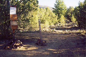
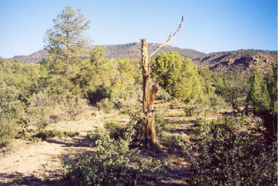
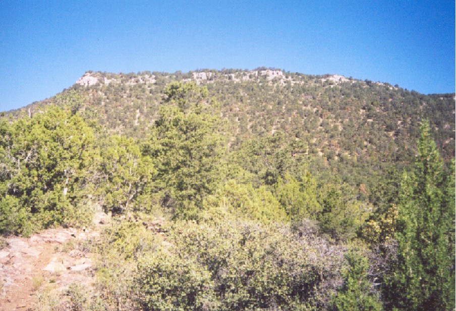
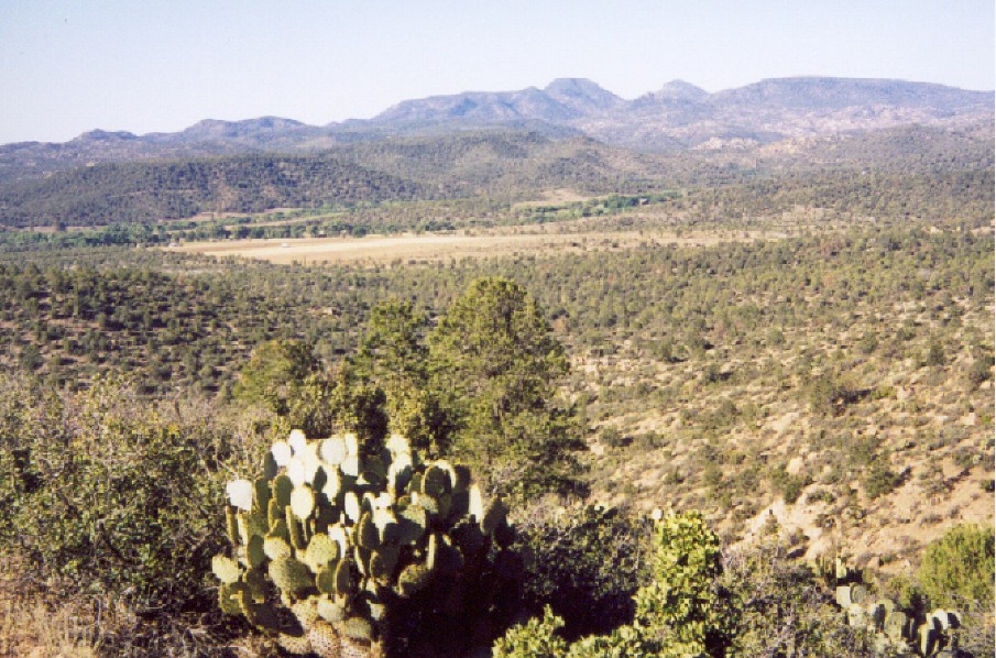
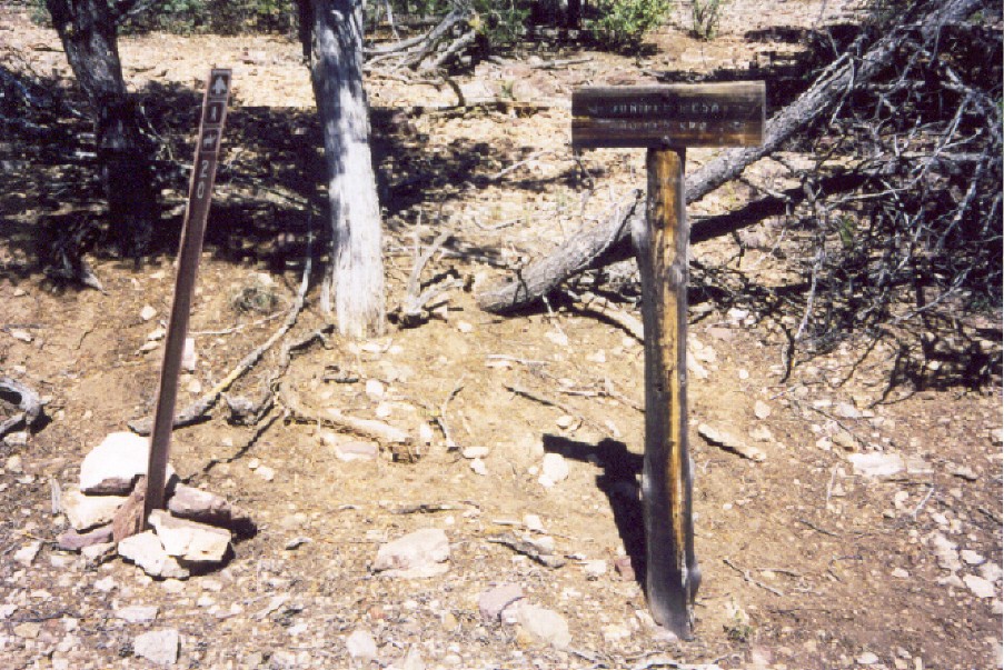
The drive to the Juniper Springs trailhead was an adventure. A beautiful scenic drive into a portion of Arizona that I have never traveled. The highlight of the early morning trip, just north of the junction to Camp Wood, was a bull elk standing off the side of the road to my right. I brought my Jeep to a dead stop and cussed myself out for not having my camera upfront with me. I watched him for a few minutes, and he studied me, or shall I say, my Jeep. After a few moments, he ambled off into the trees. Awed by the sight of this stately beast, I then took notice of a group of cows idling nearby to my left, chewing, eyeballing me nervously. Stupid animals! We pressed on to the trailhead arriving around 6:30 am. To the north and west looming above the Arizona landscape is Juniper Mesa, my objective. Hike The trailhead is small, offering little parking and no restroom facilities. Nearby is a sign-in box, and just to the right, it is the start of trail #1, The Old Military Trail. However, I started here because, in about half a mile, the Juniper Springs trail will fork left. Juniper Springs trail starts in the open, with junipers, pine, and scrub oak scattered about the landscape. Three-quarters of a mile, I began my climb in earnest to reach Juniper Mesa. Here I get a view below of the land sloping down into Walnut Creek. I wrote in my journal during my first break, "I am an idiot. An hour into the hike @ 0800, and it is hot already." An omen now that I review my journal as I typed this. It is a thousand-foot climb in a mile, slow going and rocky. And does level off. In my journal, I noted, "pleasant to walk, yet harsh in appearance. Shale rocks, dirt, dying grotesque trees. The bark beetle is here, and some pines are dying." The remaining portion of the trail is easy, and the trees begin to thicken, offering a little more shade and a breather. Not long afterward, I reached the junction of 2 and 20, the Juniper Mesa trail. A sign points out to the left, it is the direction I need to go, and to my right, it points out the direction to Juniper Springs. Continue on to Juniper Mesa Trail 20
Prescott FS Details This trail offers the traveler some unique and interesting views of northern Arizona. It also connects with east end of the Juniper Mesa Trail #20 which travels west across the entire Juniper Mesa Wilderness, thus offering a vaired wilderness experience in one of the most remote sections of northwestern Arizona. Maps, other resources: Prescott National Forest, west half; U.S.G.S. topographic 7.5' quad for Indian Peak. Trail layout: The Juniper Springs Trail climbs up the edge of Juniper Mesa to the spring. At the spring the Juniper Springs Trail joins two other routes. Trail #20 (Juniper Mesa Trail) travels west up to the mesa and then across the top of the mesa. FR 9867A (access road to the trail) leaves the spring traveling north down the mesa. The Old Military Trail (Trail #1) uses a part of this road. Precautions: The Juniper Springs Trail is steep and difficult and should only be traveled by persons well prepared and in good physical condition. There is no drinking water along the trail, so take plenty of water. There is water at Juniper Spring but it has not been tested for quality. Check out the Official Route and Triplogs. Leave No Trace and +Add a Triplog after your hike to support this local community. One-Way Notice This hike is listed as One-Way. When hiking several trails on a single "hike", log it with a generic name that describes the hike. Then link the trails traveled, check out the example. | ||||||||||||||||||||||||||||||||||||||||||||||||||||||||||||||||||||||||||||||||||||||||||||||||||||||||||||||||||||||||||||||||||||||||||||||||||||||||||||||||||||||||||||


