 Route Editor

| Guide | ♦ | 97 Triplogs | 1 Topic |
details | drive | no permit | forecast | 🔥 route |
stats |
photos | triplogs | topic | location |
| 707 | 97 | 1 |
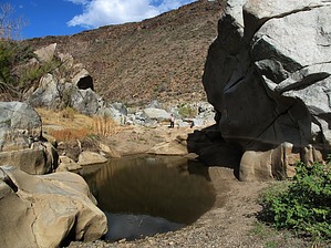
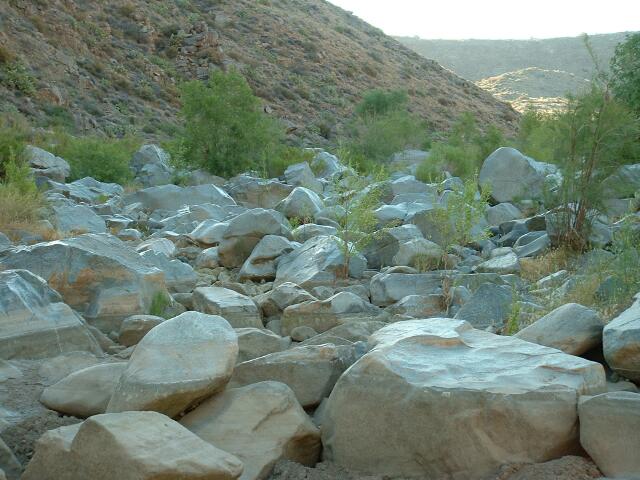
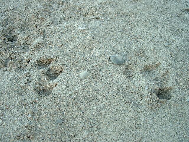
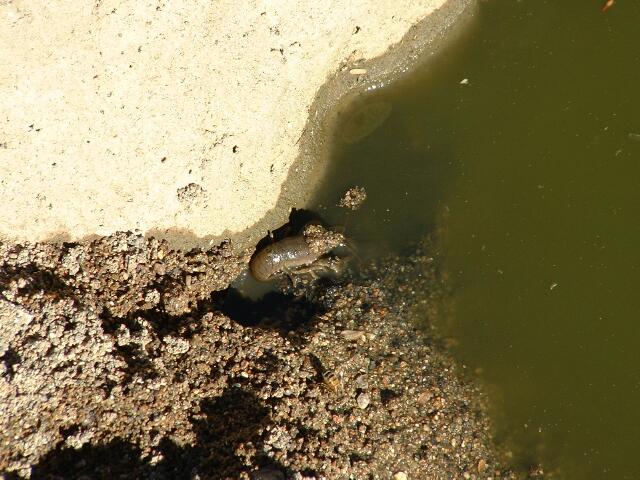
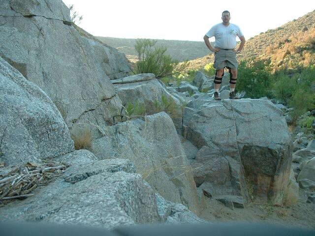
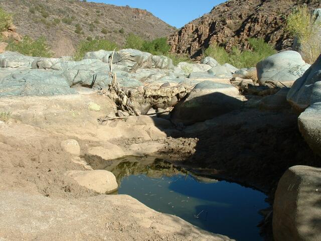
  Hike HikeThe hike to the Agua Fria River is an easy 0.8mi hike from the trailhead. Once there you will be rock hopping thru the riverbed. Miles of rock hopping. Good footwear is recommended. Your calves might cramp if you don't pre-hydrate, hydrate, keep electrolytes in balance or overdo it. It is a large canyon with much to see that is very cool. I saw mountain lion tracks and evidence of either racoons or ringtails digging after the crayfish that live in the algae-filled pools in the river bed. The stream bed is choked with huge boulders, and it takes some effort to make progress up or down the canyon. It's easiest to navigate with little to no water flowing. The boulders form many interesting areas to climb and explore. Don't let the minimal elevation change fool you, boulder hopping takes more energy.
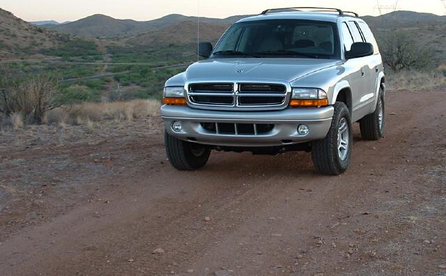
CanyonD's Visit I hiked Agua Fria in late June. It was very dry at that time, but there were still pools of water. The water was nasty looking, and I don't think I would try to filter it unless I had no options. I am sure the water pools are fresher, with the area getting some rainstorms in the past several weeks. I explored down Badger Springs road and Bloody Basin Rd. Badger Springs has some cool 4x4 roads around it. The real reason I selected this hike was to test my new Dodge Durango 4x4 on some dirt trails. I was delighted with the offroad abilities of my Durango, and I only drove about 50% of the roads back here. Due to fire danger, most of AZ was closed to hiking. This area was about the only area I could find within 2 hours of Chandler. This is BLM managed land, and information about the area can be obtained below. They were very helpful when I called. In the Area Bloody Basin Road leads back to a real cool ranch in a valley about 5-8 miles back from I17. The road is best tackled in a 4x4, but a car could make most of the road back to the park boundary. You can drive this road back to Cave Creek, but the drive is about 3 to 4 hours. Also, there is a wash near cave creek that can be impassable if the water is flowing. There are many Indian Ruins back in this area, and you can get details in guide books at REI. The Indian Ruins are located down infrequently traveled access roads that can be very rough and might require a lifted 4x4. 2011-10-07 Updated with a new trailhead location. Data and description revised/reorganized to make sense.
BLM Division Details General National Monument Info The Agua Fria National Monument is located 40 miles north of Phoenix. Brief Description The 71,100-acre Agua Fria National Monument contains one of the most significant systems of prehistoric sites in the American Southwest. At least 450 prehistoric sites and four major settlement areas are known to exist within the monument. This area contains two mesas - Perry and Black Mesa - and the Agua Fria River Canyon. In addition to its rich record of human history, the monument contains a diversity of vegetative communities, pristine riparian habitat, topographical features and a wide array of wildlife. Elevations range from 2,150 to 4,600 feet. Access Take Interstate 17 to either Badger Springs or Bloody Basin Road. Permits Required Activities that were permitted on these public lands before the designation, such as grazing and authorized rights-of-way are still allowed, except for new mining claims. No new permits will be authorized until a monument management plan is completed. Recreational Opportunities Prehistoric archaeological sites, such as stone pueblos and rock art, are numerous but remote and inaccessible. Currently, no sites have been developed for public visitation. Visitors who encounter archaeological sites are encouraged to observe, enjoy and photograph them while leaving all artifacts as found for others to discover and appreciate. Artifacts are a non-renewable resource, so we must take care of what remains. Defacing archaeological sites is vandalism and is punishable by law. Additional activities include wildlife viewing, photography, primitive camping, hiking, hunting and rugged back-country vehicle travel (no off-road travel allowed). Safety Visits to the area require special planning. Potential hazards exist, including rugged and unmarked roads, poisonous reptiles and insects, extreme heat and flash floods. Visitors should bring plenty of water and gasoline, and stay on main roads. Four-wheel drive is recommended. Check out the Official Route and Triplogs. Leave No Trace and +Add a Triplog after your hike to support this local community. | |||||||||||||||||||||||||||||||||||||||||||||||||||||||||||||||||||||||||||||||||||||||||||||||||||||||||||||||||||||||||||||||||||||||||||||||||||||||||||||||||||||||||||||||||||||||||||||||||||||||


