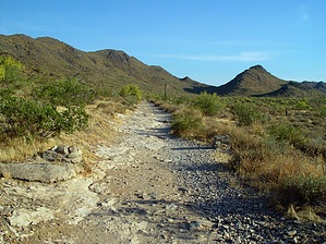
If you enjoy Piestewa and Camelback, you'll likely enjoy this hike too. The hike starts from a good-sized trailhead that includes decent restrooms. You start off heading due south down a path that is in line with 40th Street. The wide trail is flat and gravely because it was an old road or perhaps a jeep route continuation of 40th Street.
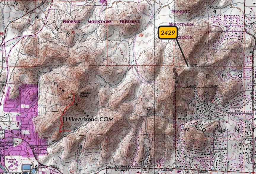
On your right is wide open and relatively flat land that extends over to the Piestewa Peak conglomerate. At 0.35 miles, you cross paths with Trail 100, where it squeezes through the mountains to Tatum. I was a little in ahh since I thought I was hiking new terrain only to realize I've mountain biked past this intersection many times in the early '90s.
The hike continues easy going to 0.5 miles, where you finally start up a slight grade. It's barely noticed, and won't have much effect on you. At 0.85 miles, things change. Here you're eased into an aggressive grade more reminiscent of Piestewa for the final 0.4 mi push to the top. It seemed harsher with the lackadaisical approach under the belt and the soft peak looming up to the left. In reality, numbers-wise, it's easier until the final ascent. This hike has its own characteristic in that it's progressively steeper as you go.
The peak itself is immediately up to your left when you reach the ridge. The views are as good as Piestewa or Camelback as far as city viewing goes. Looking over to Piestewa in the afternoon sun isn't good for photo ops. So if you're coming to view your old friend Piestewa remember to do this as an early morning hike.
I liked this hike better than expected. A combo of Piestewa, 2429, and Echo Canyon in one day would be fun too.
2013 Update The PHX Mtn Preserves named the peak "Dixie Peak".
2014-03-04 Correction - urban hikers stenciled the name on an existing post. The preserves used the name in their summit challenge, hence the 2013 assumption. It's on their agenda to make a decision. Currently, this is not an officially recognized trail.
WARNING! Hiking and outdoor related sports can be dangerous. Be responsible and prepare for the trip. Study the area you are entering and plan accordingly. Dress for the current and unexpected weather changes. Take plenty of water. Never go alone. Make an itinerary with your plan(s), route(s), destination(s) and expected return time. Give your itinerary to trusted family and/or friends.
Permit $$
None
Directions
Road
Paved - Car Okay
To hike From the intersection of Shea & 40th Street, simply go south on 40th Street for 1 mile. It dead-ends at the trailhead parking, and you can't miss it. The hike is south as if 40th Street continued.
 Route Editor

 If you enjoy Piestewa and Camelback, you'll likely enjoy this hike too. The hike starts from a good-sized trailhead that includes decent restrooms. You start off heading due south down a path that is in line with 40th Street. The wide trail is flat and gravely because it was an old road or perhaps a jeep route continuation of 40th Street.