Route Editor

| Guide | ♦ | 31 Triplogs | 2 Topics |
details | drive | no permit | forecast | 🔥 route |
stats |
photos | triplogs | topics | location |
| 314 | 31 | 2 |
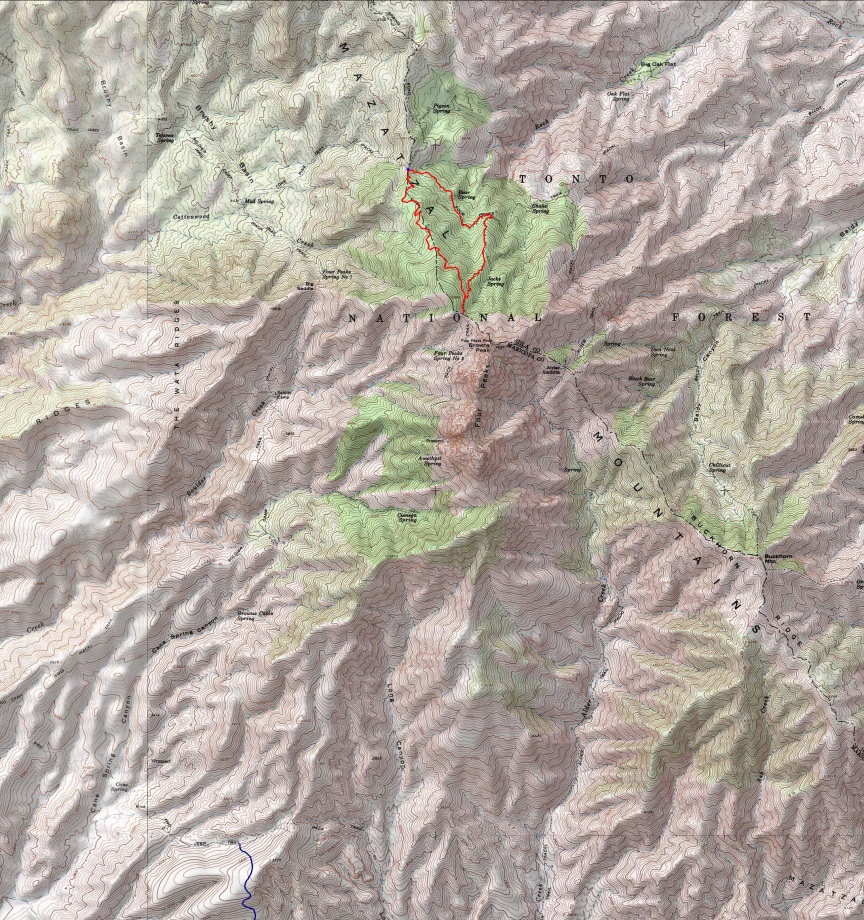
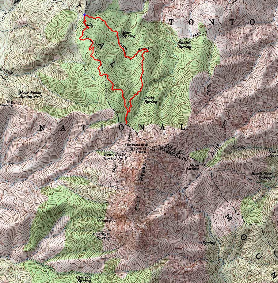
The one percent club by joebartels   Notice NoticeGo counter-clockwise as Amethyst is not well maintained, and it's easier to go down. Use the Official Route on our app or your GPS device for the best results. Overview Brown's Trail #133 is, without a doubt, the most used trail in the Four Peaks Wilderness. It's a direct route to the popular landmark Brown's Peak. What's interesting is it's newer than the rest. I've heard people call it a short cut to Brown's Saddle over the alternative Four Peaks Trail/Amethyst combo. Although true, it's barely true at maybe a tenth of a mile shorter.
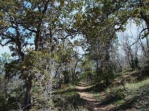
Hike A counter-clockwise approach is the way to go starting on Brown's Trail #133. Upon reaching the Amethyst junction (1.85 miles), head up to Brown's Saddle. It's only five minutes out of the loop, so I included the side tour in the trail data. The return is down, and I do mean down, the Amethyst Trail to Four Peaks Trail then over to Lone Pine Saddle Trailhead. It's been years since I've hiked the Amethyst Trail. The good news is it's a trail now. I last hiked this trail after the Lone Pine Fire. The scorched landscape was indistinct and difficult to follow. The trees were mostly standing, though burned. Now, nearly eight years after the fire, bushes are growing, and most dead trees have fallen. The trail is easy to follow, but as suspected, it's steep with few switchbacks. At one point, you think you're leaving the burn area, but it returns soon. Either the fire altered path, or this was a direct hit of some fire protection. Upon reaching the Four Peaks Trail junction, take a left and head back to the trailhead. The hike immediately changes to a pleasant stroll. Fire damage is patchy. Scraggly oak provides some nice shady sections of trail, though short-lived. What makes this trail sweet in my mind are the drainages you cross on the route. On this trip, nearly two weeks after snowmelt, the water running down was light. You will be rewarded if you time it right. On my first trip, I encountered what seemed like a river roaring down the mountain in three separate drainages. I'll never forget that feeling of excitement. I encountered several red and bluebirds, a roadrunner, countless dancing blue skippers, a pack of four or five deer, and a beaver on this trip. Okay, it wasn't a beaver as there isn't a river anywhere near, but it sure looked like a beaver!
Check out the Official Route and Triplogs. Leave No Trace and +Add a Triplog after your hike to support this local community. | |||||||||||||||||||||||||||||||||||||||||||||||||||||||||||||||||||||||||||||||||||||||||||||||||||||||||||||||||||||||||||||||||||||||||||||||||||||||||||||||||||||||||||||||||||||||||||||||||||||||||||||||||||||||||||||||