Route Editor

| Guide | ♦ | 22 Triplogs | 5 Topics |
details | drive | no permit | forecast | 🔥 route |
stats |
photos | triplogs | topics | location |
| 422 | 22 | 5 |
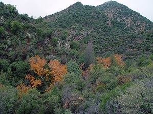
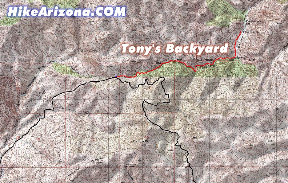
Brush with nature by joebartels   Notice NoticeTony's Ranch is closed to visitors as directed by the United States Army Corps of Engineers. Overview Hike from the origin of Haunted Canyon down to Tony's Cabin and back. The trail is overgrown and requires attention crossing the dry creek dozens of times. This hike isn't for casual backpackers. It is the best option for solitude to Tony's Cabin or to capture the essence of Autumn.
The trail is easy to find from the saddle that separates Woods Camp Canyon and Haunted Canyon. I started down in the fog. Considering this was my first time in the area, I was relying heavily on GPS. One moment I could see a mile away. Then seconds later, I could taste the damp clouds drifting past. It was awesome. Almost immediately, I encountered a corral of sorts. On the return trip, I ventured around (aka got off track) and discovered one and maybe two springs with pipes to water troughs. Who knows, perhaps this is the last resting and watering stop before heading down into the desert below. Soon after the corral, you will pass a triple water trough ( trôf ) and a gateway. The trail makes an abrupt dash up and across the mountainside. Trust panned out as it was the route to take. If you look at the map, I included you might get thoughts of shaving half a mile off this hike. The slope is solid manzanita, so I'd probably forget those thoughts. Now, why the trail cuts up the mountain; There's a ten-foot waterfall to avoid. This trail was cut with horses in mind. It's good to remember the true trail only goes where horses can travel. The trail drops slightly more in the beginning and then levels out the last half mile. Aside from the waterfall bypass, there aren't any strenuous ascents/descents. I recommend going when it's cool enough to wear jeans comfortably. The trail is overgrown nearly all the way, except for the last half mile or so to Tony's Cabin. I wore shorts and dearly paid the price. Nevertheless, I'm still smiling because it was a fun area to experience. The trail crosses the dry creek dozens of times. Sometimes it's subtle, and sometimes it seems wrong, but it always seemed to work out from what I could tell. Just keep thinking horses, and it makes perfect sense. The final stretch to Tony's Cabin is pure heaven. If it doesn't touch your soul, it's probably missing. Gate Policy: If a gate is closed upon arrival, leave it closed after you go through. If it is open, leave it open. Leaving a closed gate open may put cattle in danger. Closing an open gate may cut them off from water. Please be respectful, leave gates as found. The exception is signage on the gate directing you otherwise.
Check out the Official Route and Triplogs. Leave No Trace and +Add a Triplog after your hike to support this local community. | |||||||||||||||||||||||||||||||||||||||||||||||||||||||||||||||||||||||||||||||||||||||||||||||||||||||||||||||||||||||||||||||||||||||||||||||||||||||||||||||||||||||||||||||||||||||||||||||||||||||||||||