 Route Editor

| Guide | ♦ | 70 Triplogs | 3 Topics |
details | drive | no permit | forecast | 🔥 route |
stats |
photos | triplogs | topics | location |
| 64 | 70 | 3 |
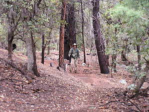
Beautiful climb to the Rim by AZHikr4444   Note NoteStats are for actual #27 one-way segment. The Donahue Trail, #27 is a lesser traveled trail north from the Highline up to Milk Ranch Point. From the Pine TH look straight up past the corrals and the cabin to the outcrop of Milk Ranch Point and sigh. This is your destination! The Donahue is accessed by following the Pine Canyon Trail #26 to the Pine View Trail. This is a beautiful 0.5 mile through the canyon, with a couple of fun creek crossings. If you have trouble rock hopping the creek at the trail, just scramble a bit up or down the creek until you find a suitable crossing. Watch for loose rocks! Arriving early and in the freezing cold and rain, as Trishness and I did, may allow you to spot elk on the hillsides along this section of the trail. You may hear their bugling urging you onward into the unknown. This stroll through the canyon does not clue you in on the workout that is in store ahead! From the intersection of Pine Canyon and the Pine View Trail, turn right and continue on the Pine View Trail another mile until it intersections with the Highline. The trail gradually becomes more exposed, with the soft pine canopy turning to chaparral and manzanita. The trail is very well established at this point, steep and rocky with a steady incline- 800ft from the trailhead to the Highline. The views to the northeast and south become better and better, and when the wind begins kicking up and you realize you are being peppered with freezing pellets of rain, you remember suddenly that this is the Rim! Okay, so how could you ever forget those views?
Begin by following the cairns as the trail ascends. However, don't get too comfortable with those cairns, as they soon all but disappear, either dismantled by nature as the snowpack melts every year, or perhaps someone just made it halfway up and decided to quit while they were ahead. I think the trail may be more difficult to follow in drier weather, as the terrain is washed and grooved in many areas. The underbrush soon takes over, and the route becomes a virtual bushwhack. A series of switchbacks (we think around 8-10) keeps you on your toes and huffing and puffing. For inspiration, look out over the stunning views, the cloud cover, and the shadow sweeping across the mountains. The occasional winks of clear blue sky and the smile of the sun on your face will give you the added energy and motivation to trudge forward. About 0.75 miles up, you will come to a small red rock chute. Scramble up, or if you feel more secure, take the small spur trail west for a short bypass. Continue through the somewhat dense brush (the trail is ironically easier to follow here, as the vegetation has kept it from washing out), until you top out on the quiet ridge of Milk Ranch Point - elevation 7200ft. You have gained 1400 ft from the Highline/Donahue junction. The views from the ridge are not as expansive as I hoped, the only drawback to this portion of the trail. The Donahue trail does continue along this ridge, eventually intersecting FS 218, and I believe if the trail moves closer to the Rim, the views may become more impressive. However, there is an extreme amount of down trees and underbrush here, and it is possible that further up the ridge the trail may disappear altogether. A future bushwhack adventure? I think so! Return down the way you came up, slipping and sliding to the Highline Junction. Take the Highline back to the Pine View Trail. After retracing your steps and re-crossing the creek a few times, you can continue on the Pine Canyon Trail back to the TH, or stay on the Highline (turn left at the sign that says "Pine Trailhead - 1 mile") for a short but sweet, and flat, loop back to the trailhead. This section of the trail follows the creek quite closely, through a boulder garden, and is nestled in an area of towering old-growth pine and new sprouts and seedlings. The soft bright green foliage of the new trees contrasts sharply with the black slash trunks of the grandfathers- a testament to the wonderful restorative power of nature. I would consider this a moderate hike for the seasoned pilgrim, and a difficult one for the newcomer or those who are out of shape. Hiking on the Rim in alternative weather can be challenging and gives you a whole different perspective on this beautiful country. Stay away during lightning, though, and be sure to have a partner who loves the Rim so much, that she doesn't mind taking pieces and parts of it home with her, mostly attached to her boots.
Check out the Official Route and Triplogs. Leave No Trace and +Add a Triplog after your hike to support this local community. One-Way Notice This hike is listed as One-Way. When hiking several trails on a single "hike", log it with a generic name that describes the hike. Then link the trails traveled, check out the example. | |||||||||||||||||||||||||||||||||||||||||||||||||||||||||||||||||||||||||||||||||||||||||||||||||||||||||||||||||||||||||||||||||||||||||||||||||||||||||||||||||||||||||||||||||||||||||||||||||||||||||||


