Route Editor

| Guide | ♦ | 28 Triplogs | 2 Topics |
details | drive | permit | forecast | route |
stats |
photos | triplogs | topics | location |
| 161 | 28 | 2 |
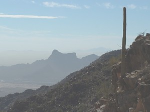
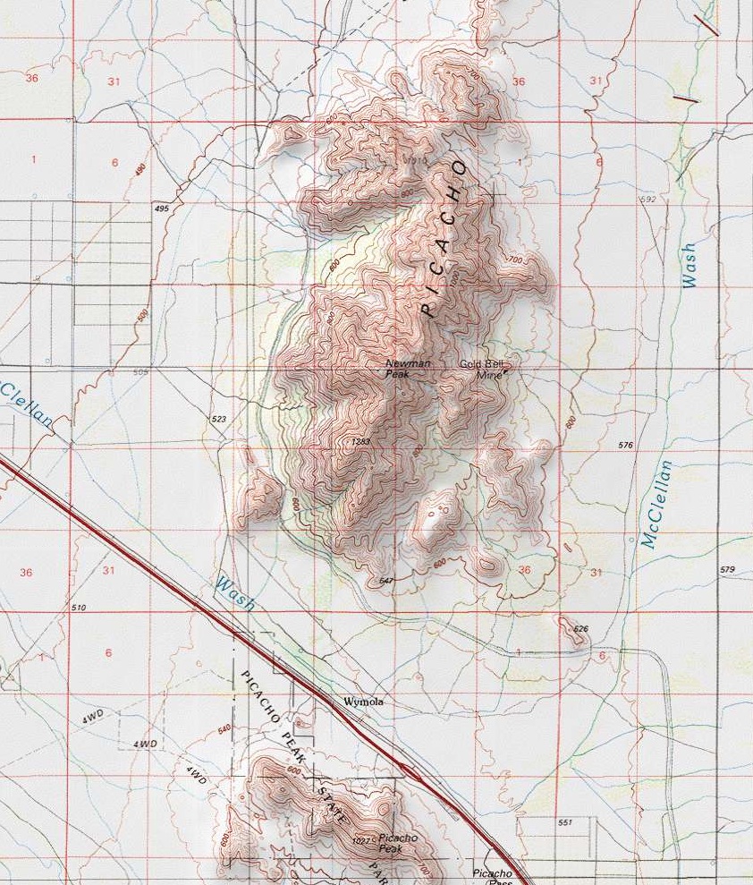
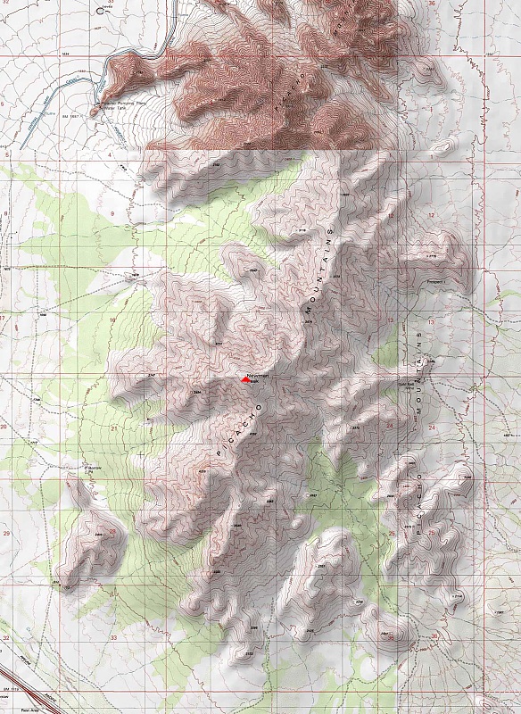
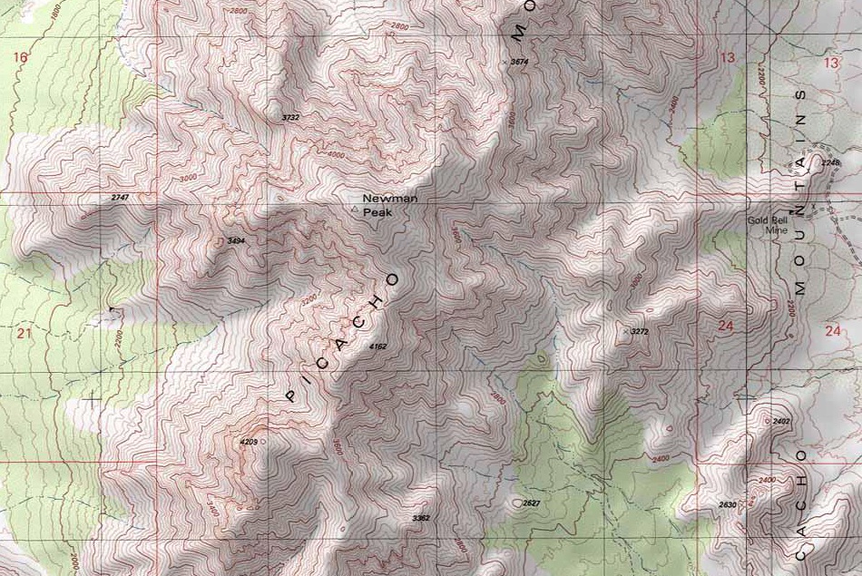
Rugged by Zepppower  Newman Peak is best described as a rugged backcountry hike. Sitting opposite of Picacho Peak, Newman is approx. 40 miles north of Tucson. Unless you want to add several miles to the hike, a 4x4 is highly recommended. Not only is there baby-powder like dust in parts of the approach road, but it also lends itself to some pretty serious rocky terrain that no average car could handle. From your parking spot, hike along the faint road until it dead-ends at a firepit/campsite. If you have a four-wheel-drive vehicle, you may be able to drive to this location. This is the end of the trail, and the rest of the route is cross country. The route to the summit follows the main gully that ends at the saddle between Newman Peak and the minor peak to the west. Follow the drainage up, picking your way through cliff bands, boulders, and cacti until you reach the summit. Newman Peak is best described as a rugged backcountry hike. Sitting opposite of Picacho Peak, Newman is approx. 40 miles north of Tucson. Unless you want to add several miles to the hike, a 4x4 is highly recommended. Not only is there baby-powder like dust in parts of the approach road, but it also lends itself to some pretty serious rocky terrain that no average car could handle. From your parking spot, hike along the faint road until it dead-ends at a firepit/campsite. If you have a four-wheel-drive vehicle, you may be able to drive to this location. This is the end of the trail, and the rest of the route is cross country. The route to the summit follows the main gully that ends at the saddle between Newman Peak and the minor peak to the west. Follow the drainage up, picking your way through cliff bands, boulders, and cacti until you reach the summit.Climbing the east side is the only real viable option unless you're using climbing gear and want to be on some very loose rock. An obvious gully on the east side takes you up steep terrain with a wide variety of choices and route selection. Experienced travelers will easily pick their way to the top following the various cliff bands and steepening rock-hopping. And have a fun but challenging day of it. Staying north as you continue upward, you'll be rewarded with views of layers and layers of mountains in all directions. From the summit of Newman Peak, many mountain ranges are visible: Santa Catalinas, Silverbell Mountains, Tucson Mountains, Superstition Mountains, Tortolitas Mountains, and Table Tops Mountains, to name just a few. Not for the faint of heart simply because of the relentless steepness - the legs will surely get a workout.
A plaque at the base of this mountain states it was named for a soldier killed in the only battle of the Civil War to occur in Arizona. Ironically, another plaque in the area commemorating the battle does not list Newman.
Check out the Official Route and Triplogs. Leave No Trace and +Add a Triplog after your hike to support this local community. | ||||||||||||||||||||||||||||||||||||||||||||||||||||||||||||||||||||||||||||||||||||||||